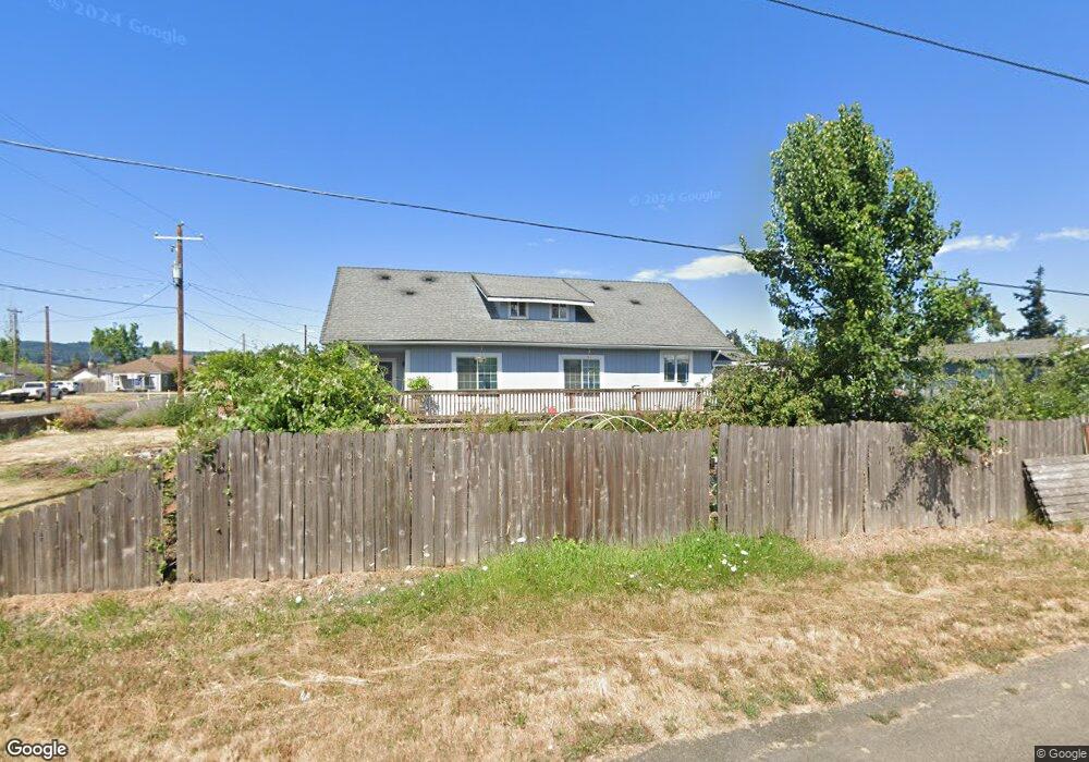
275 N Front St Creswell, OR 97426
Estimated Value: $440,000 - $516,000
4
Beds
5
Baths
2,378
Sq Ft
$206/Sq Ft
Est. Value
About This Home
This home is located at 275 N Front St, Creswell, OR 97426 and is currently estimated at $489,079, approximately $205 per square foot. 275 N Front St is a home located in Lane County with nearby schools including Creslane Elementary School, Creswell Middle School, and Creswell High School.
Ownership History
Date
Name
Owned For
Owner Type
Purchase Details
Closed on
Feb 23, 2019
Sold by
Williams Heather A and Williams Michael D
Bought by
Williams Michael D and Williams Heather A
Current Estimated Value
Home Financials for this Owner
Home Financials are based on the most recent Mortgage that was taken out on this home.
Original Mortgage
$285,917
Outstanding Balance
$248,867
Interest Rate
4.12%
Mortgage Type
FHA
Estimated Equity
$240,212
Purchase Details
Closed on
Dec 14, 2016
Sold by
Williams Heather and Kleppe Heather
Bought by
Williams Heather A
Purchase Details
Closed on
Aug 14, 2015
Sold by
U S Bank National Association
Bought by
Kleppe Heather
Home Financials for this Owner
Home Financials are based on the most recent Mortgage that was taken out on this home.
Original Mortgage
$137,000
Interest Rate
3.86%
Mortgage Type
Purchase Money Mortgage
Purchase Details
Closed on
Apr 20, 2015
Sold by
Lampe Ronald and Lampe Cynthia
Bought by
U S Bank National Association
Purchase Details
Closed on
Oct 7, 2014
Sold by
Lampe Ronald and Lampe Cynthia
Bought by
Us Bank National Association
Purchase Details
Closed on
May 4, 2007
Sold by
Lampe Ronald C
Bought by
Lampe Ronald C and Lampe Cynthia L
Home Financials for this Owner
Home Financials are based on the most recent Mortgage that was taken out on this home.
Original Mortgage
$212,000
Interest Rate
6.14%
Mortgage Type
New Conventional
Purchase Details
Closed on
Sep 3, 1998
Sold by
Lampe Cindy L
Bought by
Lampe Ronald C
Home Financials for this Owner
Home Financials are based on the most recent Mortgage that was taken out on this home.
Original Mortgage
$59,360
Interest Rate
9.99%
Purchase Details
Closed on
Jul 21, 1998
Sold by
Evans Daniel and Evans Dee
Bought by
Evans Dee Craig
Home Financials for this Owner
Home Financials are based on the most recent Mortgage that was taken out on this home.
Original Mortgage
$59,360
Interest Rate
9.99%
Create a Home Valuation Report for This Property
The Home Valuation Report is an in-depth analysis detailing your home's value as well as a comparison with similar homes in the area
Home Values in the Area
Average Home Value in this Area
Purchase History
| Date | Buyer | Sale Price | Title Company |
|---|---|---|---|
| Williams Michael D | -- | Fidelity National Title | |
| Williams Heather A | -- | Cascade Title Company | |
| Kleppe Heather | $121,400 | Western Title & Escrow Co | |
| U S Bank National Association | $142,450 | None Available | |
| Us Bank National Association | $142,450 | None Available | |
| Lampe Ronald C | -- | First American Title Ins Co | |
| Lampe Ronald C | -- | Western Pioneer Title Co | |
| Lampe Ronald C | $74,200 | Western Pioneer Title Co | |
| Evans Dee Craig | -- | -- |
Source: Public Records
Mortgage History
| Date | Status | Borrower | Loan Amount |
|---|---|---|---|
| Open | Williams Michael D | $285,917 | |
| Previous Owner | Kleppe Heather | $137,000 | |
| Previous Owner | Lampe Ronald C | $212,000 | |
| Previous Owner | Lampe Ronald C | $59,360 |
Source: Public Records
Tax History Compared to Growth
Tax History
| Year | Tax Paid | Tax Assessment Tax Assessment Total Assessment is a certain percentage of the fair market value that is determined by local assessors to be the total taxable value of land and additions on the property. | Land | Improvement |
|---|---|---|---|---|
| 2025 | $3,051 | $185,924 | -- | -- |
| 2024 | $2,283 | $180,509 | -- | -- |
| 2023 | $2,283 | $175,252 | $0 | $0 |
| 2022 | $2,458 | $170,148 | $0 | $0 |
| 2021 | $2,375 | $165,193 | $0 | $0 |
| 2020 | $2,342 | $160,382 | $0 | $0 |
| 2019 | $2,290 | $155,711 | $0 | $0 |
| 2018 | $2,258 | $146,773 | $0 | $0 |
| 2017 | $2,190 | $146,773 | $0 | $0 |
| 2016 | $2,243 | $142,498 | $0 | $0 |
| 2015 | $2,162 | $138,348 | $0 | $0 |
Source: Public Records
Map
Nearby Homes
- 156 N 1st St
- 368 Hillegas Ave
- 689 Blue Jay Loop
- 692 N 1st St
- 700 N Mill St Unit 109
- 700 N Mill St
- 589 Mary Neal Ln
- 83354 N Pacific Hwy
- 521 S 7th St
- 0 Holbrook Ln Unit 339588620
- 460 Meadow Ln
- 1 Queens Ave Unit 1
- 491 Ironwood Loop
- 645 Boulder Loop
- 375 Sunday Dr
- 316 Sunday Dr
- 336 Sunday Dr
- 685 St Andrews Loop
- 33465 Irish Ln
- 370 Magnolia Dr