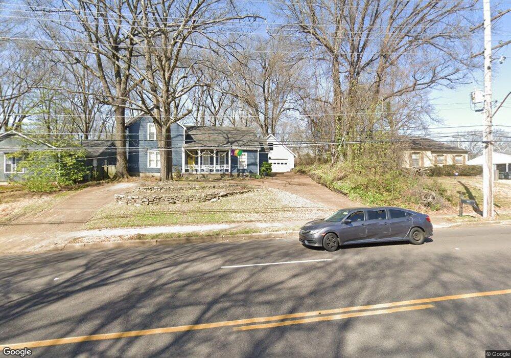
275 N White Station Rd Memphis, TN 38117
Audubon Park NeighborhoodEstimated Value: $293,000 - $349,000
4
Beds
2
Baths
1,882
Sq Ft
$173/Sq Ft
Est. Value
About This Home
This home is located at 275 N White Station Rd, Memphis, TN 38117 and is currently estimated at $326,291, approximately $173 per square foot. 275 N White Station Rd is a home located in Shelby County with nearby schools including Richland Elementary School, White Station Middle, and White Station High.
Ownership History
Date
Name
Owned For
Owner Type
Purchase Details
Closed on
Feb 7, 2011
Sold by
Dierssen Cynthia Ellane and Freeman William Donald
Bought by
Mcivor Carrie R
Current Estimated Value
Home Financials for this Owner
Home Financials are based on the most recent Mortgage that was taken out on this home.
Original Mortgage
$163,741
Outstanding Balance
$111,671
Interest Rate
4.71%
Mortgage Type
FHA
Estimated Equity
$214,620
Create a Home Valuation Report for This Property
The Home Valuation Report is an in-depth analysis detailing your home's value as well as a comparison with similar homes in the area
Home Values in the Area
Average Home Value in this Area
Purchase History
| Date | Buyer | Sale Price | Title Company |
|---|---|---|---|
| Mcivor Carrie R | $168,000 | None Available |
Source: Public Records
Mortgage History
| Date | Status | Borrower | Loan Amount |
|---|---|---|---|
| Open | Mcivor Carrie R | $163,741 |
Source: Public Records
Tax History Compared to Growth
Tax History
| Year | Tax Paid | Tax Assessment Tax Assessment Total Assessment is a certain percentage of the fair market value that is determined by local assessors to be the total taxable value of land and additions on the property. | Land | Improvement |
|---|---|---|---|---|
| 2025 | $2,148 | $73,050 | $16,475 | $56,575 |
| 2024 | $2,148 | $63,350 | $17,400 | $45,950 |
| 2023 | $3,859 | $63,350 | $17,400 | $45,950 |
| 2022 | $3,859 | $63,350 | $17,400 | $45,950 |
| 2021 | $3,904 | $63,350 | $17,400 | $45,950 |
| 2020 | $3,585 | $49,475 | $17,400 | $32,075 |
| 2019 | $3,585 | $49,475 | $17,400 | $32,075 |
| 2018 | $3,585 | $49,475 | $17,400 | $32,075 |
| 2017 | $2,033 | $49,475 | $17,400 | $32,075 |
| 2016 | $2,011 | $46,025 | $0 | $0 |
| 2014 | $2,011 | $46,025 | $0 | $0 |
Source: Public Records
Map
Nearby Homes
- 296 N White Station Rd
- 5238 Peg Ln
- 258 N White Station Rd
- 226 N White Station Rd
- 192 N White Station Rd
- 5362 Wilton Ave
- 379 Mcelroy Rd
- 5340 Rich Rd
- 151 N White Station Rd
- 446 Rosser Rd
- 448 N White Station Rd
- 5121 Lynbar Ave
- 142 W Bendel Cir
- 202 Betty jo Ln
- 422 Mcelroy Rd
- 352 Leonora Dr
- 346 Leonora Dr
- 430 Mcelroy Rd
- 125 W Bendel Cir
- 496 Chalmers Rd
- 287 N White Station Rd
- 267 N White Station Rd
- 276 Amanda St
- 286 Amanda St
- 268 Amanda St
- 295 N White Station Rd
- 259 N White Station Rd
- 294 Amanda St
- 5254 Brenton Ave
- 280 N White Station Rd
- 258 Amanda St
- 249 N White Station Rd
- 301 N White Station Rd
- 5231 Peg Ln
- 5260 Brenton Ave
- 250 Amanda St
- 300 Amanda St
- 290 N White Station Rd
- 277 Amanda St
- 287 Amanda St