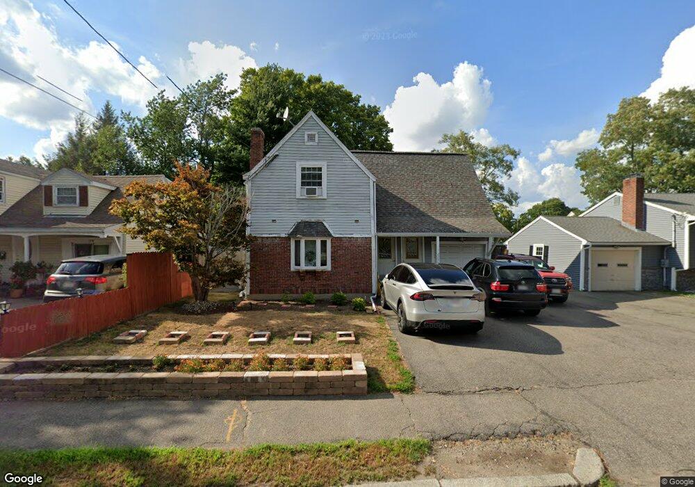
275 W Squantum St Quincy, MA 02171
Montclair NeighborhoodEstimated Value: $891,000 - $1,173,000
5
Beds
4
Baths
2,716
Sq Ft
$381/Sq Ft
Est. Value
About This Home
This home is located at 275 W Squantum St, Quincy, MA 02171 and is currently estimated at $1,034,326, approximately $380 per square foot. 275 W Squantum St is a home located in Norfolk County with nearby schools including Montclair Elementary School, Atlantic Middle School, and North Quincy High School.
Ownership History
Date
Name
Owned For
Owner Type
Purchase Details
Closed on
May 17, 2021
Sold by
Cheng-Chen Jackie H
Bought by
Cheng-Chen Jackie H and Chu Lisa
Current Estimated Value
Purchase Details
Closed on
Nov 24, 1997
Sold by
Barry Adm John J
Bought by
Chen Jackie Hc
Home Financials for this Owner
Home Financials are based on the most recent Mortgage that was taken out on this home.
Original Mortgage
$60,000
Interest Rate
7.17%
Mortgage Type
Purchase Money Mortgage
Create a Home Valuation Report for This Property
The Home Valuation Report is an in-depth analysis detailing your home's value as well as a comparison with similar homes in the area
Home Values in the Area
Average Home Value in this Area
Purchase History
| Date | Buyer | Sale Price | Title Company |
|---|---|---|---|
| Cheng-Chen Jackie H | -- | None Available | |
| Chen Jackie Hc | $146,000 | -- |
Source: Public Records
Mortgage History
| Date | Status | Borrower | Loan Amount |
|---|---|---|---|
| Previous Owner | Chen Jackie Hc | $135,000 | |
| Previous Owner | Chen Jackie Hc | $60,000 |
Source: Public Records
Tax History Compared to Growth
Tax History
| Year | Tax Paid | Tax Assessment Tax Assessment Total Assessment is a certain percentage of the fair market value that is determined by local assessors to be the total taxable value of land and additions on the property. | Land | Improvement |
|---|---|---|---|---|
| 2025 | $11,115 | $964,000 | $386,800 | $577,200 |
| 2024 | $10,523 | $933,700 | $386,800 | $546,900 |
| 2023 | $9,862 | $886,100 | $368,400 | $517,700 |
| 2022 | $10,358 | $864,600 | $320,400 | $544,200 |
| 2021 | $9,383 | $772,900 | $305,100 | $467,800 |
| 2020 | $9,730 | $782,800 | $305,100 | $477,700 |
| 2019 | $9,480 | $755,400 | $285,100 | $470,300 |
| 2018 | $9,162 | $686,800 | $264,000 | $422,800 |
| 2017 | $9,106 | $642,600 | $251,400 | $391,200 |
| 2016 | $8,293 | $577,500 | $218,600 | $358,900 |
| 2015 | $7,753 | $531,000 | $198,700 | $332,300 |
| 2014 | $7,278 | $489,800 | $189,300 | $300,500 |
Source: Public Records
Map
Nearby Homes
- 444 W Squantum St
- 115 W Squantum St Unit 810
- 115 W Squantum St Unit 907
- 39 Fayette St Unit 102
- 182 Granite Ave
- 260 Elmwood Ave
- 204 Farrington St
- 143 Arlington St
- 15 California Ave
- 21 Linden St Unit 417
- 511 Hancock St Unit 207
- 150 Hancock St Unit 102
- 522 Hancock St
- 26 Buckingham Rd
- 129 Beale St
- 1 Edwin St Unit C
- 400 Adams St
- 400 Adams St Unit A
- 94 Newbury Ave Unit 100
- 225 S Central Ave
- 279 W Squantum St
- 267 W Squantum St
- 74 Sealund Rd
- 78 Sealund Rd
- 48 Sealund Rd
- 70 Sealund Rd
- 40 Sealund Rd
- 261 W Squantum St
- 52 Sealund Rd
- 34 Sealund Rd
- 266 W Squantum St
- 276 W Squantum St
- 272 W Squantum St
- 278 W Squantum St
- 64 Sealund Rd
- 282 W Squantum St
- 293 W Squantum St
- 71 Sealund Rd
- 284 W Squantum St
- 9 Bowdoin St