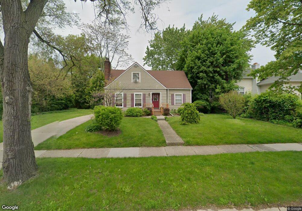
2751 Electric Ave Port Huron, MI 48060
Estimated Value: $169,000 - $187,000
3
Beds
2
Baths
1,300
Sq Ft
$137/Sq Ft
Est. Value
About This Home
This home is located at 2751 Electric Ave, Port Huron, MI 48060 and is currently estimated at $178,242, approximately $137 per square foot. 2751 Electric Ave is a home located in St. Clair County with nearby schools including Woodrow Wilson Elementary School, Central Middle School, and Port Huron High School.
Ownership History
Date
Name
Owned For
Owner Type
Purchase Details
Closed on
Aug 17, 2023
Sold by
Kaatz Lorene R
Bought by
Kaatz Lorene R
Current Estimated Value
Purchase Details
Closed on
Oct 24, 2016
Sold by
Furst Homes Llc
Bought by
Kaatz Lorene R
Home Financials for this Owner
Home Financials are based on the most recent Mortgage that was taken out on this home.
Original Mortgage
$68,935
Interest Rate
3.99%
Mortgage Type
FHA
Purchase Details
Closed on
Oct 24, 2013
Sold by
Malott Phyllis A
Bought by
Furst Homes
Create a Home Valuation Report for This Property
The Home Valuation Report is an in-depth analysis detailing your home's value as well as a comparison with similar homes in the area
Home Values in the Area
Average Home Value in this Area
Purchase History
| Date | Buyer | Sale Price | Title Company |
|---|---|---|---|
| Kaatz Lorene R | -- | None Listed On Document | |
| Kaatz Lorene R | $72,400 | None Available | |
| Furst Homes | $29,001 | None Available |
Source: Public Records
Mortgage History
| Date | Status | Borrower | Loan Amount |
|---|---|---|---|
| Previous Owner | Kaatz Lorene R | $68,935 |
Source: Public Records
Tax History Compared to Growth
Tax History
| Year | Tax Paid | Tax Assessment Tax Assessment Total Assessment is a certain percentage of the fair market value that is determined by local assessors to be the total taxable value of land and additions on the property. | Land | Improvement |
|---|---|---|---|---|
| 2025 | $2,370 | $85,000 | $0 | $0 |
| 2024 | $2,024 | $82,100 | $0 | $0 |
| 2023 | $1,912 | $72,900 | $0 | $0 |
| 2022 | $2,017 | $63,300 | $0 | $0 |
| 2021 | $1,915 | $57,800 | $0 | $0 |
| 2020 | $1,936 | $54,600 | $54,600 | $0 |
| 2019 | $1,902 | $40,000 | $0 | $0 |
| 2018 | $1,860 | $40,000 | $0 | $0 |
| 2017 | $1,660 | $36,500 | $0 | $0 |
| 2016 | $1,901 | $36,500 | $0 | $0 |
| 2015 | $1,866 | $36,300 | $36,300 | $0 |
| 2014 | $1,866 | $34,800 | $34,800 | $0 |
| 2013 | -- | $34,100 | $0 | $0 |
Source: Public Records
Map
Nearby Homes
- 2718 Electric Ave
- 2710 Electric Ave
- 2815 Military St
- 2724 Military St
- 2704 Military St
- 1403 Catherine McAuley Dr
- 2411 10th St
- 1414 Beard St
- 2444 Military St
- 2430 Military St Unit 2434
- 2977 Military St
- 823 Beard St
- 3136 Military St
- 730 Jenkinson St
- 913 Tunnel St
- 1112 Minnie St
- 1127 Minnie St
- 831 Bancroft St
- 1319 Minnie St
- 2109 Military St
- 2747 Electric Ave
- 2743 Electric Ave
- 2761 Electric Ave
- 2752 Mason Ave
- 2746 Mason Ave
- 2754 Electric Ave
- 2740 Electric Ave
- 2762 Electric Ave Unit 2764
- 2723 Electric Ave
- 2746 Electric Ave
- 2734 Electric Ave
- 2728 Electric Ave
- 1115 Center Ave Unit 1117
- 2761 Mason Ave
- 2800 Electric Ave
- 2800 Electric Ave
- 2739 Mason Ave
- 2805 Electric Ave
- 2717 Electric Ave
- 2804 Electric Ave