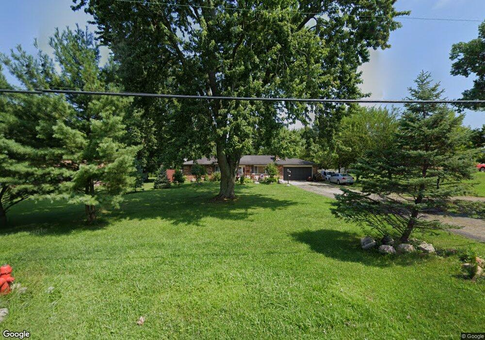
2752 State Route 122 Franklin, OH 45005
Estimated Value: $229,000 - $289,000
3
Beds
2
Baths
1,248
Sq Ft
$209/Sq Ft
Est. Value
About This Home
This home is located at 2752 State Route 122, Franklin, OH 45005 and is currently estimated at $260,611, approximately $208 per square foot. 2752 State Route 122 is a home located in Warren County with nearby schools including Clearcreek Elementary School, Dennis Elementary School, and Springboro Intermediate School.
Ownership History
Date
Name
Owned For
Owner Type
Purchase Details
Closed on
Feb 21, 2004
Sold by
Phelps William C
Bought by
Volk David A
Current Estimated Value
Home Financials for this Owner
Home Financials are based on the most recent Mortgage that was taken out on this home.
Original Mortgage
$84,000
Outstanding Balance
$39,149
Interest Rate
5.74%
Mortgage Type
Purchase Money Mortgage
Estimated Equity
$221,462
Purchase Details
Closed on
Sep 24, 1987
Sold by
Griffith Stephen E and Griffith Li
Bought by
Phelps and Phelps Wm C
Create a Home Valuation Report for This Property
The Home Valuation Report is an in-depth analysis detailing your home's value as well as a comparison with similar homes in the area
Home Values in the Area
Average Home Value in this Area
Purchase History
| Date | Buyer | Sale Price | Title Company |
|---|---|---|---|
| Volk David A | $114,000 | -- | |
| Phelps | $57,000 | -- |
Source: Public Records
Mortgage History
| Date | Status | Borrower | Loan Amount |
|---|---|---|---|
| Open | Volk David A | $84,000 |
Source: Public Records
Tax History Compared to Growth
Tax History
| Year | Tax Paid | Tax Assessment Tax Assessment Total Assessment is a certain percentage of the fair market value that is determined by local assessors to be the total taxable value of land and additions on the property. | Land | Improvement |
|---|---|---|---|---|
| 2024 | $2,713 | $66,360 | $23,100 | $43,260 |
| 2023 | $2,270 | $51,303 | $12,915 | $38,388 |
| 2022 | $2,270 | $51,303 | $12,915 | $38,388 |
| 2021 | $2,121 | $51,303 | $12,915 | $38,388 |
| 2020 | $1,978 | $41,710 | $10,500 | $31,210 |
| 2019 | $1,833 | $41,710 | $10,500 | $31,210 |
| 2018 | $1,823 | $41,710 | $10,500 | $31,210 |
| 2017 | $1,841 | $37,702 | $9,632 | $28,070 |
| 2016 | $1,915 | $37,702 | $9,632 | $28,070 |
| 2015 | $1,820 | $37,702 | $9,632 | $28,070 |
| 2014 | $1,820 | $33,960 | $8,680 | $25,290 |
| 2013 | $1,819 | $41,100 | $10,500 | $30,600 |
Source: Public Records
Map
Nearby Homes
- 3085 Ohio 122
- 3122 N State Route 741
- 3138 Patrick Ct
- 3626 Colton Ct
- 0 Colton Ct Unit 1824949
- 2 Colton Ct
- 0 Colton Ct
- 02 Colton Ct
- 0 Aniston Ct Unit 1824950
- 0 Aniston Ct
- 3562 Aniston Ct
- 3600 Yellow Finch Way
- 0 Ohio 122
- 3441 Madison Grace Way
- 2276 Presley Ct
- 2268 Presley Ct
- 4480 N St Rt 123
- 4480 State Route 123
- 3617 Garrett Dr
- 3136 Pekin Rd
- 2768 State Route 122
- 2768 St Rt 122
- 2700 State Route 122
- 2790 W St Rt 122
- 2790 State Route 122
- 2690 State Route 122
- 2806 State Route 122
- 2698 N St Rt 122
- 2698 State Route 122
- 3551 State Route 123
- 2690 N St Rt 122
- 2690 N Route 122
- 3571 State Route 123
- 3571 St Rt 123
- 2832 State Route 122
- 2753 State Route 122
- 2777 State Route 122
- 3589 State Route 123
- 2850 State Route 122
- 3605 State Route 123