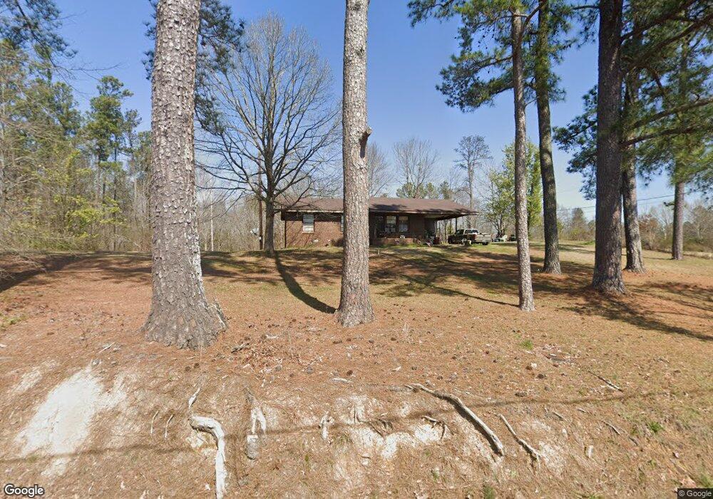
276 Henson Rd SW Cave Spring, GA 30124
Estimated Value: $158,415 - $660,000
--
Bed
--
Bath
1,288
Sq Ft
$265/Sq Ft
Est. Value
About This Home
This home is located at 276 Henson Rd SW, Cave Spring, GA 30124 and is currently estimated at $341,354, approximately $265 per square foot. 276 Henson Rd SW is a home located in Floyd County with nearby schools including Coosa Middle School and Coosa High School.
Ownership History
Date
Name
Owned For
Owner Type
Purchase Details
Closed on
Jan 2, 1991
Sold by
Mccord Angela Elaine
Bought by
Powell Angela E
Current Estimated Value
Purchase Details
Closed on
May 1, 1982
Bought by
P and R
Purchase Details
Closed on
Feb 24, 1982
Sold by
Camp Kerney W and Mccord Angie E
Bought by
Mccord Angela Elaine
Purchase Details
Closed on
Apr 26, 1979
Sold by
Brewer Captain J and Twilley Billy G
Bought by
Camp Kerney W and Mccord Angie E
Purchase Details
Closed on
Jun 22, 1978
Bought by
Brewer Captain J and Twilley Billy G
Create a Home Valuation Report for This Property
The Home Valuation Report is an in-depth analysis detailing your home's value as well as a comparison with similar homes in the area
Home Values in the Area
Average Home Value in this Area
Purchase History
| Date | Buyer | Sale Price | Title Company |
|---|---|---|---|
| Powell Angela E | -- | -- | |
| P | -- | -- | |
| Mccord Angela Elaine | -- | -- | |
| Camp Kerney W | $30,000 | -- | |
| Brewer Captain J | $1,200 | -- |
Source: Public Records
Mortgage History
| Date | Status | Borrower | Loan Amount |
|---|---|---|---|
| Open | Powell Angela E | $71,558 | |
| Closed | Powell Angela M | $87,569 | |
| Closed | Powell Angela E | $75,264 |
Source: Public Records
Tax History Compared to Growth
Tax History
| Year | Tax Paid | Tax Assessment Tax Assessment Total Assessment is a certain percentage of the fair market value that is determined by local assessors to be the total taxable value of land and additions on the property. | Land | Improvement |
|---|---|---|---|---|
| 2024 | $557 | $59,912 | $6,600 | $53,312 |
| 2023 | $408 | $51,428 | $6,000 | $45,428 |
| 2022 | $220 | $35,744 | $4,760 | $30,984 |
| 2021 | $225 | $29,772 | $4,330 | $25,442 |
| 2020 | $706 | $28,168 | $3,765 | $24,403 |
| 2019 | $679 | $27,071 | $3,765 | $23,306 |
| 2018 | $655 | $25,712 | $3,586 | $22,126 |
| 2017 | $641 | $24,873 | $3,320 | $21,553 |
| 2016 | $657 | $25,104 | $3,320 | $21,784 |
| 2015 | $645 | $25,104 | $3,320 | $21,784 |
| 2014 | $645 | $25,104 | $3,320 | $21,784 |
Source: Public Records
Map
Nearby Homes
- 0 Buttermilk Rd SW Unit 22437934
- 0 Buttermilk Rd SW Unit 10462359
- 0 Buttermilk Rd SW Unit 7527264
- 0 Gadsden Rd SW Unit 7531195
- 0 Gadsden Rd SW Unit 10466656
- 995 Gadsden Rd SW
- 2.9 County Road 368
- 2.92 County Road 368
- 115 County Road 157
- 0 Blacks Bluff Rd SW Unit 10449213
- 79 Mill St SW
- 4 Church St
- 7112 Blacks Bluff Rd SW Unit E
- 7 Alabama St
- 6 River St SW
- 12325 U S 411
- 95 Joy Dr SW
- 0 Cave Spring Rd SW Unit LotWP001 22451642
- 0 Cave Spring Rd SW Unit 10452242
- 0 Ridge Rd SW Unit 10366822
- 276 Henson Rd SW
- 312 Henson Rd SW
- 312 Henson Rd SW
- 261 Henson Rd SW
- 206 Henson Rd SW
- 350 Henson Rd SW
- 83 Angel Rd SW
- 98 Angel Rd SW
- 154 Henson Rd SW
- 125 Angel Rd SW
- 130 Angel Rd SW
- 170 Angel Rd SW
- 3455 Co Rd 101
- 1345 Buttermilk Rd SW
- 1409 Buttermilk Rd SW
- 75 Henson Rd SW
- 24 Henson Rd SW
- 1422 Buttermilk Rd SW
- 1422 Buttermilk Rd SW
- 13 Henson Rd SW