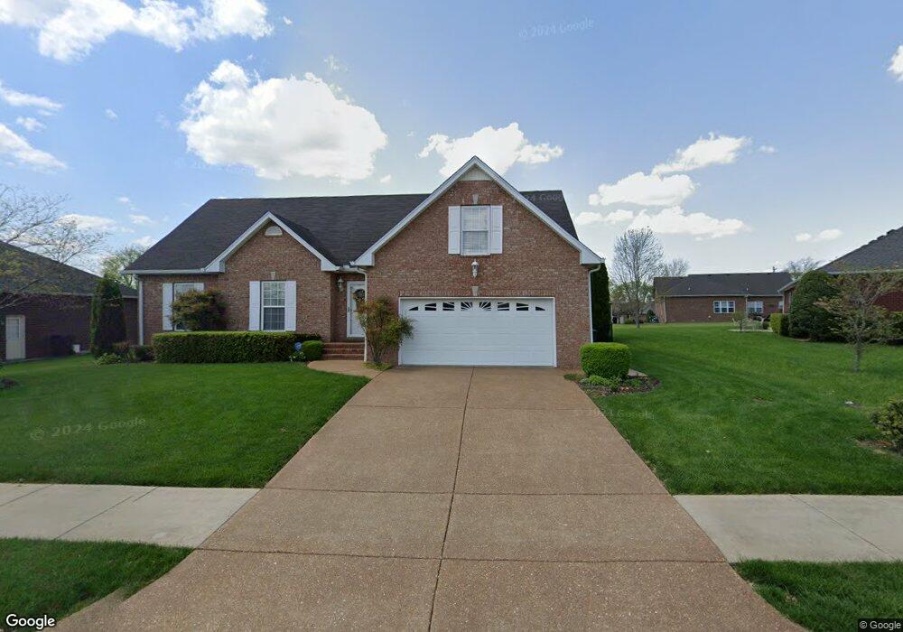
276 Walbrook Dr Gallatin, TN 37066
Estimated Value: $434,372 - $502,000
Studio
2
Baths
2,250
Sq Ft
$210/Sq Ft
Est. Value
About This Home
This home is located at 276 Walbrook Dr, Gallatin, TN 37066 and is currently estimated at $471,843, approximately $209 per square foot. 276 Walbrook Dr is a home located in Sumner County with nearby schools including Howard Elementary School and St. John Vianney Catholic School.
Ownership History
Date
Name
Owned For
Owner Type
Purchase Details
Closed on
Sep 19, 2016
Sold by
Racine Joyce D and Racine Charles E
Bought by
Racine Joyce D
Current Estimated Value
Purchase Details
Closed on
Oct 30, 2008
Sold by
Jones Randall R and Jones Barbara
Bought by
Racine Joyce D
Home Financials for this Owner
Home Financials are based on the most recent Mortgage that was taken out on this home.
Original Mortgage
$75,000
Outstanding Balance
$48,896
Interest Rate
6.11%
Mortgage Type
Unknown
Estimated Equity
$422,947
Create a Home Valuation Report for This Property
The Home Valuation Report is an in-depth analysis detailing your home's value as well as a comparison with similar homes in the area
Home Values in the Area
Average Home Value in this Area
Purchase History
| Date | Buyer | Sale Price | Title Company |
|---|---|---|---|
| Racine Joyce D | -- | None Available | |
| Racine Joyce D | $223,850 | None Available |
Source: Public Records
Mortgage History
| Date | Status | Borrower | Loan Amount |
|---|---|---|---|
| Open | Racine Joyce D | $75,000 | |
| Closed | Racine Joyce D | $80,000 |
Source: Public Records
Tax History
| Year | Tax Paid | Tax Assessment Tax Assessment Total Assessment is a certain percentage of the fair market value that is determined by local assessors to be the total taxable value of land and additions on the property. | Land | Improvement |
|---|---|---|---|---|
| 2025 | $1,588 | $111,775 | $18,750 | $93,025 |
| 2024 | $1,588 | $111,775 | $18,750 | $93,025 |
| 2023 | $2,247 | $73,625 | $14,625 | $59,000 |
| 2022 | $2,254 | $73,625 | $14,625 | $59,000 |
| 2021 | $2,254 | $73,625 | $14,625 | $59,000 |
| 2020 | $2,254 | $73,625 | $14,625 | $59,000 |
| 2019 | $2,254 | $0 | $0 | $0 |
| 2018 | $1,946 | $0 | $0 | $0 |
| 2017 | $1,946 | $0 | $0 | $0 |
| 2016 | $1,394 | $0 | $0 | $0 |
| 2015 | $1,946 | $0 | $0 | $0 |
| 2014 | $1,719 | $0 | $0 | $0 |
Source: Public Records
Map
Nearby Homes
- 223 Osprey Dr
- 520 Dottie Dr
- 177 Hedgeway Ct
- 191 Avalon Dr
- 2209 Holmesburg Pvt Cir
- 563 Becks Place
- 1240 Chapel Cove
- 2020 Skippack Pvt Cir
- 1029 Stoney Brook Pvt Bend
- 309 Apollo Pvt Way
- 321 Apollo Pvt Way
- 2009 Skippack Pvt Cir
- 325 Apollo Pvt Way
- 2064 Holmesburg Private Cir
- 300 Great Belt Pvt Bend
- 300 Great Belt Private Bend
- 340 Chapel Cove
- 2225 Holmesburg Pvt Cir
- 2229 Holmesburg Pvt Cir
- 317 Great Belt Pvt Bend
- 272 Walbrook Dr
- 282 Walbrook Dr
- 277 Osprey Dr
- 273 Osprey Dr
- 268 Walbrook Dr
- 281 Osprey Dr
- 269 Osprey Dr
- 271 Walbrook Dr
- 275 Walbrook Dr
- 279 Walbrook Dr
- 267 Walbrook Dr
- 283 Walbrook Dr
- 287 Walbrook Dr
- 264 Walbrook Dr
- 263 Osprey Dr
- 287 Osprey Dr
- 260 Walbrook Dr
- 278 Osprey Dr
- 260 Wildcat Run
- 264 Wildcat Run
Your Personal Tour Guide
Ask me questions while you tour the home.