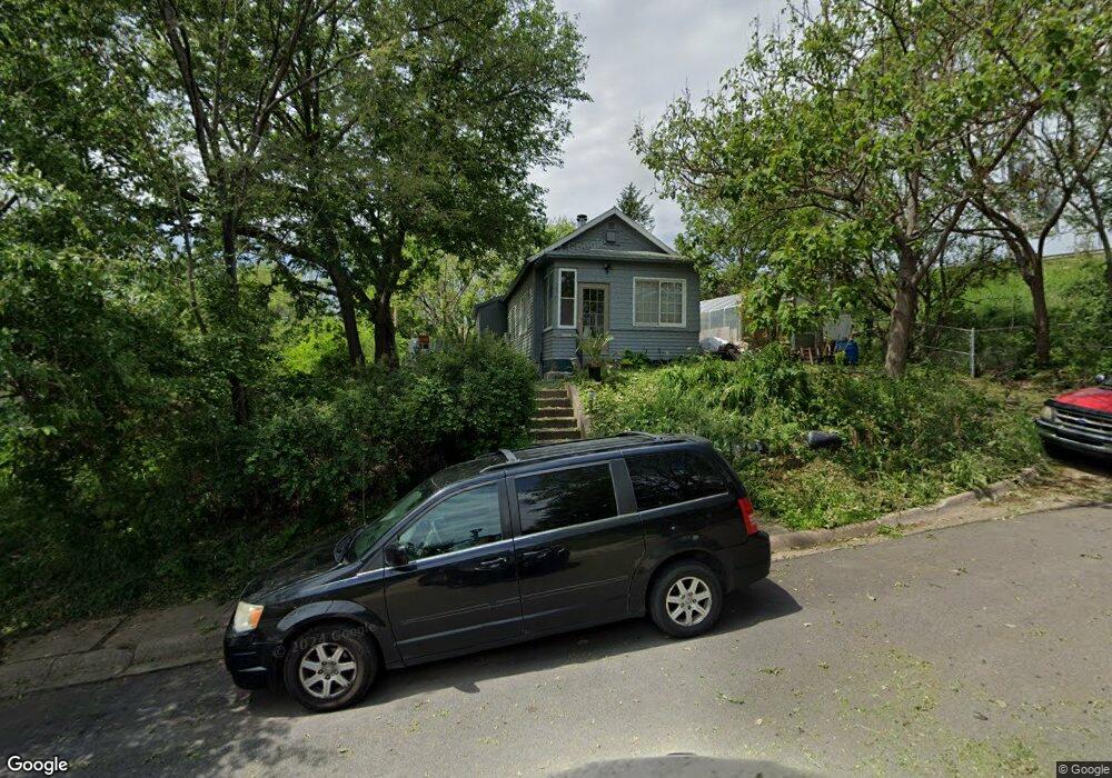
2761 Dean Cir Omaha, NE 68105
Vinton Street NeighborhoodEstimated Value: $133,000 - $161,000
1
Bed
1
Bath
805
Sq Ft
$176/Sq Ft
Est. Value
About This Home
This home is located at 2761 Dean Cir, Omaha, NE 68105 and is currently estimated at $141,357, approximately $175 per square foot. 2761 Dean Cir is a home located in Douglas County with nearby schools including Field Club Elementary School, Norris Middle School, and Our Lady Of Lourdes School.
Ownership History
Date
Name
Owned For
Owner Type
Purchase Details
Closed on
Jun 4, 2025
Sold by
Community Health Development Partners Ll
Bought by
Iswam-303 Llc
Current Estimated Value
Purchase Details
Closed on
Jul 4, 2022
Sold by
Grant Michael F
Bought by
Community Health Development Partners Llc
Purchase Details
Closed on
Jun 13, 2022
Sold by
Hl Folsom Diete
Bought by
Grant Michael F
Create a Home Valuation Report for This Property
The Home Valuation Report is an in-depth analysis detailing your home's value as well as a comparison with similar homes in the area
Home Values in the Area
Average Home Value in this Area
Purchase History
| Date | Buyer | Sale Price | Title Company |
|---|---|---|---|
| Iswam-303 Llc | $195,000 | Unity Title | |
| Community Health Development Partners Llc | $132,000 | Nebraska Title | |
| Grant Michael F | -- | Nebraska Title |
Source: Public Records
Tax History Compared to Growth
Tax History
| Year | Tax Paid | Tax Assessment Tax Assessment Total Assessment is a certain percentage of the fair market value that is determined by local assessors to be the total taxable value of land and additions on the property. | Land | Improvement |
|---|---|---|---|---|
| 2025 | $1,789 | $105,300 | $8,300 | $97,000 |
| 2024 | $1,608 | $105,300 | $8,300 | $97,000 |
| 2023 | $1,608 | $76,200 | $8,300 | $67,900 |
| 2022 | $1,661 | $77,800 | $9,900 | $67,900 |
| 2021 | $0 | $72,800 | $9,900 | $62,900 |
| 2020 | $0 | $65,400 | $3,500 | $61,900 |
| 2019 | $603 | $65,400 | $3,500 | $61,900 |
| 2018 | $604 | $28,100 | $3,500 | $24,600 |
| 2017 | $607 | $28,100 | $3,500 | $24,600 |
| 2016 | $603 | $28,100 | $3,500 | $24,600 |
| 2015 | $595 | $28,100 | $3,500 | $24,600 |
| 2014 | $595 | $28,100 | $3,500 | $24,600 |
Source: Public Records
Map
Nearby Homes
- 2916 Arbor St
- 2508 S 26th St
- 2510 S 26th St
- 3004 Arbor St
- 2507 Bancroft St
- 2915 S 26th St
- 2711 Shirley St
- 2436 S 23rd St
- 1706 S 26th St
- 3009 S 24th St
- 2822 S 32nd Ave
- 3103 Spring St
- 3401 Arbor St
- 1546 S 25th Ave
- 1742 S 32nd Ave
- 1516 S 29th St
- 1525 S 25th Ave
- 2707 S 20th St
- 1914 Bancroft St
- 2336 S 35th St
- 2753 Dean Cir
- 2762 Dean Cir
- 2758 Dean Cir
- 2766 Dean Cir
- 2754 Dean Cir
- 2457 S 27th Ave
- 2453 S 27th Ave
- 2451 S 27th Ave
- 2461 S 27th Ave
- 2447 S 27th Ave
- 2761 Hazel St
- 2757 Hazel St
- 2765 Hazel St Unit 1
- 2765 Hazel St
- 2765 Hazel St Unit 2
- 2751 Hazel St
- 2769 Hazel St
- 2419 S 27th Ave
- 2413 S 27th Ave
- 2409 S 27th Ave