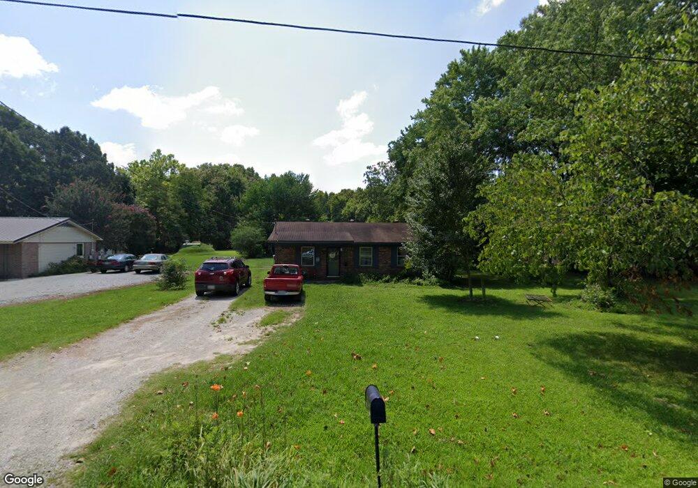
2766 Ashport Rd Jackson, TN 38305
Estimated Value: $136,000 - $161,000
--
Bed
1
Bath
1,280
Sq Ft
$114/Sq Ft
Est. Value
About This Home
This home is located at 2766 Ashport Rd, Jackson, TN 38305 and is currently estimated at $145,652, approximately $113 per square foot. 2766 Ashport Rd is a home located in Madison County with nearby schools including East Elementary School, Northeast Middle School, and North Side High School.
Ownership History
Date
Name
Owned For
Owner Type
Purchase Details
Closed on
Feb 28, 2014
Sold by
Smith Anthony Shayne
Bought by
Smith Christy Ann
Current Estimated Value
Home Financials for this Owner
Home Financials are based on the most recent Mortgage that was taken out on this home.
Original Mortgage
$28,500
Outstanding Balance
$21,610
Interest Rate
4.35%
Mortgage Type
New Conventional
Estimated Equity
$124,042
Purchase Details
Closed on
Jul 3, 1996
Sold by
Andrew Trimmer
Bought by
Anthony Smith
Purchase Details
Closed on
Jun 27, 1996
Bought by
Smith Anthony Shayne
Purchase Details
Closed on
Dec 21, 1980
Bought by
Trimmer Andrew
Purchase Details
Closed on
Jan 1, 1980
Create a Home Valuation Report for This Property
The Home Valuation Report is an in-depth analysis detailing your home's value as well as a comparison with similar homes in the area
Home Values in the Area
Average Home Value in this Area
Purchase History
| Date | Buyer | Sale Price | Title Company |
|---|---|---|---|
| Smith Christy Ann | $31,154 | -- | |
| Anthony Smith | $47,900 | -- | |
| Smith Anthony Shayne | $49,900 | -- | |
| Trimmer Andrew | -- | -- | |
| -- | $4,000 | -- |
Source: Public Records
Mortgage History
| Date | Status | Borrower | Loan Amount |
|---|---|---|---|
| Open | Smith Christy Ann | $28,500 |
Source: Public Records
Tax History Compared to Growth
Tax History
| Year | Tax Paid | Tax Assessment Tax Assessment Total Assessment is a certain percentage of the fair market value that is determined by local assessors to be the total taxable value of land and additions on the property. | Land | Improvement |
|---|---|---|---|---|
| 2024 | $526 | $28,050 | $3,375 | $24,675 |
| 2022 | $526 | $28,050 | $3,375 | $24,675 |
| 2021 | $341 | $14,525 | $3,000 | $11,525 |
| 2020 | $341 | $14,525 | $3,000 | $11,525 |
| 2019 | $341 | $14,525 | $3,000 | $11,525 |
| 2018 | $341 | $14,525 | $3,000 | $11,525 |
| 2017 | $360 | $14,675 | $3,000 | $11,675 |
| 2016 | $316 | $14,675 | $3,000 | $11,675 |
| 2015 | $316 | $14,675 | $3,000 | $11,675 |
| 2014 | $316 | $14,675 | $3,000 | $11,675 |
Source: Public Records
Map
Nearby Homes
- 0 Highway 70 E
- 228 Joy Ln
- 53 Beaumont Dr
- 199 Joy Ln
- 00 Hwy 70 E
- 74 Morisch Rd
- 135 Eagle Ridge Dr
- 3023 Christmasville Rd
- 00 Waynick Rd
- 92 Barnes Rd
- 10 Bermuda Cove
- 138 Wild Valley Dr
- 0 Wild Valley Drive & Watson Rd
- 440 Doak Mason Rd
- 98 Cotton Ridge Dr
- 0 Wild Valley Dr
- 0 Rider Dr
- 2142 Hwy 70 E
- 0 Hwy 70 & Bedford White Rd
- 71 Ellendale Place
- 2770 Ashport Rd
- 2762 Ashport Rd
- 2774 Ashport Rd
- 2760 Ashport Rd
- 2780 Ashport Rd
- 2756 Ashport Rd
- 2763 Ashport Rd
- 2750 Ashport Rd
- 2745 Ashport Rd
- 2802 Ashport Rd
- 2746 Ashport Rd
- 2721 Ashport Rd
- 2740 Ashport Rd
- 2736 Ashport Rd
- 2769 Ashport Rd
- 2804 Ashport Rd
- 2732 Ashport Rd
- 2730 Ashport Rd
- 2705 Ashport Rd
- 2699 Ashport Rd