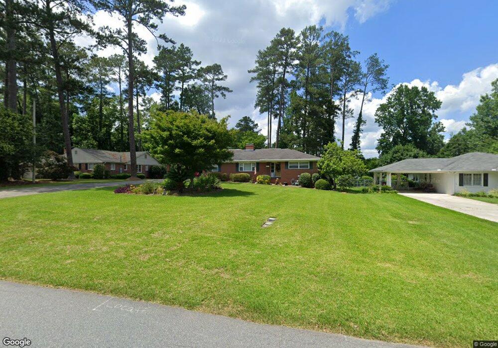
2767 Sheffield Rd Macon, GA 31204
Estimated Value: $213,110 - $234,000
3
Beds
3
Baths
1,952
Sq Ft
$114/Sq Ft
Est. Value
About This Home
This home is located at 2767 Sheffield Rd, Macon, GA 31204 and is currently estimated at $223,278, approximately $114 per square foot. 2767 Sheffield Rd is a home located in Bibb County with nearby schools including Rosa Taylor Elementary School, Miller Fine Arts Magnet Middle School, and Central High School.
Ownership History
Date
Name
Owned For
Owner Type
Purchase Details
Closed on
May 31, 2002
Bought by
Haynes Richard B and Haynes Sylvia M
Current Estimated Value
Purchase Details
Closed on
Apr 23, 1998
Create a Home Valuation Report for This Property
The Home Valuation Report is an in-depth analysis detailing your home's value as well as a comparison with similar homes in the area
Home Values in the Area
Average Home Value in this Area
Purchase History
| Date | Buyer | Sale Price | Title Company |
|---|---|---|---|
| Haynes Richard B | $114,000 | -- | |
| -- | $107,000 | -- |
Source: Public Records
Tax History Compared to Growth
Tax History
| Year | Tax Paid | Tax Assessment Tax Assessment Total Assessment is a certain percentage of the fair market value that is determined by local assessors to be the total taxable value of land and additions on the property. | Land | Improvement |
|---|---|---|---|---|
| 2025 | $1,443 | $65,713 | $8,480 | $57,233 |
| 2024 | $1,491 | $65,713 | $8,480 | $57,233 |
| 2023 | $1,682 | $63,790 | $8,480 | $55,310 |
| 2022 | $2,410 | $76,610 | $8,454 | $68,156 |
| 2021 | $2,094 | $62,118 | $7,153 | $54,965 |
| 2020 | $1,985 | $58,128 | $6,828 | $51,300 |
| 2019 | $1,845 | $54,139 | $6,503 | $47,636 |
| 2018 | $2,830 | $51,207 | $6,503 | $44,704 |
| 2017 | $1,363 | $43,367 | $6,724 | $36,643 |
| 2016 | $1,500 | $43,367 | $6,724 | $36,643 |
| 2015 | $2,255 | $46,039 | $7,564 | $38,475 |
| 2014 | $2,875 | $51,038 | $8,899 | $42,140 |
Source: Public Records
Map
Nearby Homes
- 789 Pinewood Dr
- 946 Fair Oaks Dr
- 2925 Malvern Hill Dr
- 2749 Northwoods Dr S
- 2956 Malvern Hill Dr
- 2939 General Lee Rd
- 676 Pierce Ave
- 796 Lee Rd
- 630 Pierce Ave
- 2740 Riverview Rd
- 2659 Gwinnett Dr
- 759 Mosby Ct
- 803 Captain Kell Dr
- 3175 Stinsonville Rd
- 509 Sugarloaf Dr
- 2576 Old Holton Rd
- 3341 Stinsonville Rd
- 2526 Old Holton Rd
- 720 Corbin Ave
- 2471 Old Holton Rd
- 2789 Sheffield Rd
- 2745 Sheffield Rd
- 0 Sheffield Rd Unit 8685344
- 0 Sheffield Rd Unit 8481519
- 0 Sheffield Rd Unit 7114495
- 0 Sheffield Rd Unit 3263088
- 2766 Forest Ridge Dr
- 2825 Sheffield Rd Unit D16
- 2825 Sheffield Rd
- 2768 Forest Ridge Dr
- 2721 Sheffield Rd
- 830 Pinewood Dr
- 2766 Sheffield Rd
- 2788 Sheffield Rd
- 2746 Sheffield Rd
- 2824 Forest Ridge Dr Unit .EMPTY
- 2824 Forest Ridge Dr Unit D-9
- 2824 Forest Ridge Dr
- 848 Pinewood Dr
- 2722 Sheffield Rd