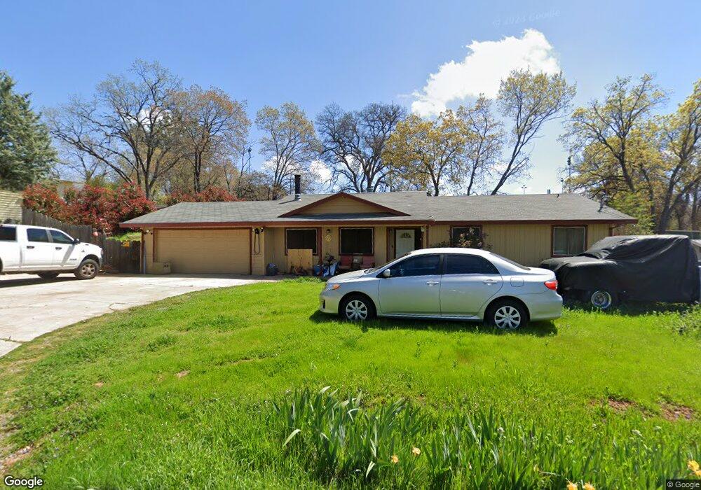
2767 Spear St Placerville, CA 95667
Estimated Value: $426,000 - $455,311
3
Beds
2
Baths
1,455
Sq Ft
$307/Sq Ft
Est. Value
About This Home
This home is located at 2767 Spear St, Placerville, CA 95667 and is currently estimated at $446,078, approximately $306 per square foot. 2767 Spear St is a home located in El Dorado County with nearby schools including El Dorado High School, Country Day Montessori, and El Dorado Adventist School.
Ownership History
Date
Name
Owned For
Owner Type
Purchase Details
Closed on
Jun 11, 2025
Sold by
Williams Michael R and Williams Christy R
Bought by
Michael & Christy Williams Family Trust and Williams
Current Estimated Value
Purchase Details
Closed on
Apr 4, 2011
Sold by
Mackey Gale and Mackey Kristen M
Bought by
Williams Michael R and Williams Christy R
Home Financials for this Owner
Home Financials are based on the most recent Mortgage that was taken out on this home.
Original Mortgage
$165,690
Interest Rate
4.62%
Mortgage Type
FHA
Purchase Details
Closed on
Feb 9, 2006
Sold by
Mackey Gale and Mackey Kristen
Bought by
Mackey Gale and Mackey Kristen M
Home Financials for this Owner
Home Financials are based on the most recent Mortgage that was taken out on this home.
Original Mortgage
$275,000
Interest Rate
6.2%
Mortgage Type
New Conventional
Purchase Details
Closed on
Aug 24, 2002
Sold by
Mackey Gale
Bought by
Mackey Gale and Mackey Kristen
Home Financials for this Owner
Home Financials are based on the most recent Mortgage that was taken out on this home.
Original Mortgage
$181,000
Interest Rate
6.29%
Purchase Details
Closed on
Aug 6, 2001
Sold by
Durbin Delores J
Bought by
Mackey Gale
Home Financials for this Owner
Home Financials are based on the most recent Mortgage that was taken out on this home.
Original Mortgage
$180,000
Interest Rate
7.09%
Purchase Details
Closed on
Jul 30, 2001
Sold by
Mackey Kristen M
Bought by
Mackey Gale
Home Financials for this Owner
Home Financials are based on the most recent Mortgage that was taken out on this home.
Original Mortgage
$180,000
Interest Rate
7.09%
Purchase Details
Closed on
May 27, 1994
Sold by
Durbin Delores J
Bought by
Durbin Delores J
Home Financials for this Owner
Home Financials are based on the most recent Mortgage that was taken out on this home.
Original Mortgage
$80,800
Interest Rate
8.53%
Create a Home Valuation Report for This Property
The Home Valuation Report is an in-depth analysis detailing your home's value as well as a comparison with similar homes in the area
Home Values in the Area
Average Home Value in this Area
Purchase History
| Date | Buyer | Sale Price | Title Company |
|---|---|---|---|
| Michael & Christy Williams Family Trust | -- | None Listed On Document | |
| Williams Michael R | $170,000 | Old Republic Title Company | |
| Mackey Gale | -- | Fidelity National Title Co | |
| Mackey Gale | -- | Old Republic Title Company | |
| Mackey Gale | $189,500 | First American Title Ins Co | |
| Mackey Gale | -- | First American Title Ins Co | |
| Durbin Delores J | -- | First American Title Co |
Source: Public Records
Mortgage History
| Date | Status | Borrower | Loan Amount |
|---|---|---|---|
| Previous Owner | Williams Michael R | $165,690 | |
| Previous Owner | Mackey Gale | $275,000 | |
| Previous Owner | Mackey Gale | $181,000 | |
| Previous Owner | Mackey Gale | $180,000 | |
| Previous Owner | Durbin Delores J | $80,800 |
Source: Public Records
Tax History
| Year | Tax Paid | Tax Assessment Tax Assessment Total Assessment is a certain percentage of the fair market value that is determined by local assessors to be the total taxable value of land and additions on the property. | Land | Improvement |
|---|---|---|---|---|
| 2025 | $2,278 | $217,784 | $51,239 | $166,545 |
| 2024 | $2,278 | $213,515 | $50,235 | $163,280 |
| 2023 | $2,251 | $209,329 | $49,250 | $160,079 |
| 2022 | $2,220 | $205,226 | $48,285 | $156,941 |
| 2021 | $2,195 | $201,203 | $47,339 | $153,864 |
| 2020 | $2,163 | $199,141 | $46,854 | $152,287 |
| 2019 | $2,136 | $195,237 | $45,936 | $149,301 |
| 2018 | $2,072 | $191,410 | $45,036 | $146,374 |
| 2017 | $2,042 | $187,657 | $44,153 | $143,504 |
| 2016 | $2,011 | $183,979 | $43,288 | $140,691 |
| 2015 | $1,954 | $181,218 | $42,639 | $138,579 |
| 2014 | $1,920 | $177,669 | $41,804 | $135,865 |
Source: Public Records
Map
Nearby Homes
- 629 James Dr
- 664 David Cir
- 691 David Cir
- 2701 Coloma St
- 837 Hillcrest St
- 2812 Bronzecrest St
- 2816 Holly Ct
- 2796 Coloma St
- 837 Vivian Ct
- 918 Woodpecker Ct
- 2401 Roxana St
- 2905 Wood St
- 2603 Kereka Ct
- 2968 Coloma St
- 2705 Woodridge Ct
- 525 Skyline Dr
- 2624 Liberty Mine Ct
- 2532 Golden Eagle Dr
- 0 Ray Lawyer Dr Unit 225065793
- 901 Union St
Your Personal Tour Guide
Ask me questions while you tour the home.