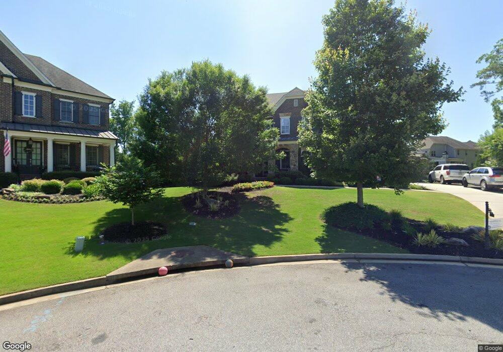
2768 Barnhill Dr Marietta, GA 30062
East Cobb NeighborhoodEstimated Value: $1,215,000 - $1,369,000
4
Beds
5
Baths
4,520
Sq Ft
$288/Sq Ft
Est. Value
About This Home
This home is located at 2768 Barnhill Dr, Marietta, GA 30062 and is currently estimated at $1,303,839, approximately $288 per square foot. 2768 Barnhill Dr is a home with nearby schools including Mountain View Elementary School, Hightower Trail Middle School, and Pope High School.
Ownership History
Date
Name
Owned For
Owner Type
Purchase Details
Closed on
Mar 14, 2014
Sold by
Ashton Atlanta Residential
Bought by
Mathis Jay C and Lee Cynthia J
Current Estimated Value
Home Financials for this Owner
Home Financials are based on the most recent Mortgage that was taken out on this home.
Original Mortgage
$703,850
Outstanding Balance
$531,107
Interest Rate
4.3%
Mortgage Type
New Conventional
Estimated Equity
$772,732
Create a Home Valuation Report for This Property
The Home Valuation Report is an in-depth analysis detailing your home's value as well as a comparison with similar homes in the area
Home Values in the Area
Average Home Value in this Area
Purchase History
| Date | Buyer | Sale Price | Title Company |
|---|---|---|---|
| Mathis Jay C | $785,531 | -- |
Source: Public Records
Mortgage History
| Date | Status | Borrower | Loan Amount |
|---|---|---|---|
| Open | Mathis Jay C | $703,850 |
Source: Public Records
Tax History Compared to Growth
Tax History
| Year | Tax Paid | Tax Assessment Tax Assessment Total Assessment is a certain percentage of the fair market value that is determined by local assessors to be the total taxable value of land and additions on the property. | Land | Improvement |
|---|---|---|---|---|
| 2025 | $13,760 | $528,896 | $120,000 | $408,896 |
| 2024 | $13,770 | $528,896 | $120,000 | $408,896 |
| 2023 | $13,329 | $533,568 | $120,000 | $413,568 |
| 2022 | $9,929 | $348,660 | $78,000 | $270,660 |
| 2021 | $9,929 | $348,660 | $78,000 | $270,660 |
| 2020 | $9,222 | $316,368 | $84,000 | $232,368 |
| 2019 | $9,222 | $316,368 | $84,000 | $232,368 |
| 2018 | $8,947 | $303,820 | $84,000 | $219,820 |
| 2017 | $8,478 | $303,820 | $84,000 | $219,820 |
| 2016 | $8,479 | $303,820 | $84,000 | $219,820 |
| 2015 | $8,690 | $303,820 | $84,000 | $219,820 |
| 2014 | $1,783 | $60,000 | $0 | $0 |
Source: Public Records
Map
Nearby Homes
- 2260 Falkirk Pointe Dr
- 2607 Lulworth Ln
- 2998 Kodiak Ct
- 2919 Manitoba Ln
- 2864 Saint Andrews Way NE
- 3091 Branford Ct
- 2138 Cedar Forks Dr Unit 2
- 2478 Alston Dr NE
- 3006 Alberta Dr
- 2186 Cedar Forks Dr
- 2540 Stoney Brook Ln NE
- 2404 Pondside Ct NE
- 2197 Cedar Forks Dr Unit 1
- 3237 Harvest Way
- 3152 Normandy Cir NE
- 2963 Timberline Rd Unit 2
- 2422 Salem Dr NE
- 2581 Oak Village Place NE
- 2764 Barnhill Dr
- 2772 Barnhill Dr
- 2555 Lulworth Ln
- 2760 Barnhill Dr
- 2551 Lulworth Ln
- 2773 Barnhill Dr
- 2769 Barnhill Dr
- 2765 Barnhill Dr
- 2559 Lulworth Ln
- 2761 Barnhill Dr
- 2552 Lulworth Ln
- 2800 Post Oak Tritt Rd
- 2563 Lulworth Ln
- 2757 Barnhill Dr
- 2752 Barnhill Dr
- 2265 Falkirk Pointe Dr
- 2275 Falkirk Pointe Dr
- 2632 Blanton Ct
- 2753 Barnhill Dr
- 2560 Lulworth Ln