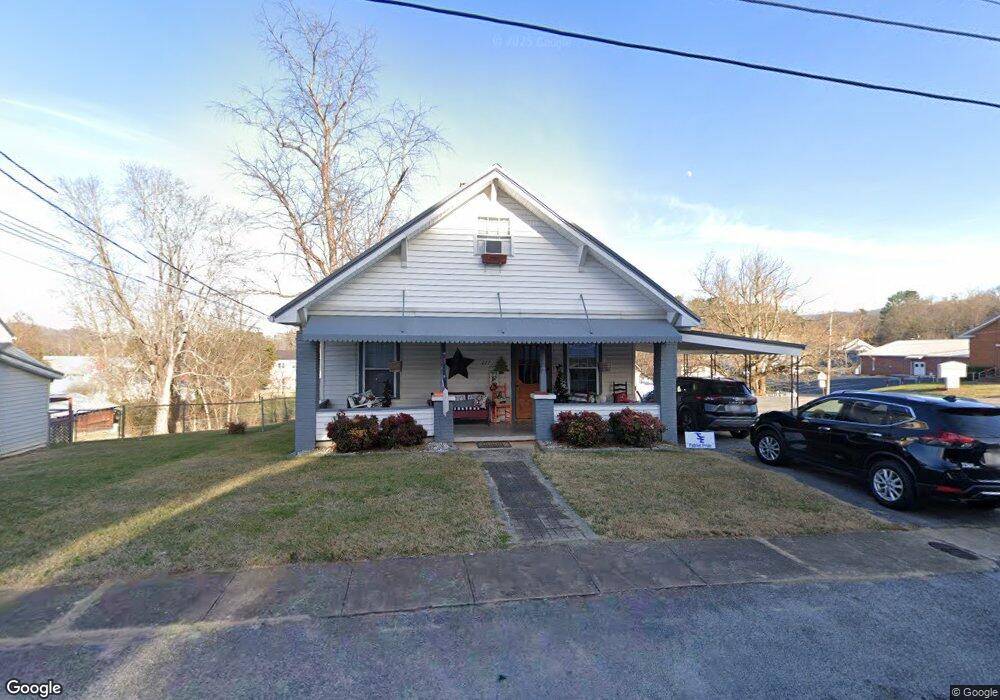
277 J Forrest Thomas St Bluff City, TN 37618
Estimated Value: $126,606 - $238,000
--
Bed
1
Bath
1,305
Sq Ft
$148/Sq Ft
Est. Value
About This Home
This home is located at 277 J Forrest Thomas St, Bluff City, TN 37618 and is currently estimated at $192,902, approximately $147 per square foot. 277 J Forrest Thomas St is a home located in Sullivan County with nearby schools including Bluff City Elementary School, Sullivan East Middle School, and Sullivan East High School.
Ownership History
Date
Name
Owned For
Owner Type
Purchase Details
Closed on
Jan 23, 2006
Current Estimated Value
Create a Home Valuation Report for This Property
The Home Valuation Report is an in-depth analysis detailing your home's value as well as a comparison with similar homes in the area
Home Values in the Area
Average Home Value in this Area
Purchase History
| Date | Buyer | Sale Price | Title Company |
|---|---|---|---|
| -- | $104,000 | -- |
Source: Public Records
Tax History Compared to Growth
Tax History
| Year | Tax Paid | Tax Assessment Tax Assessment Total Assessment is a certain percentage of the fair market value that is determined by local assessors to be the total taxable value of land and additions on the property. | Land | Improvement |
|---|---|---|---|---|
| 2024 | -- | $21,550 | $1,100 | $20,450 |
| 2023 | $799 | $21,550 | $1,100 | $20,450 |
| 2022 | $773 | $21,550 | $1,100 | $20,450 |
| 2021 | $773 | $21,550 | $1,100 | $20,450 |
| 2020 | $530 | $21,550 | $1,100 | $20,450 |
| 2019 | $794 | $20,625 | $1,100 | $19,525 |
| 2018 | $790 | $20,625 | $1,100 | $19,525 |
| 2017 | $790 | $20,625 | $1,100 | $19,525 |
| 2016 | $690 | $17,900 | $1,100 | $16,800 |
| 2014 | $641 | $17,888 | $0 | $0 |
Source: Public Records
Map
Nearby Homes
- 3593 Tennessee 390
- Lot 10 Highland Cir
- 371 Jonesboro Dr
- 426 Neal Dr
- Tbd Sells Rd
- 712 Old Elizabethton Hwy
- 290 Lakeview Dr
- Tbd Highway 11e
- 0 Randall Laura Ln
- 212 Littrell Private Dr
- 386 Andy Cole Rd
- 435 Whitehead Rd
- 112 Golden Rod Dr
- 1702 Fox Meadows Cir
- 1723 Fox Meadows Cir
- 1807 Fox Meadows Cir
- Salem Plan at The Hideaway at Fox Meadows
- Freeport Plan at The Hideaway at Fox Meadows
- Mansfield Plan at The Hideaway at Fox Meadows
- Richland Plan at The Hideaway at Fox Meadows
- 277 Maple Dr
- 271 J Forrest Thomas St
- 271 J Forrest Thomas St
- 271 J Forrest Thomas St
- 265 J Forrest Thomas St
- 314 Parks Worley St
- 438 Cedar St
- 257 J Forrest Thomas St
- 310 Parks Worley St
- 444 Cedar St
- 308 Carter St
- 304 Carter St
- 316 Carter St
- 332 James St
- 322 Parks Worley St
- 328 Carter St
- 321 James Ave
- 454 Cedar St
- 318 James St
- 334 Carter St