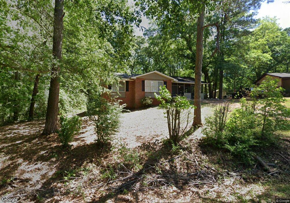
2770 Carter Loop Thomaston, GA 30286
Estimated Value: $86,000 - $111,547
3
Beds
2
Baths
1,146
Sq Ft
$84/Sq Ft
Est. Value
About This Home
This home is located at 2770 Carter Loop, Thomaston, GA 30286 and is currently estimated at $95,887, approximately $83 per square foot. 2770 Carter Loop is a home located in Upson County with nearby schools including Upson-Lee South Elementary School, Upson-Lee North Elementary School, and Upson-Lee Middle School.
Ownership History
Date
Name
Owned For
Owner Type
Purchase Details
Closed on
Feb 2, 2021
Sold by
Johnson Lankston
Bought by
Webb Brittany
Current Estimated Value
Home Financials for this Owner
Home Financials are based on the most recent Mortgage that was taken out on this home.
Original Mortgage
$43,200
Outstanding Balance
$38,337
Interest Rate
2.65%
Mortgage Type
New Conventional
Estimated Equity
$57,550
Purchase Details
Closed on
Jul 27, 2005
Sold by
Ellington Lisa
Bought by
Johnson Lankston O
Home Financials for this Owner
Home Financials are based on the most recent Mortgage that was taken out on this home.
Original Mortgage
$50,000
Interest Rate
5.48%
Mortgage Type
New Conventional
Create a Home Valuation Report for This Property
The Home Valuation Report is an in-depth analysis detailing your home's value as well as a comparison with similar homes in the area
Purchase History
| Date | Buyer | Sale Price | Title Company |
|---|---|---|---|
| Webb Brittany | $54,000 | -- | |
| Johnson Lankston O | $55,000 | -- |
Source: Public Records
Mortgage History
| Date | Status | Borrower | Loan Amount |
|---|---|---|---|
| Open | Webb Brittany | $43,200 | |
| Previous Owner | Johnson Lankston O | $50,000 |
Source: Public Records
Tax History
| Year | Tax Paid | Tax Assessment Tax Assessment Total Assessment is a certain percentage of the fair market value that is determined by local assessors to be the total taxable value of land and additions on the property. | Land | Improvement |
|---|---|---|---|---|
| 2025 | $734 | $28,501 | $1,688 | $26,813 |
| 2024 | $734 | $27,826 | $1,688 | $26,138 |
| 2023 | $731 | $26,855 | $1,688 | $25,167 |
| 2022 | $584 | $21,044 | $1,688 | $19,356 |
| 2021 | $542 | $22,566 | $1,688 | $20,878 |
| 2020 | $549 | $21,474 | $1,688 | $19,786 |
| 2019 | $546 | $19,810 | $1,688 | $18,122 |
| 2018 | $546 | $19,810 | $1,688 | $18,122 |
| 2017 | $555 | $18,510 | $1,688 | $16,822 |
| 2016 | $545 | $17,938 | $1,688 | $16,250 |
| 2015 | $545 | $17,938 | $1,688 | $16,250 |
| 2014 | $546 | $17,938 | $1,688 | $16,250 |
Source: Public Records
Map
Nearby Homes
- 2088 Wiley St
- 1484 Zorn St
- 0 Davis Lake Rd Unit 10511531
- 0 Highway 19 S Unit 24061935
- 112 Pasley St
- 276 Davis Lake Rd
- 0 Olympia Dr Unit 10716451
- 209 Upson Ave
- 133 Springdale Dr
- 374 Gordon School Rd
- 105 Upson Ave
- 701 S Green St
- 702 S Green St
- 603 S Green St
- 801 Greenwood Rd
- 312 Magnolia Ave
- 314 Cherokee Rd
- 120 Glenview Way Unit LOT 15
- 610 S Church St
- 135 Saw Mill Ct
- 2762 Carter Loop
- 2752 Carter Loop
- 1304 Grantling St
- 1201 Spring St
- 1308 Grantling St
- 1205 Spring St
- 2750 Carter Loop
- 1310 Grantling St
- 1207 Spring St
- 1303 Grantling St
- 2850 Pickard Place
- 1206 Spring St
- 1309 Grantling St
- 1314 Grantling St
- 1211 Spring St
- 0 Pickard Place Unit 11111933
- 1095 Solomon St
- 1085 Solomon St
- 1101 Solomon St
- 2719 Carter Loop
Your Personal Tour Guide
Ask me questions while you tour the home.