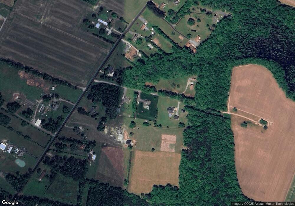
2772 Manning Rd Suffolk, VA 23434
Holy Neck NeighborhoodEstimated Value: $444,000 - $518,000
4
Beds
2
Baths
2,491
Sq Ft
$190/Sq Ft
Est. Value
About This Home
This home is located at 2772 Manning Rd, Suffolk, VA 23434 and is currently estimated at $473,732, approximately $190 per square foot. 2772 Manning Rd is a home located in Suffolk City with nearby schools including Southwestern Elementary School, Forest Glen Middle School, and Lakeland High School.
Ownership History
Date
Name
Owned For
Owner Type
Purchase Details
Closed on
Dec 12, 2014
Sold by
Secretary Of Veterans Affairs
Bought by
Mathews Jesse E
Current Estimated Value
Home Financials for this Owner
Home Financials are based on the most recent Mortgage that was taken out on this home.
Original Mortgage
$256,150
Outstanding Balance
$194,934
Interest Rate
3.98%
Mortgage Type
New Conventional
Estimated Equity
$278,798
Purchase Details
Closed on
Jun 18, 2014
Sold by
Equity Trustees Llc and Hall Luther B
Bought by
Sec Of Veterans Affairs
Create a Home Valuation Report for This Property
The Home Valuation Report is an in-depth analysis detailing your home's value as well as a comparison with similar homes in the area
Home Values in the Area
Average Home Value in this Area
Purchase History
| Date | Buyer | Sale Price | Title Company |
|---|---|---|---|
| Mathews Jesse E | $240,950 | -- | |
| Sec Of Veterans Affairs | $231,336 | -- |
Source: Public Records
Mortgage History
| Date | Status | Borrower | Loan Amount |
|---|---|---|---|
| Open | Sec Of Veterans Affairs | $256,150 |
Source: Public Records
Tax History Compared to Growth
Tax History
| Year | Tax Paid | Tax Assessment Tax Assessment Total Assessment is a certain percentage of the fair market value that is determined by local assessors to be the total taxable value of land and additions on the property. | Land | Improvement |
|---|---|---|---|---|
| 2025 | $5,709 | $491,500 | $61,900 | $429,600 |
| 2024 | $5,709 | $445,600 | $56,300 | $389,300 |
| 2023 | $5,161 | $430,100 | $56,300 | $373,800 |
| 2022 | $4,017 | $368,500 | $56,300 | $312,200 |
| 2021 | $3,926 | $353,700 | $56,300 | $297,400 |
| 2020 | $3,697 | $333,100 | $56,300 | $276,800 |
| 2019 | $3,697 | $333,100 | $56,300 | $276,800 |
| 2018 | $3,576 | $325,800 | $46,900 | $278,900 |
| 2017 | $3,375 | $315,400 | $46,900 | $268,500 |
| 2016 | $3,266 | $305,200 | $46,900 | $258,300 |
| 2015 | $1,673 | $305,200 | $46,900 | $258,300 |
| 2014 | $1,673 | $305,200 | $46,900 | $258,300 |
Source: Public Records
Map
Nearby Homes
- 2313 Manning Rd
- 1925 Copeland Rd
- 2101 Manning Rd
- 710 W Liberty Spring Rd
- 0 N Liberty Spring Rd (Tract: Ches Block 4-61-119)
- 3439 Jackson Rd
- 3320 Jackson Rd
- 2395 Copeland Rd
- 3003 Whaleyville Blvd
- 98 AC Whaleyville Blvd
- Hwy 13 Whaleyville Blvd
- .26+AC Lummis Rd
- 1913 Whaleyville Blvd
- 3316 Holland Rd
- 3221 Holland Rd
- 3320 Holland Rd
- 3240 Holland Rd
- .51ac Holland Rd
- 207 Beechwood Dr
- 2615 Jackson Rd
- 2764 Manning Rd
- 2778 Manning Rd
- 2722 Manning Rd
- 2710 Manning Rd
- 2736 Manning Rd
- 2776 Manning Rd
- 2706 Manning Rd
- 2702 Manning Rd
- 2792 Manning Rd
- 2804 Manning Rd
- 2698 Manning Rd
- 2705 Manning Rd
- 2705 Manning Rd
- 2820 Manning Rd
- 2674 Manning Rd
- 68 AC Manning Rd
- 2701 Manning Rd
- 2801 Manning Rd
- 1.50ac Manning Rd
- 5.6ac Manning Rd
