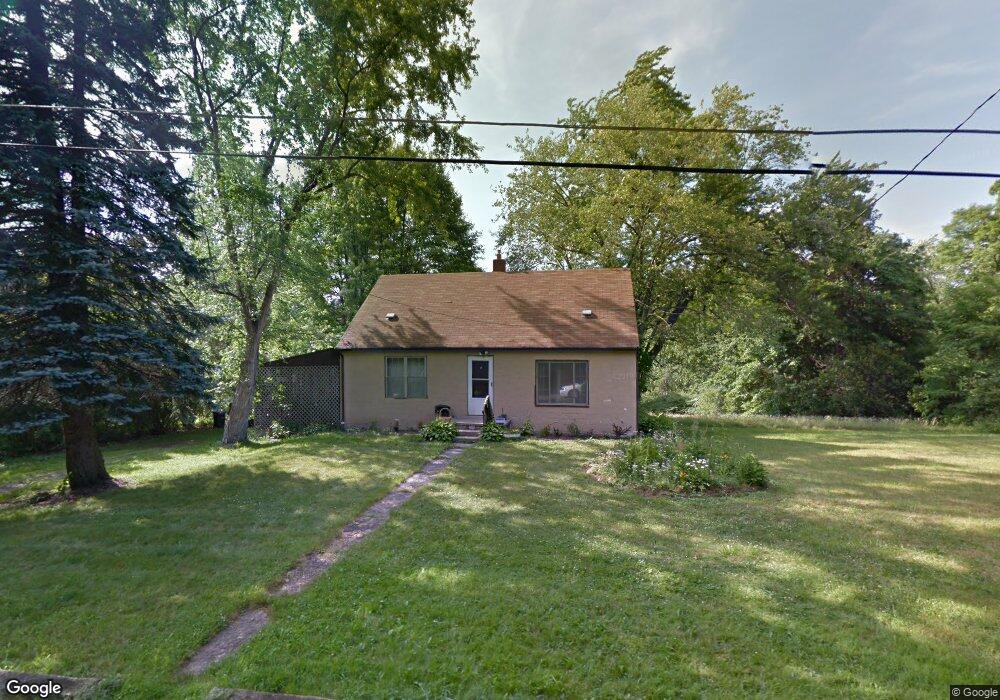
2776 Baker St Youngstown, OH 44505
McGuffey Heights NeighborhoodEstimated Value: $61,588 - $87,000
2
Beds
1
Bath
1,424
Sq Ft
$53/Sq Ft
Est. Value
About This Home
This home is located at 2776 Baker St, Youngstown, OH 44505 and is currently estimated at $74,897, approximately $52 per square foot. 2776 Baker St is a home located in Mahoning County with nearby schools including M.L. King Elementary School, Williamson Elementary School, and East High School.
Ownership History
Date
Name
Owned For
Owner Type
Purchase Details
Closed on
Mar 14, 2024
Sold by
Ware Magieleon C and Collier Magieleon C
Bought by
Ware Magieleon C
Current Estimated Value
Purchase Details
Closed on
Jul 2, 1993
Sold by
Hayes Earl and Mckelvey George
Bought by
Hayes Mccoy and Hayes Carol
Purchase Details
Closed on
Jan 9, 1989
Sold by
Clarett Henry A and Clarett Ruby
Bought by
Collier Mageileon C
Purchase Details
Closed on
Nov 4, 1985
Sold by
Hays Earl and Hays Elizabeth
Bought by
Clarett Henry A and Clarett Ruby
Purchase Details
Closed on
May 23, 1980
Bought by
Hays Earl and Hays Elizabeth
Create a Home Valuation Report for This Property
The Home Valuation Report is an in-depth analysis detailing your home's value as well as a comparison with similar homes in the area
Home Values in the Area
Average Home Value in this Area
Purchase History
| Date | Buyer | Sale Price | Title Company |
|---|---|---|---|
| Ware Magieleon C | -- | None Listed On Document | |
| Ware Magieleon C | -- | None Listed On Document | |
| Hayes Mccoy | $977 | None Available | |
| Collier Mageileon C | $23,000 | -- | |
| Clarett Henry A | -- | -- | |
| Hays Earl | -- | -- |
Source: Public Records
Tax History Compared to Growth
Tax History
| Year | Tax Paid | Tax Assessment Tax Assessment Total Assessment is a certain percentage of the fair market value that is determined by local assessors to be the total taxable value of land and additions on the property. | Land | Improvement |
|---|---|---|---|---|
| 2024 | $343 | $7,150 | $1,160 | $5,990 |
| 2023 | $340 | $7,150 | $1,160 | $5,990 |
| 2022 | $140 | $2,230 | $1,110 | $1,120 |
| 2021 | $140 | $2,230 | $1,110 | $1,120 |
| 2020 | $140 | $2,230 | $1,110 | $1,120 |
| 2019 | $148 | $2,070 | $1,030 | $1,040 |
| 2018 | $149 | $2,070 | $1,030 | $1,040 |
| 2017 | $158 | $2,070 | $1,030 | $1,040 |
| 2016 | $171 | $2,610 | $1,030 | $1,580 |
| 2015 | $167 | $2,610 | $1,030 | $1,580 |
| 2014 | $166 | $2,610 | $1,030 | $1,580 |
| 2013 | $164 | $2,610 | $1,030 | $1,580 |
Source: Public Records
Map
Nearby Homes
- 1003 Liberty Rd
- 1214 Brighton St
- 1720 Jacobs Rd
- 1325 Miami Ave
- 902 Miami St
- 2051 Blair Ave
- V/L Jacobs Rd
- 2951 Megan Cir
- 2831 Benford Ln
- 2954 Megan Cir
- 227 Greeley Ln
- 405 Drake Ave
- 566 Sunshine Ave
- 1538 Republic Ave
- 71 Duncan Ln
- 332 Lansdowne Blvd
- OL 38 Mccartney Rd
- 598 Cassius Ave
- 1125 N Garland Ave
- 0 Homestead Rd
- 3818 Baker St
- 2826 Baker St
- 2829 Baker St
- 2810 McGuffey Rd
- 2833 Baker St
- 2830 McGuffey Rd
- 1200 Forest Glen Ave
- 1403 Hillcrest Ave
- 2747 McGuffey Rd
- 2811 McGuffey Rd
- 2730 McGuffey Rd
- 2819 McGuffey Rd
- 2722 McGuffey Rd
- 2835 McGuffey Rd
- 2848 McGuffey Rd
- 2741 McGuffey Rd
- 2841 McGuffey Rd
- 521 Forest Glen Ave
- 1049 Bryn Mawr Ave
- 2845 McGuffey Rd