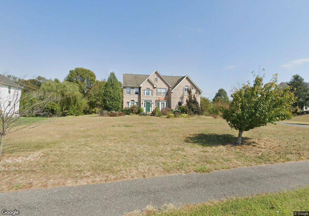
278 Jennings Way Mickleton, NJ 08056
East Greenwich Township NeighborhoodEstimated Value: $712,000 - $776,000
--
Bed
--
Bath
3,265
Sq Ft
$225/Sq Ft
Est. Value
About This Home
This home is located at 278 Jennings Way, Mickleton, NJ 08056 and is currently estimated at $734,222, approximately $224 per square foot. 278 Jennings Way is a home located in Gloucester County with nearby schools including Jeffrey Clark School, Samuel Mickle School, and Kingsway Regional Middle School.
Ownership History
Date
Name
Owned For
Owner Type
Purchase Details
Closed on
Jun 26, 2003
Sold by
Heritage Summer Meadow Lp
Bought by
Vogel William Todd and Vogel Carole Teresa
Current Estimated Value
Home Financials for this Owner
Home Financials are based on the most recent Mortgage that was taken out on this home.
Original Mortgage
$298,150
Outstanding Balance
$129,335
Interest Rate
5.53%
Mortgage Type
Purchase Money Mortgage
Estimated Equity
$604,887
Create a Home Valuation Report for This Property
The Home Valuation Report is an in-depth analysis detailing your home's value as well as a comparison with similar homes in the area
Home Values in the Area
Average Home Value in this Area
Purchase History
| Date | Buyer | Sale Price | Title Company |
|---|---|---|---|
| Vogel William Todd | $372,780 | Commonwealth Land Title Ins |
Source: Public Records
Mortgage History
| Date | Status | Borrower | Loan Amount |
|---|---|---|---|
| Open | Vogel William Todd | $298,150 |
Source: Public Records
Tax History Compared to Growth
Tax History
| Year | Tax Paid | Tax Assessment Tax Assessment Total Assessment is a certain percentage of the fair market value that is determined by local assessors to be the total taxable value of land and additions on the property. | Land | Improvement |
|---|---|---|---|---|
| 2025 | $13,695 | $430,800 | $83,300 | $347,500 |
| 2024 | $13,260 | $430,800 | $83,300 | $347,500 |
| 2023 | $13,260 | $430,800 | $83,300 | $347,500 |
| 2022 | $12,885 | $430,800 | $83,300 | $347,500 |
| 2021 | $12,971 | $430,800 | $83,300 | $347,500 |
| 2020 | $13,032 | $430,800 | $83,300 | $347,500 |
| 2019 | $12,898 | $430,800 | $83,300 | $347,500 |
| 2018 | $12,275 | $372,300 | $112,900 | $259,400 |
| 2017 | $12,115 | $372,300 | $112,900 | $259,400 |
| 2016 | $11,973 | $372,300 | $112,900 | $259,400 |
| 2015 | $11,474 | $372,300 | $112,900 | $259,400 |
| 2014 | $10,767 | $372,300 | $112,900 | $259,400 |
Source: Public Records
Map
Nearby Homes
- 121 White Owl Trail
- 976 Bridgeton Pike
- B 45, L 10.02 Wolfert Station Rd
- 67 E Rattling Run Rd
- 34 Redkist Dr
- 32 Redkist Dr
- 28 Redkist Dr
- 53 Redkist Dr
- 55 Redkist Dr
- 57 Redkist Dr
- 72 Redkist Dr
- 59 Redkist Dr
- 74 Redkist Dr
- 11 Redkist Dr
- 76 Redkist Dr
- 9 Redkist Dr
- 7 Redkist Dr
- Carriage Home-Ashford Plan at Orchard View at Mullica Hill - Carriage Homes
- Belford Plan at Orchard View at Mullica Hill
- Chatham Plan at Orchard View at Mullica Hill