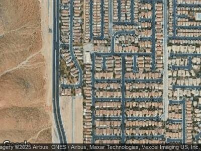
278 Lenape Heights Ave Las Vegas, NV 89148
Rhodes Ranch NeighborhoodEstimated Value: $569,009 - $619,000
4
Beds
3
Baths
2,780
Sq Ft
$214/Sq Ft
Est. Value
About This Home
This home is located at 278 Lenape Heights Ave, Las Vegas, NV 89148 and is currently estimated at $595,252, approximately $214 per square foot. 278 Lenape Heights Ave is a home located in Clark County with nearby schools including Don and Dee Snyder Elementary School, Wilbur & Theresa Faiss Middle School, and Sierra Vista High School.
Ownership History
Date
Name
Owned For
Owner Type
Purchase Details
Closed on
Mar 31, 2003
Sold by
Rhodes Ranch General Partnership
Bought by
Lai Charles and Hon Ann Yin Nei
Current Estimated Value
Home Financials for this Owner
Home Financials are based on the most recent Mortgage that was taken out on this home.
Original Mortgage
$165,700
Interest Rate
7.5%
Create a Home Valuation Report for This Property
The Home Valuation Report is an in-depth analysis detailing your home's value as well as a comparison with similar homes in the area
Home Values in the Area
Average Home Value in this Area
Purchase History
| Date | Buyer | Sale Price | Title Company |
|---|---|---|---|
| Lai Charles | $243,605 | Commerce Title |
Source: Public Records
Mortgage History
| Date | Status | Borrower | Loan Amount |
|---|---|---|---|
| Open | Lai Charles | $150,000 | |
| Open | Lai Charles | $281,190 | |
| Closed | Lai Charles | $273,000 | |
| Closed | Lai Charles | $165,700 |
Source: Public Records
Tax History Compared to Growth
Tax History
| Year | Tax Paid | Tax Assessment Tax Assessment Total Assessment is a certain percentage of the fair market value that is determined by local assessors to be the total taxable value of land and additions on the property. | Land | Improvement |
|---|---|---|---|---|
| 2025 | $3,938 | $144,232 | $46,200 | $98,032 |
| 2024 | $3,647 | $144,232 | $46,200 | $98,032 |
| 2023 | $3,647 | $132,349 | $39,900 | $92,449 |
| 2022 | $3,377 | $121,027 | $36,750 | $84,277 |
| 2021 | $3,127 | $114,228 | $34,300 | $79,928 |
| 2020 | $2,901 | $113,483 | $34,300 | $79,183 |
| 2019 | $2,719 | $109,660 | $31,500 | $78,160 |
| 2018 | $2,594 | $102,436 | $28,000 | $74,436 |
| 2017 | $3,132 | $106,140 | $31,500 | $74,640 |
| 2016 | $2,428 | $93,076 | $17,500 | $75,576 |
| 2015 | $2,423 | $88,746 | $14,350 | $74,396 |
| 2014 | $2,421 | $76,822 | $9,450 | $67,372 |
Source: Public Records
Map
Nearby Homes
- 91 Bowler Springs St
- 83 Rock Run St
- 7417 Manfre St
- 180 Duck Hollow Ave
- 115 Cora Hills Ct
- 81 Alpine Bay Ave
- 9174 Mcginnis Ave
- 74 Harbor Coast St Unit 2
- 7361 Ringquist St
- 19 Dryden Park Ave
- 7282 Quarterhorse Ln
- 21 Ocean Harbour Ln
- 9056 Maycott Ave
- 151 Cliff Valley Dr
- 9519 Chandler Springs Ave
- 9329 Iceland Spar Ct
- 170 Wicked Wedge Way
- 9066 Hilverson Ave
- 9519 Wild Valley Ave
- 9496 Wild Valley Ave
- 278 Lenape Heights Ave
- 270 Lenape Heights Ave Unit 5
- 286 Lenape Heights Ave
- 121 Cooks Creek Ct
- 262 Lenape Heights Ave Unit 5
- 127 Cooks Creek Ct
- 120 Cooks Creek Ct
- 254 Lenape Heights Ave
- 277 Lenape Heights Ave
- 269 Lenape Heights Ave
- 285 Lenape Heights Ave
- 261 Lenape Heights Ave
- 126 Cooks Creek Ct
- 119 Standing Stone St
- 133 Cooks Creek Ct
- 121 Standing Stone St
- 121 Standing Stone St Unit n/a
- 117 Standing Stone St
- 125 Standing Stone St
- 115 Standing Stone St
