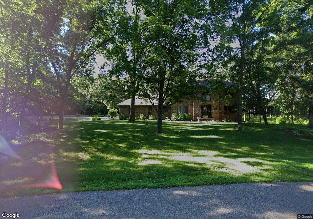
278 Station Cir N Hudson, WI 54016
Estimated Value: $683,191 - $768,000
4
Beds
4
Baths
3,626
Sq Ft
$200/Sq Ft
Est. Value
About This Home
This home is located at 278 Station Cir N, Hudson, WI 54016 and is currently estimated at $723,548, approximately $199 per square foot. 278 Station Cir N is a home located in St. Croix County with nearby schools including North Hudson Elementary School, Hudson Middle School, and Hudson High School.
Ownership History
Date
Name
Owned For
Owner Type
Purchase Details
Closed on
Dec 31, 2020
Sold by
Dybvig Robert H and Rohr Bonnie J
Bought by
Dybvig Robert H and Rohr Bonnie J
Current Estimated Value
Purchase Details
Closed on
Aug 5, 2020
Sold by
Calhoun Douglas R and Calhoun Linda A
Bought by
Calhoun Douglas R and Calhoun Linda A
Home Financials for this Owner
Home Financials are based on the most recent Mortgage that was taken out on this home.
Original Mortgage
$428,000
Interest Rate
3.1%
Mortgage Type
Construction
Purchase Details
Closed on
Jun 26, 2020
Sold by
Currey Randy and Currey Louise
Bought by
Calhoun Douglas R and Calhoun Linda A
Home Financials for this Owner
Home Financials are based on the most recent Mortgage that was taken out on this home.
Original Mortgage
$428,000
Interest Rate
3.1%
Mortgage Type
Construction
Purchase Details
Closed on
Oct 18, 2018
Sold by
Sundet Douglas C and Sundet Roxanne E
Bought by
Currey Randy and Currey Louise
Home Financials for this Owner
Home Financials are based on the most recent Mortgage that was taken out on this home.
Original Mortgage
$225,000
Interest Rate
4.5%
Mortgage Type
Construction
Create a Home Valuation Report for This Property
The Home Valuation Report is an in-depth analysis detailing your home's value as well as a comparison with similar homes in the area
Home Values in the Area
Average Home Value in this Area
Purchase History
| Date | Buyer | Sale Price | Title Company |
|---|---|---|---|
| Dybvig Robert H | -- | None Listed On Document | |
| Calhoun Douglas R | -- | None Available | |
| Calhoun Douglas R | $535,000 | Titlesmart | |
| Currey Randy | $500,000 | None Available |
Source: Public Records
Mortgage History
| Date | Status | Borrower | Loan Amount |
|---|---|---|---|
| Previous Owner | Calhoun Douglas R | $428,000 | |
| Previous Owner | Currey Randy | $225,000 |
Source: Public Records
Tax History
| Year | Tax Paid | Tax Assessment Tax Assessment Total Assessment is a certain percentage of the fair market value that is determined by local assessors to be the total taxable value of land and additions on the property. | Land | Improvement |
|---|---|---|---|---|
| 2025 | $8,813 | $640,900 | $172,600 | $468,300 |
| 2024 | $84 | $640,900 | $172,600 | $468,300 |
| 2023 | $8,478 | $640,900 | $172,600 | $468,300 |
| 2022 | $8,927 | $640,900 | $172,600 | $468,300 |
| 2021 | $8,723 | $433,000 | $89,700 | $343,300 |
| 2020 | $8,434 | $433,000 | $89,700 | $343,300 |
| 2019 | $7,878 | $433,000 | $89,700 | $343,300 |
| 2018 | $7,808 | $433,000 | $89,700 | $343,300 |
| 2017 | $7,518 | $433,000 | $89,700 | $343,300 |
| 2016 | $7,518 | $433,000 | $89,700 | $343,300 |
| 2015 | $6,903 | $433,000 | $89,700 | $343,300 |
| 2014 | $6,847 | $433,000 | $89,700 | $343,300 |
| 2013 | $7,467 | $476,100 | $120,000 | $356,100 |
Source: Public Records
Map
Nearby Homes
- 811 Fox Tree Ln N
- 241 Starrwood
- 214 Galahad Place N
- 641 8th St N
- 612 4th St N Unit 15
- 1029 Sommers St N
- 1031 Sommers St N
- 1110 Partridge Ln N
- 1264 10th St N
- 1143 Sommers St N
- 403 7th St N
- 418 4th St N
- 530 Lakeside Bay Dr S
- 709 Saint Croix St N
- 1026 Monroe St N
- 479 Mariner Dr
- 322 5th St N
- 888 Bluebird Ct N
- 1075 Autumn Oak Ln
- 312 Meadow Dr N
- 330 Station Ln N
- 270 Station Cir N
- 420 Pineview N
- 325 Station Ln N
- 414 Pineview N
- 273 Station Cir N
- 334 Station Ln N
- 317 Station Ln N
- 311 Station Ln N
- 335 Station Ln N
- 549 Sommers Landing Rd N
- 408 Pineview N
- 262 Station Cir N
- 263 Station Cir N
- 345 Station Ln N
- 560 Sommers Landing Rd N
- 413 Pineview N
- 419 Pineview N
- 535 Sommers Landing Rd N
- 402 Pineview N
Your Personal Tour Guide
Ask me questions while you tour the home.