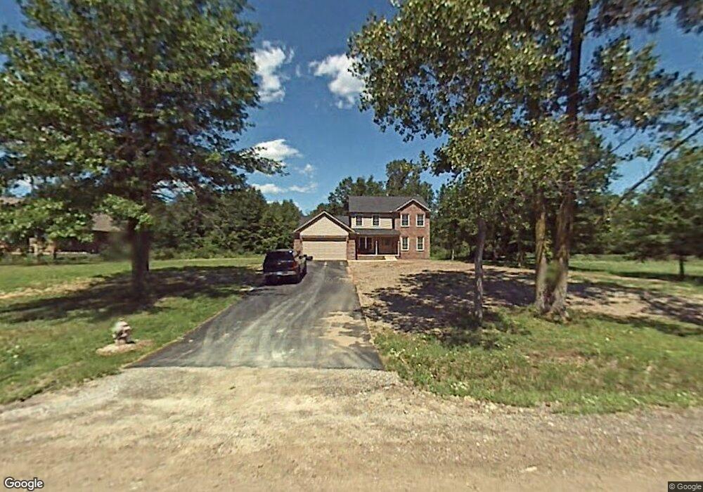
27800 Bredow Ave Romulus, MI 48174
Estimated Value: $486,000 - $572,000
4
Beds
3
Baths
2,438
Sq Ft
$217/Sq Ft
Est. Value
About This Home
This home is located at 27800 Bredow Ave, Romulus, MI 48174 and is currently estimated at $529,169, approximately $217 per square foot. 27800 Bredow Ave is a home located in Wayne County with nearby schools including Wegienka Elementary School, Brownstown Middle School, and Patrick Henry Middle School.
Ownership History
Date
Name
Owned For
Owner Type
Purchase Details
Closed on
Dec 3, 2004
Sold by
Oliver John D
Bought by
Cooper Christopher S and Cooper Toni C
Current Estimated Value
Purchase Details
Closed on
Jun 20, 2003
Sold by
Strochine Terry L
Bought by
Oliver John D and Oliver Coleen M
Create a Home Valuation Report for This Property
The Home Valuation Report is an in-depth analysis detailing your home's value as well as a comparison with similar homes in the area
Home Values in the Area
Average Home Value in this Area
Purchase History
| Date | Buyer | Sale Price | Title Company |
|---|---|---|---|
| Cooper Christopher S | $132,000 | -- | |
| Oliver John D | $115,000 | -- |
Source: Public Records
Tax History Compared to Growth
Tax History
| Year | Tax Paid | Tax Assessment Tax Assessment Total Assessment is a certain percentage of the fair market value that is determined by local assessors to be the total taxable value of land and additions on the property. | Land | Improvement |
|---|---|---|---|---|
| 2025 | $4,284 | $280,300 | $0 | $0 |
| 2024 | $4,284 | $251,400 | $0 | $0 |
| 2023 | $4,083 | $237,400 | $0 | $0 |
| 2022 | $5,670 | $220,800 | $0 | $0 |
| 2021 | $5,491 | $208,400 | $0 | $0 |
| 2020 | $5,411 | $165,300 | $0 | $0 |
| 2019 | $5,204 | $147,900 | $0 | $0 |
| 2018 | $3,564 | $146,600 | $0 | $0 |
| 2017 | $2,975 | $103,400 | $0 | $0 |
| 2016 | $4,965 | $103,400 | $0 | $0 |
| 2015 | $8,311 | $98,500 | $0 | $0 |
| 2013 | $8,750 | $87,500 | $0 | $0 |
| 2012 | -- | $87,500 | $15,600 | $71,900 |
Source: Public Records
Map
Nearby Homes
- 27557 Bredow Ave
- 19497 Inkster Rd
- 19497 Inkster Rd
- 19106 Sylvia Ave
- 20701 Doves Pointe Dr Unit 85
- 20730 Doves Pointe Dr Unit 14
- 29463 Sibley Rd
- 22017 Letour St
- 19340 Heiden Dr Unit 20
- 0000 Sibley Sibley Rd
- 22213 Inkster Rd
- VAC Sibley Rd
- 25679 Sibley Rd
- 17425 Spartan Dr
- 22293 Georgia Pine Dr
- 25609 King Rd
- 27520 West Rd
- 17380 Michigan Heights Dr Unit 137
- 000 Central St
- 16784 Heather Blvd
- 27700 Bredow Rd
- 27700 Bredow Ave
- 27900 Bredow Ave
- 27731 Bredow Ave
- 27687 Bredow Ave
- 27600 Bredow Ave
- 27615 Bredow Ave
- 27775 Bredow Ave
- 27501 Bredow Ave
- 19920 Inkster Rd
- 19940 Inkster Rd
- 20026 Inkster Rd
- 19850 Inkster Rd
- 20046 Inkster Rd
- 19826 Inkster Rd
- 20080 Inkster Rd
- 28055 Bredow Ave
- 20100 Inkster Rd
- 19600 Inkster Rd
- 19969 Inkster Rd Unit Bldg-Unit