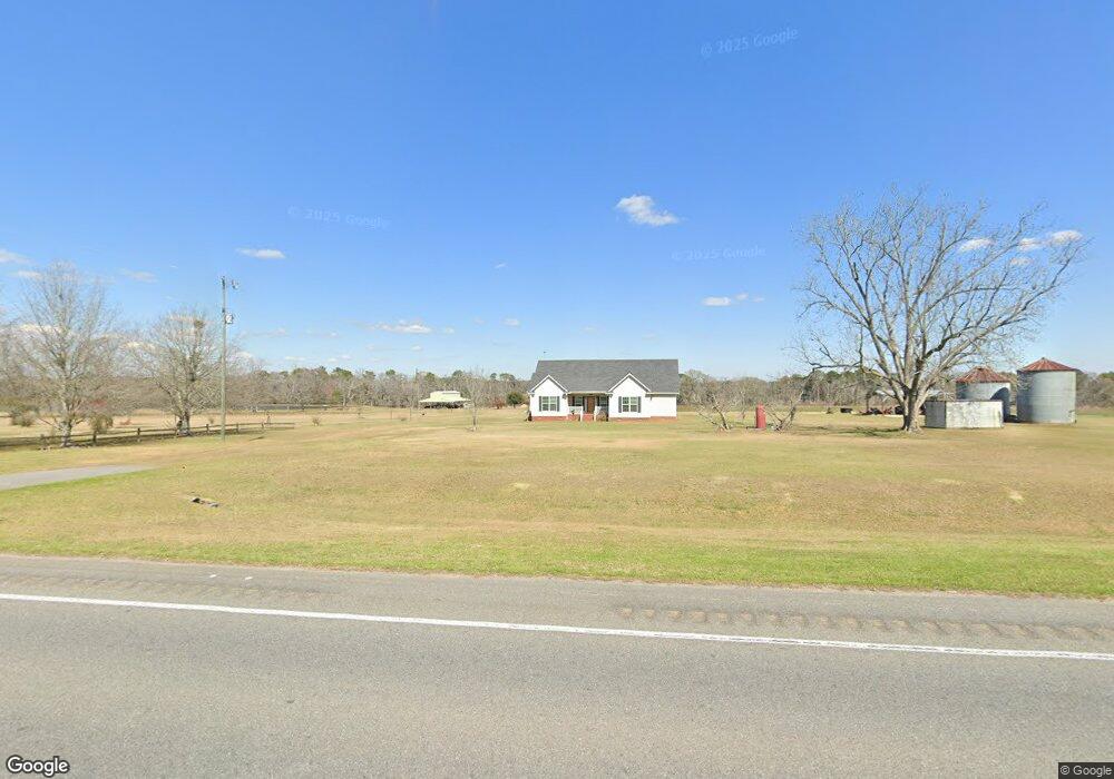
2785 Ga Highway 133 S Moultrie, GA 31788
Estimated Value: $207,000 - $281,000
--
Bed
2
Baths
1,666
Sq Ft
$140/Sq Ft
Est. Value
About This Home
This home is located at 2785 Ga Highway 133 S, Moultrie, GA 31788 and is currently estimated at $233,353, approximately $140 per square foot. 2785 Ga Highway 133 S is a home located in Colquitt County with nearby schools including Odom Elementary School, Willie J. Williams Middle School, and C.A. Gray Junior High School.
Ownership History
Date
Name
Owned For
Owner Type
Purchase Details
Closed on
Sep 13, 2015
Sold by
Bridges Olin
Bought by
Bridges Allegood Glenda and Rowley Peggy Jean
Current Estimated Value
Purchase Details
Closed on
Jan 21, 2014
Sold by
Metcalfe Sharon Dale
Bought by
Bridges Avis A
Purchase Details
Closed on
Nov 28, 2001
Bought by
Bridges Avis A
Purchase Details
Closed on
May 21, 1987
Bought by
Bridges Avis A
Create a Home Valuation Report for This Property
The Home Valuation Report is an in-depth analysis detailing your home's value as well as a comparison with similar homes in the area
Home Values in the Area
Average Home Value in this Area
Purchase History
| Date | Buyer | Sale Price | Title Company |
|---|---|---|---|
| Bridges Allegood Glenda | -- | -- | |
| Bridges Allegood Glenda | -- | -- | |
| Bridges Avis A | $2,100 | -- | |
| Bridges Avis A | -- | -- | |
| Bridges Avis A | $50,000 | -- |
Source: Public Records
Tax History Compared to Growth
Tax History
| Year | Tax Paid | Tax Assessment Tax Assessment Total Assessment is a certain percentage of the fair market value that is determined by local assessors to be the total taxable value of land and additions on the property. | Land | Improvement |
|---|---|---|---|---|
| 2024 | $1,617 | $84,212 | $1,883 | $82,329 |
| 2023 | $1,642 | $66,431 | $1,883 | $64,548 |
| 2022 | $1,286 | $60,179 | $1,674 | $58,505 |
| 2021 | $1,140 | $53,187 | $1,674 | $51,513 |
| 2020 | $1,063 | $49,242 | $1,674 | $47,568 |
| 2019 | $1,305 | $53,694 | $1,674 | $52,020 |
| 2018 | $1,373 | $53,694 | $1,674 | $52,020 |
| 2017 | $1,318 | $54,672 | $2,652 | $52,020 |
| 2016 | $1,336 | $54,672 | $2,652 | $52,020 |
| 2015 | $1,346 | $54,672 | $2,652 | $52,020 |
| 2014 | -- | $36,086 | $2,652 | $33,434 |
| 2013 | -- | $36,086 | $2,652 | $33,433 |
Source: Public Records
Map
Nearby Homes
- 2262 Sardis Church Rd
- 182 Horseshoe Dr
- 0 Sardis Church Rd
- 0 Upper Trail Unit 913421
- 0 Upper Trail Unit 913422
- 277 Indian Creek Subdivision
- 124 Flint Dr
- 132 Tallokas Trail
- 270 Old Timey Trail
- 1113 Georgia 133
- 410 Indian Trail
- 0 Old Timey Trail
- 31 31st Ave SE
- 292 Robin Ln
- 65 Packer Pride Dr SE
- 16 Francine Way SE
- 48 Packer Pride Dr SE
- 4 Baldwin Place SE
- 157 Quail Ridge
- 85 Cobblestone Blvd SE
- 2777 Ga Highway 133 S
- 2890 Ga Highway 133 S
- 3062 Ga Highway 133 S
- 3059 Ga Highway 133 S
- 2685 Ga Highway 133 S
- 3099 Ga Highway 133 S
- 287 Culbertson Rd
- 282 Culbertson Rd
- 301 Culbertson Rd
- 3122 Ga Highway 133 S
- 3125 Ga Highway 133 S
- 210 W E Hart Rd
- 61.98 Ac Ga Hwy 133
- 490 Mcmullen Rd
- 108 Old Culbertson Rd
- 2510 Ga Highway 133 S
- 158 Old Culbertson Rd
- 2557 Ga Highway 133 S
- 400 Culbertson Rd
- 550 Mcmullen Rd