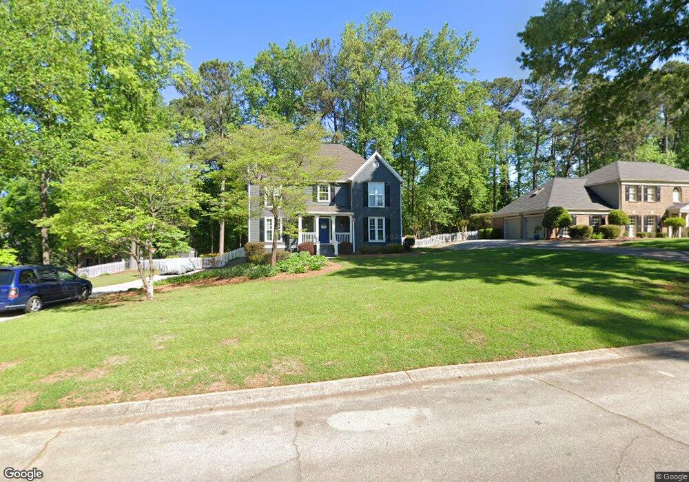
2785 Saxon Dr Unit 5 Duluth, GA 30096
Estimated Value: $471,080 - $512,000
4
Beds
3
Baths
2,178
Sq Ft
$227/Sq Ft
Est. Value
About This Home
This home is located at 2785 Saxon Dr Unit 5, Duluth, GA 30096 and is currently estimated at $494,270, approximately $226 per square foot. 2785 Saxon Dr Unit 5 is a home located in Gwinnett County with nearby schools including M. H. Mason Elementary School, Hull Middle School, and Peachtree Ridge High School.
Ownership History
Date
Name
Owned For
Owner Type
Purchase Details
Closed on
Nov 1, 2002
Sold by
Mcneese William R and Mcneese Nancy S
Bought by
Baggett Brooks D and Baggett Elizabeth L
Current Estimated Value
Home Financials for this Owner
Home Financials are based on the most recent Mortgage that was taken out on this home.
Original Mortgage
$157,050
Outstanding Balance
$67,469
Interest Rate
6.63%
Mortgage Type
New Conventional
Estimated Equity
$426,801
Create a Home Valuation Report for This Property
The Home Valuation Report is an in-depth analysis detailing your home's value as well as a comparison with similar homes in the area
Home Values in the Area
Average Home Value in this Area
Purchase History
| Date | Buyer | Sale Price | Title Company |
|---|---|---|---|
| Baggett Brooks D | $209,400 | -- |
Source: Public Records
Mortgage History
| Date | Status | Borrower | Loan Amount |
|---|---|---|---|
| Open | Baggett Brooks D | $157,050 |
Source: Public Records
Tax History Compared to Growth
Tax History
| Year | Tax Paid | Tax Assessment Tax Assessment Total Assessment is a certain percentage of the fair market value that is determined by local assessors to be the total taxable value of land and additions on the property. | Land | Improvement |
|---|---|---|---|---|
| 2025 | $1,183 | $194,320 | $30,240 | $164,080 |
| 2024 | $4,060 | $168,840 | $32,000 | $136,840 |
| 2023 | $4,060 | $168,840 | $32,000 | $136,840 |
| 2022 | $4,867 | $154,960 | $30,000 | $124,960 |
| 2021 | $4,110 | $124,480 | $24,000 | $100,480 |
| 2020 | $2,968 | $110,200 | $20,000 | $90,200 |
| 2019 | $3,734 | $110,200 | $20,000 | $90,200 |
| 2018 | $2,740 | $99,240 | $20,000 | $79,240 |
| 2016 | $2,598 | $92,520 | $18,400 | $74,120 |
| 2015 | $3,096 | $88,640 | $18,000 | $70,640 |
| 2014 | -- | $76,240 | $14,000 | $62,240 |
Source: Public Records
Map
Nearby Homes
- 2745 Saxon Dr
- 2746 Saxon Dr
- 2661 Willow Green Dr
- 3076 Harris Mill Ct
- 3411 Swallowtail Terrace
- 3161 Willowstone Dr
- 3024 Orchard Ridge Cir Unit 3024
- 3050 Orchard Ridge Cir
- 3311 Dogwood Ln Unit I
- 2782 Evanshire Ave Unit 107
- 2852 Evanshire Ave Unit 114
- 2762 Evanshire Ave Unit 105
- 2832 Evanshire Ave Unit 112
- 2822 Evanshire Ave Unit 111
- 2380 Edgar Park Place Unit 101
- 2772 Evanshire Ave Unit 106
- 2862 Evanshire Ave Unit 115
- 0 Saxon Dr Unit 7429815
- 0 Saxon Dr Unit 3207902
- 2775 Saxon Dr
- 2795 Saxon Dr
- 2778 Winston Way
- 2765 Saxon Dr
- 3144 Brookshire Way Unit 5
- 2786 Saxon Dr Unit 5
- 2776 Saxon Dr
- 2768 Winston Way Unit 7
- 2796 Saxon Dr Unit 5
- 2766 Saxon Dr
- 3154 Brookshire Way Unit 5
- 2755 Saxon Dr
- 0 Brookshire Way Unit 8690084
- 0 Brookshire Way Unit 8689741
- 0 Brookshire Way Unit 8033298
- 0 Brookshire Way Unit 8999008
- 0 Brookshire Way Unit 8937360
- 0 Brookshire Way Unit 7068691