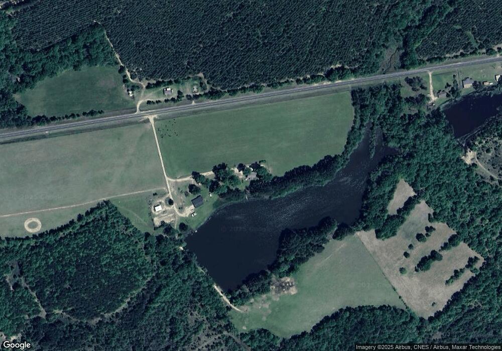
2786 Soperton Hwy Eastman, GA 31023
Estimated Value: $131,000 - $258,000
--
Bed
2
Baths
1,450
Sq Ft
$128/Sq Ft
Est. Value
About This Home
This home is located at 2786 Soperton Hwy, Eastman, GA 31023 and is currently estimated at $185,063, approximately $127 per square foot. 2786 Soperton Hwy is a home located in Dodge County with nearby schools including Dodge County High School.
Ownership History
Date
Name
Owned For
Owner Type
Purchase Details
Closed on
Jun 22, 2020
Sold by
Robertson Lori Cranford
Bought by
Robertson Lori Cranford and Robertson Robert Matthew
Current Estimated Value
Home Financials for this Owner
Home Financials are based on the most recent Mortgage that was taken out on this home.
Original Mortgage
$67,000
Outstanding Balance
$46,086
Interest Rate
3.2%
Mortgage Type
New Conventional
Estimated Equity
$138,977
Purchase Details
Closed on
Jul 8, 2003
Sold by
Cranford Tommy
Bought by
Martel Lori C
Create a Home Valuation Report for This Property
The Home Valuation Report is an in-depth analysis detailing your home's value as well as a comparison with similar homes in the area
Home Values in the Area
Average Home Value in this Area
Purchase History
| Date | Buyer | Sale Price | Title Company |
|---|---|---|---|
| Robertson Lori Cranford | -- | -- | |
| Martel Lori C | -- | -- |
Source: Public Records
Mortgage History
| Date | Status | Borrower | Loan Amount |
|---|---|---|---|
| Open | Robertson Lori Cranford | $67,000 |
Source: Public Records
Tax History Compared to Growth
Tax History
| Year | Tax Paid | Tax Assessment Tax Assessment Total Assessment is a certain percentage of the fair market value that is determined by local assessors to be the total taxable value of land and additions on the property. | Land | Improvement |
|---|---|---|---|---|
| 2024 | $993 | $40,193 | $1,900 | $38,293 |
| 2023 | $1,038 | $40,193 | $1,900 | $38,293 |
| 2022 | $942 | $38,583 | $1,449 | $37,134 |
| 2021 | $935 | $38,214 | $1,449 | $36,765 |
| 2020 | $795 | $38,007 | $1,242 | $36,765 |
| 2019 | $893 | $35,666 | $1,242 | $34,424 |
| 2018 | $911 | $35,666 | $1,242 | $34,424 |
| 2017 | $911 | $35,666 | $1,242 | $34,424 |
| 2016 | $942 | $38,848 | $1,242 | $37,606 |
| 2015 | -- | $38,847 | $1,242 | $37,606 |
| 2014 | -- | $39,290 | $1,242 | $38,048 |
| 2013 | -- | $39,289 | $1,241 | $38,048 |
Source: Public Records
Map
Nearby Homes
- LOT 5 Bowen Dr
- 0 Smith Rd
- 6515 Fred Bohannon Rd
- 2628 Chauncey Dublin Hwy
- 0 Shady Oaks Rd Unit 10400925
- 0 Shady Oaks Rd Unit 246471
- 1940 Horne Rd
- 534 Soperton Hwy
- 431 Pine Bluff Rd
- 0 Jim Pruett Rd Unit 25211863
- 0 Jim Pruett Rd Unit 10540625
- 0 Windy Way
- 0 Forest Ave Unit 10588959
- 5559 Bacon Ave
- 5533 Russell Ave
- 0 Williams Dr Unit 10632909
- 5616 Beulah Ave
- 5811 5th Ave
- 5422 1st Ave
- 220 Page St
- 2784 Soperton Hwy
- 2677 Soperton Hwy
- 281 New Union Church Rd
- 46 Shady Ln
- 0 Reedy Branch Rd Unit 8118978
- 0 Reedy Branch Rd
- 1449 Reedy Branch Rd
- 1294 Reedy Branch Rd
- 1294 Reedy Branch Rd
- 1592 Reedy Branch Rd
- 1317 Reedy Branch Rd
- 1301 Reedy Branch Rd
- 3132 Soperton Hwy
- 0 New Union Church Rd
- 1241 Reedy Branch Rd
- 3156 Soperton Hwy
- 1290 New Union Church Rd
- 1211 Reedy Branch Rd
- 1605 Reedy Branch Rd
- 1422 Golden Rd
