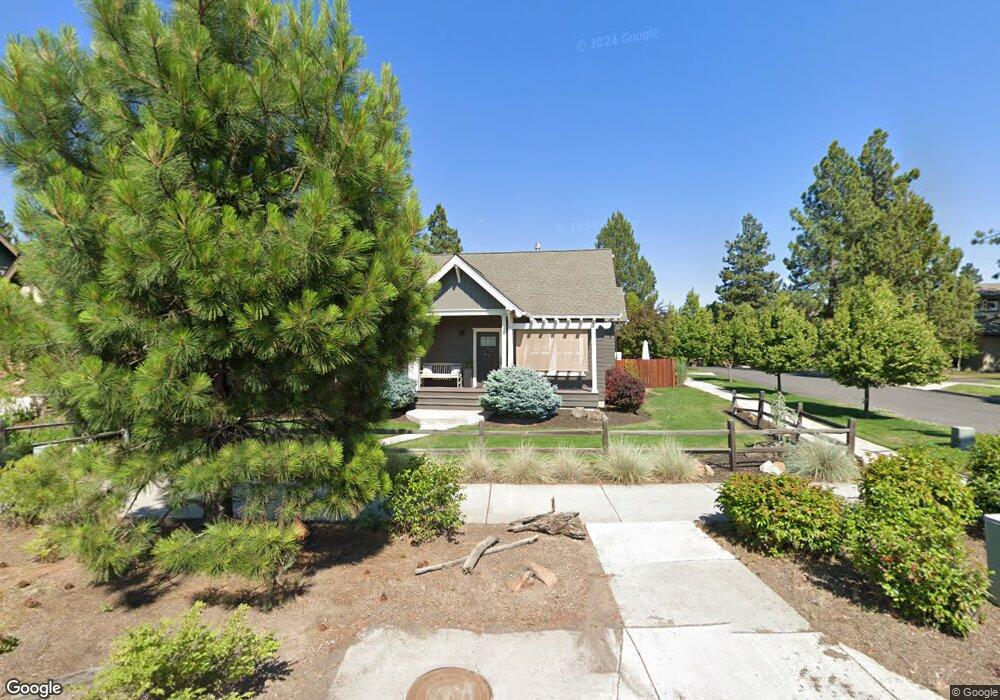
2788 NW Colter Ave Bend, OR 97701
Summit West NeighborhoodEstimated Value: $823,000 - $860,000
2
Beds
2
Baths
1,236
Sq Ft
$685/Sq Ft
Est. Value
About This Home
This home is located at 2788 NW Colter Ave, Bend, OR 97701 and is currently estimated at $847,219, approximately $685 per square foot. 2788 NW Colter Ave is a home located in Deschutes County with nearby schools including High Lakes Elementary School, Pacific Crest Middle School, and Summit High School.
Ownership History
Date
Name
Owned For
Owner Type
Purchase Details
Closed on
Apr 3, 2013
Sold by
Tennant Real Estate Llc
Bought by
Brock Todd L and Brock Cynthia L
Current Estimated Value
Home Financials for this Owner
Home Financials are based on the most recent Mortgage that was taken out on this home.
Original Mortgage
$275,488
Outstanding Balance
$193,735
Interest Rate
3.54%
Mortgage Type
FHA
Estimated Equity
$653,484
Purchase Details
Closed on
Sep 12, 2006
Sold by
Double S Construction Llc
Bought by
Tennant Real Estate Llc
Create a Home Valuation Report for This Property
The Home Valuation Report is an in-depth analysis detailing your home's value as well as a comparison with similar homes in the area
Home Values in the Area
Average Home Value in this Area
Purchase History
| Date | Buyer | Sale Price | Title Company |
|---|---|---|---|
| Brock Todd L | $285,000 | Amerititle | |
| Tennant Real Estate Llc | -- | Accommodation |
Source: Public Records
Mortgage History
| Date | Status | Borrower | Loan Amount |
|---|---|---|---|
| Open | Brock Todd L | $275,488 |
Source: Public Records
Tax History Compared to Growth
Tax History
| Year | Tax Paid | Tax Assessment Tax Assessment Total Assessment is a certain percentage of the fair market value that is determined by local assessors to be the total taxable value of land and additions on the property. | Land | Improvement |
|---|---|---|---|---|
| 2025 | $4,104 | $242,900 | -- | -- |
| 2024 | $3,949 | $235,830 | -- | -- |
| 2023 | $3,660 | $228,970 | $0 | $0 |
| 2022 | $3,415 | $215,840 | $0 | $0 |
| 2021 | $3,421 | $209,560 | $0 | $0 |
| 2020 | $3,245 | $209,560 | $0 | $0 |
| 2019 | $3,155 | $203,460 | $0 | $0 |
| 2018 | $3,066 | $197,540 | $0 | $0 |
| 2017 | $3,042 | $191,790 | $0 | $0 |
| 2016 | $2,904 | $186,210 | $0 | $0 |
| 2015 | $2,826 | $180,790 | $0 | $0 |
| 2014 | $2,744 | $175,530 | $0 | $0 |
Source: Public Records
Map
Nearby Homes
- 1399 NW Fort Clatsop St Unit 1&2
- 2589 NW Lemhi Pass Dr
- 62947 Levins Ln
- 2612 NW Lemhi Pass Dr
- 2745 NW Ordway Ave Unit 209
- 2745 NW Ordway Ave Unit 207
- 2745 NW Ordway Ave Unit 300
- 2745 NW Ordway Ave Unit 212
- 2745 NW Ordway Ave Unit 104
- 1251 NW Stanhope Way Unit 250
- 1650 NW Lewis St Unit 4
- 2580 NW Shields Dr
- 1676 NW William Clark St
- 2429 NW Dorion Way
- 2927 NW Celilo Ln
- 3056 NW Blodgett Way
- 1178 NW Singleton Place
- 3035 NW Celilo Ln
- 3067 NW Celilo Ln
- 2234 NW Reserve Camp Ct
- 1314 NW Mt Washington Dr
- 1322 NW Mt Washington Dr
- 2787 NW Colter Ave
- 1330 NW Mt Washington Dr
- 2775 NW Colter Ave
- 1272 NW Mt Washington Dr
- 1338 NW Mt Washington Dr
- 1272 NW Mount Washington Dr
- 1303 NW Mt Washington Dr
- 1301 NW Fort Clatsop St
- 1313 NW Fort Clatsop St Unit 2
- 1313 NW Fort Clatsop St Unit 1
- 1271 NW Fort Clatsop St
- 1346 NW Mt Washington Dr
- 1315 NW Mt Washington Dr
- 1295 NW Mt Washington Dr
- 1325 NW Fort Clatsop St
- 1283 NW Mt Washington Dr
- 1260 NW Mt Washington Dr
- 1327 NW Mt Washington Dr