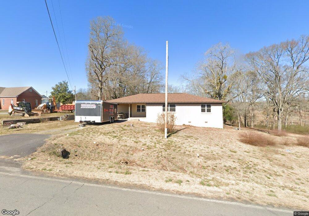
279 Highway 330 E Clinton, AR 72031
Estimated Value: $88,000 - $182,000
Studio
1
Bath
1,526
Sq Ft
$83/Sq Ft
Est. Value
About This Home
This home is located at 279 Highway 330 E, Clinton, AR 72031 and is currently estimated at $127,052, approximately $83 per square foot. 279 Highway 330 E is a home with nearby schools including Clinton Elementary School, Clinton Junior High School, and Clinton High School.
Ownership History
Date
Name
Owned For
Owner Type
Purchase Details
Closed on
Jan 16, 2026
Sold by
Holland Justin and Holland Mecca
Bought by
Berry Joshua and Berry Brooke
Current Estimated Value
Home Financials for this Owner
Home Financials are based on the most recent Mortgage that was taken out on this home.
Original Mortgage
$149,940
Outstanding Balance
$149,940
Interest Rate
6.21%
Mortgage Type
New Conventional
Estimated Equity
-$22,888
Purchase Details
Closed on
Oct 16, 2025
Sold by
First Service Bank
Bought by
Berry Dennis and Berry Charlotte
Purchase Details
Closed on
Jul 28, 2025
Sold by
Gray Debbie
Bought by
First Service Bank
Purchase Details
Closed on
Dec 28, 2021
Sold by
Kidd Charlene
Bought by
Oyler Robert C and Oyler Martha Sue
Home Financials for this Owner
Home Financials are based on the most recent Mortgage that was taken out on this home.
Original Mortgage
$153,000
Interest Rate
3.12%
Mortgage Type
Construction
Purchase Details
Closed on
Apr 27, 2018
Sold by
Kidd Joe
Bought by
Kidd Joe and Kidd Charlene
Create a Home Valuation Report for This Property
The Home Valuation Report is an in-depth analysis detailing your home's value as well as a comparison with similar homes in the area
Home Values in the Area
Average Home Value in this Area
Purchase History
| Date | Buyer | Sale Price | Title Company |
|---|---|---|---|
| Berry Joshua | $176,400 | Professional Land Title Of Ark | |
| Berry Dennis | $85,000 | Pro Land Title | |
| First Service Bank | $50,000 | None Listed On Document | |
| Oyler Robert C | $100,000 | None Listed On Document | |
| Kidd Joe | -- | None Available |
Source: Public Records
Mortgage History
| Date | Status | Borrower | Loan Amount |
|---|---|---|---|
| Open | Berry Joshua | $149,940 | |
| Previous Owner | Oyler Robert C | $153,000 |
Source: Public Records
Tax History
| Year | Tax Paid | Tax Assessment Tax Assessment Total Assessment is a certain percentage of the fair market value that is determined by local assessors to be the total taxable value of land and additions on the property. | Land | Improvement |
|---|---|---|---|---|
| 2025 | $610 | $33,830 | $250 | $33,580 |
| 2024 | $605 | $12,580 | $250 | $12,330 |
| 2023 | $605 | $12,580 | $250 | $12,330 |
| 2022 | $230 | $12,580 | $250 | $12,330 |
| 2021 | $263 | $13,330 | $1,000 | $12,330 |
| 2020 | $253 | $13,330 | $1,000 | $12,330 |
| 2019 | $305 | $12,480 | $1,000 | $11,480 |
| 2018 | $611 | $12,480 | $1,000 | $11,480 |
| 2017 | $354 | $12,480 | $1,000 | $11,480 |
| 2015 | -- | $8,090 | $1,000 | $7,090 |
| 2014 | -- | $8,090 | $1,000 | $7,090 |
| 2013 | -- | $8,090 | $1,000 | $7,090 |
Source: Public Records
Map
Nearby Homes
- 4263 Highway 65 S
- Lot #2 Lynch Dr
- Lot 3 Lynch Dr
- 428 Morningside Rd N
- 1381 E Hwy 330
- Lots 9 &10 Kip Ln
- Clinton Kip Ln
- Clinton Kip Ln
- 715 Jason St
- 504 Boar Rd
- 000 Donnies Dr
- 936 Cemetery Rd
- 00 Pinewood Rd
- 0 Whipporwill Ln Unit 26010348
- 240 Huie St
- 229 Richard St
- 0 Highway 65 S Unit 20037632
- 0000 Highway 65 S
- 799 Barrens Community Rd
- 2304 Highway 65 S
- 279 State Highway 330
- 279 Hwy 330 E
- 339 Highway 330 E
- 266 Highway 330 E
- 294 Highway 330 E
- 282 Highway 330 E
- 208 Highway 330 E
- 201 Highway 330 E
- 173 Highway 330 E
- 173 State Highway 330
- 190 Stephens St Unit DAN
- 352 Highway 330 E
- 191 Dan Stephens Dr
- 226 Terry Ln
- 151 Stephens St Unit DAN
- 1101 Highway 330 E
- 2424 State Highway 330
- 281 Wanda Ave
- 274 Wanda Ave
- 4711 Highway 65 S
Your Personal Tour Guide
Ask me questions while you tour the home.