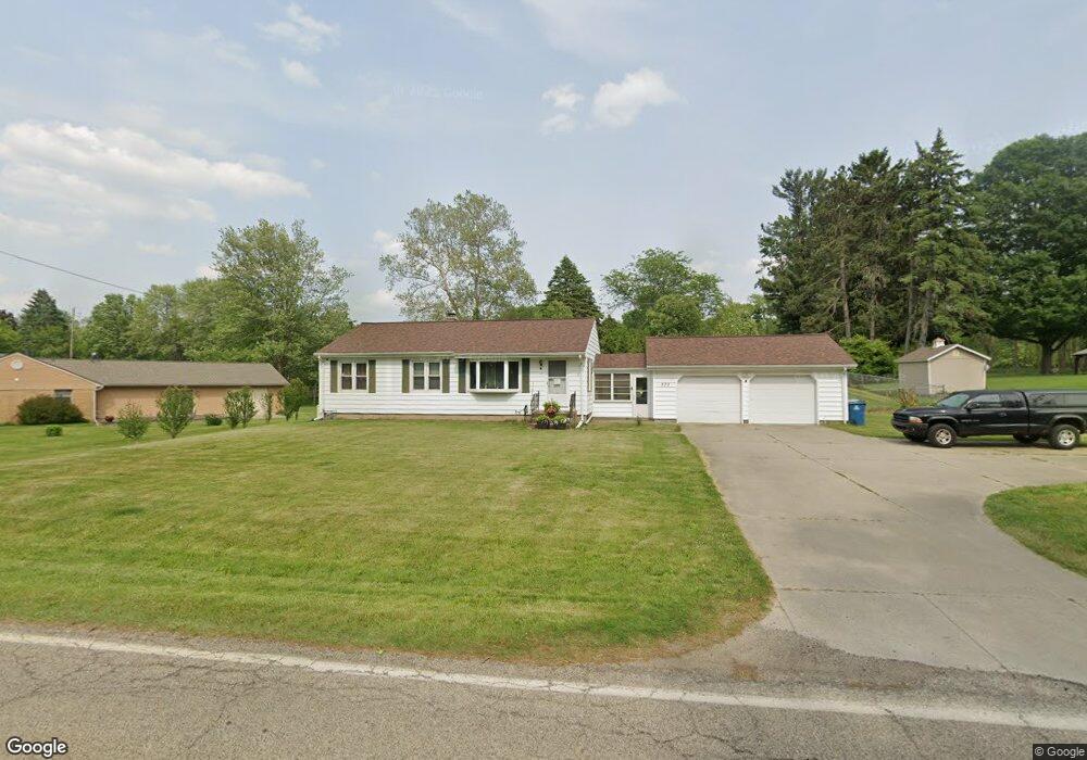
279 Minges Rd S Battle Creek, MI 49015
Minges Brook Riverside NeighborhoodEstimated Value: $208,775 - $230,000
3
Beds
1
Bath
1,040
Sq Ft
$211/Sq Ft
Est. Value
About This Home
This home is located at 279 Minges Rd S, Battle Creek, MI 49015 and is currently estimated at $219,444, approximately $211 per square foot. 279 Minges Rd S is a home located in Calhoun County with nearby schools including Lakeview Middle School, Lakeview High School, and Arbor Academy.
Ownership History
Date
Name
Owned For
Owner Type
Purchase Details
Closed on
May 21, 2014
Sold by
Austin Janice Lynn and Maggard Susan K
Bought by
Mckeown Mark Lee and Mckeown Barbara Ellen
Current Estimated Value
Home Financials for this Owner
Home Financials are based on the most recent Mortgage that was taken out on this home.
Original Mortgage
$74,745
Outstanding Balance
$56,643
Interest Rate
4.18%
Mortgage Type
New Conventional
Estimated Equity
$162,801
Purchase Details
Closed on
Dec 12, 2001
Sold by
Wall Patsy J
Bought by
Wall and Austin
Purchase Details
Closed on
Dec 18, 2000
Sold by
Wall John F
Create a Home Valuation Report for This Property
The Home Valuation Report is an in-depth analysis detailing your home's value as well as a comparison with similar homes in the area
Home Values in the Area
Average Home Value in this Area
Purchase History
| Date | Buyer | Sale Price | Title Company |
|---|---|---|---|
| Mckeown Mark Lee | $89,000 | None Available | |
| Wall | -- | -- | |
| -- | -- | -- |
Source: Public Records
Mortgage History
| Date | Status | Borrower | Loan Amount |
|---|---|---|---|
| Open | Mckeown Mark Lee | $74,745 |
Source: Public Records
Tax History Compared to Growth
Tax History
| Year | Tax Paid | Tax Assessment Tax Assessment Total Assessment is a certain percentage of the fair market value that is determined by local assessors to be the total taxable value of land and additions on the property. | Land | Improvement |
|---|---|---|---|---|
| 2025 | -- | $88,300 | $0 | $0 |
| 2024 | $2,077 | $81,593 | $0 | $0 |
| 2023 | $2,381 | $70,481 | $0 | $0 |
| 2022 | $1,876 | $61,405 | $0 | $0 |
| 2021 | $2,304 | $56,550 | $0 | $0 |
| 2020 | $2,280 | $53,455 | $0 | $0 |
| 2019 | $2,189 | $54,045 | $0 | $0 |
| 2018 | $2,189 | $52,249 | $6,438 | $45,811 |
| 2017 | $2,124 | $49,532 | $0 | $0 |
| 2016 | $2,089 | $45,639 | $0 | $0 |
| 2015 | $1,944 | $44,650 | $7,533 | $37,117 |
| 2014 | $1,944 | $43,457 | $7,533 | $35,924 |
Source: Public Records
Map
Nearby Homes
- 15 Timothy Ln
- 4281 Watkins Rd
- 4275 Watkins Rd
- 292 W Hamilton Ln
- 117 Pheasant Run
- 220 Deer Path Ln
- 4293 Beckley Rd
- 244 Deer Path Ln
- 219 W Hamilton Ln
- 168 Pheasant Run
- 12800 Minges Rd S
- 29 Langley Rd E
- 33 Langley Rd E
- 25 Minges Rd W
- 211 Beckwith Dr
- 12740 Minges Rd S
- 215 Beckwith Dr
- 148 Wahwahtaysee Way
- 66 Wealthy
- 0 Beckley Rd Unit 25047007
- 277 Minges Rd S
- 281 Minges Rd S
- 100 Peachtree Dr
- 278 Minges Rd S
- 34 Birchwood Ln
- 282 Minges Rd S
- 271 Minges Rd S
- 40 Birchwood Ln
- 285 Minges Rd S
- 104 Peachtree Dr
- 284 Minges Rd S
- 265 Minges Rd S
- 33 Columbine Ln
- 270 Minges Rd S
- 108 Peachtree Dr
- 289 Minges Rd S
- 37 Birchwood Ln
- 33 Birchwood Ln
- 109 Peachtree Dr
- 204 Minges Rd S