Estimated Value: $468,000 - $580,000
3
Beds
2
Baths
2,265
Sq Ft
$231/Sq Ft
Est. Value
About This Home
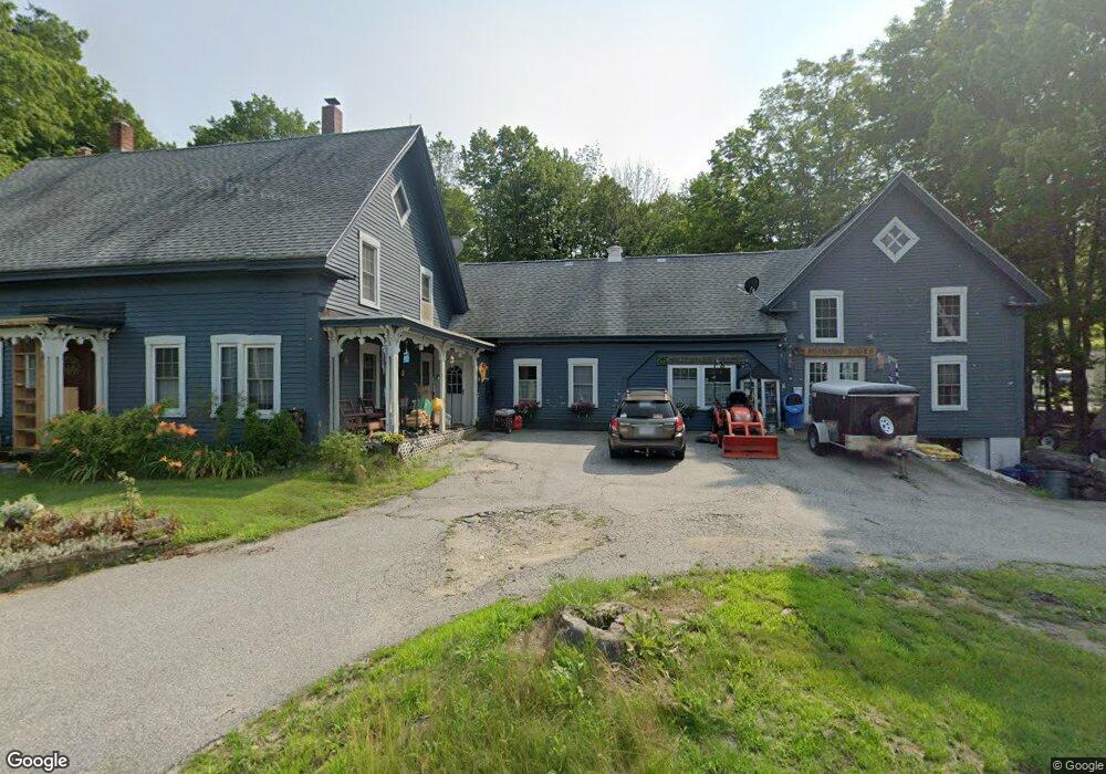
This home is located at 279 N Stark Hwy, Weare, NH 03281 and is currently estimated at $523,154, approximately $230 per square foot. 279 N Stark Hwy is a home with nearby schools including Center Woods Elementary School, Weare Middle School, and John Stark Regional High School.
Ownership History
Date
Name
Owned For
Owner Type
Purchase Details
Closed on
Feb 12, 2001
Sold by
Roy Jean R
Bought by
Anderson Kristen M
Current Estimated Value
Home Financials for this Owner
Home Financials are based on the most recent Mortgage that was taken out on this home.
Original Mortgage
$142,020
Outstanding Balance
$51,492
Interest Rate
7.13%
Estimated Equity
$471,662
Create a Home Valuation Report for This Property
The Home Valuation Report is an in-depth analysis detailing your home's value as well as a comparison with similar homes in the area
Home Values in the Area
Average Home Value in this Area
Purchase History
| Date | Buyer | Sale Price | Title Company |
|---|---|---|---|
| Anderson Kristen M | $36,000 | -- |
Source: Public Records
Mortgage History
| Date | Status | Borrower | Loan Amount |
|---|---|---|---|
| Open | Anderson Kristen M | $75,000 | |
| Closed | Anderson Kristen M | $72,109 | |
| Open | Anderson Kristen M | $142,020 |
Source: Public Records
Tax History Compared to Growth
Tax History
| Year | Tax Paid | Tax Assessment Tax Assessment Total Assessment is a certain percentage of the fair market value that is determined by local assessors to be the total taxable value of land and additions on the property. | Land | Improvement |
|---|---|---|---|---|
| 2024 | $6,631 | $325,200 | $103,400 | $221,800 |
| 2023 | $6,127 | $325,200 | $103,400 | $221,800 |
| 2022 | $5,573 | $320,300 | $103,400 | $216,900 |
| 2021 | $5,509 | $320,300 | $103,400 | $216,900 |
| 2020 | $5,590 | $233,400 | $73,500 | $159,900 |
| 2019 | $5,534 | $233,400 | $73,500 | $159,900 |
| 2018 | $5,341 | $231,900 | $73,500 | $158,400 |
| 2016 | $5,188 | $231,900 | $73,500 | $158,400 |
| 2015 | $5,152 | $229,900 | $73,500 | $156,400 |
| 2014 | $5,106 | $229,900 | $73,500 | $156,400 |
| 2013 | $4,837 | $222,400 | $73,500 | $148,900 |
Source: Public Records
Map
Nearby Homes
- 233 N Stark Hwy
- 92 Woodbury Rd
- 101-125 Winslow Rd
- 108 E Shore Dr
- 281 Hodgdon Rd
- 10 Sap House Rd
- 30 Dels Way
- 62 Collins Landing Rd Unit 46
- 107 Branch Rd
- 194 Buckley Rd Unit 2
- 194 Buckley Rd Unit 44
- 463 Craney Hill Rd
- 11 White Birch Rd
- 0 Huntington Hill Rd Unit 69
- Lot 13 E Deering Rd
- 0 Als Dr Unit 196
- 586 C-4 Craney Hill Rd
- 57 Lyndsey Ln
- 849 River Rd
- 196 Deering Center Rd
- 273 N Stark Hwy
- 281 N Stark Hwy
- 260 N Stark Hwy
- 257 N Stark Hwy
- 302 N Stark Hwy
- 299 N Stark Hwy
- 299 N Stark Hwy
- 56 John Connor Rd
- 301 N Stark Hwy
- 239 N Stark Hwy
- 68 John Connor Rd
- 84 John Connor Rd
- 325 N Stark Hwy
- 52 Concord Stage Rd
- 54 John Connor Rd
- 55 Woodbury Rd
- 236 N Stark Hwy
- 92 John Connor Rd
- 70 Concord Stage Rd
- 327 N Stark Hwy