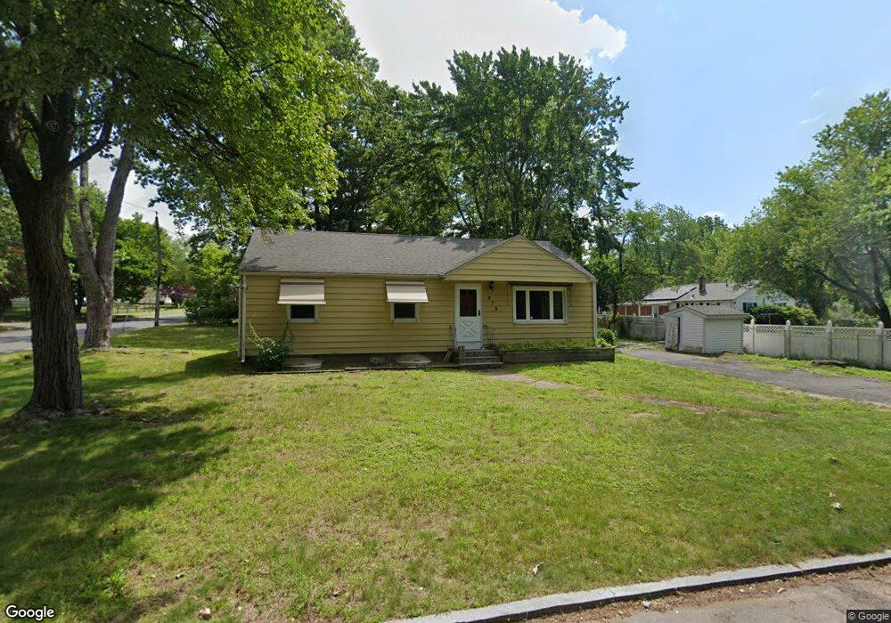
279 Stapleton Rd Springfield, MA 01109
Sixteen Acres NeighborhoodEstimated Value: $261,000 - $302,000
3
Beds
2
Baths
942
Sq Ft
$299/Sq Ft
Est. Value
About This Home
This home is located at 279 Stapleton Rd, Springfield, MA 01109 and is currently estimated at $281,323, approximately $298 per square foot. 279 Stapleton Rd is a home located in Hampden County with nearby schools including Frank H. Freedman School, John J Duggan Middle, and Springfield High School of Science and Technology.
Ownership History
Date
Name
Owned For
Owner Type
Purchase Details
Closed on
Jul 28, 2022
Sold by
Bcns Investments Llc
Bought by
Old Green Acres Llc
Current Estimated Value
Purchase Details
Closed on
Jul 8, 2010
Sold by
Johnson Christopher C
Bought by
College Realty Llc
Purchase Details
Closed on
Mar 4, 2010
Sold by
Sanders Abe D
Bought by
Frankstone Grp Llc
Purchase Details
Closed on
Jul 19, 2001
Sold by
Veroneau Francis E
Bought by
Sanders Abe D
Home Financials for this Owner
Home Financials are based on the most recent Mortgage that was taken out on this home.
Original Mortgage
$68,918
Interest Rate
7.2%
Mortgage Type
Purchase Money Mortgage
Create a Home Valuation Report for This Property
The Home Valuation Report is an in-depth analysis detailing your home's value as well as a comparison with similar homes in the area
Home Values in the Area
Average Home Value in this Area
Purchase History
| Date | Buyer | Sale Price | Title Company |
|---|---|---|---|
| Old Green Acres Llc | $825,000 | None Available | |
| College Realty Llc | $122,500 | -- | |
| Frankstone Grp Llc | $75,000 | -- | |
| Sanders Abe D | $70,000 | -- |
Source: Public Records
Mortgage History
| Date | Status | Borrower | Loan Amount |
|---|---|---|---|
| Previous Owner | Sanders Abe D | $68,918 | |
| Previous Owner | Sanders Abe D | $25,000 | |
| Closed | Sanders Abe D | $2,756 |
Source: Public Records
Tax History
| Year | Tax Paid | Tax Assessment Tax Assessment Total Assessment is a certain percentage of the fair market value that is determined by local assessors to be the total taxable value of land and additions on the property. | Land | Improvement |
|---|---|---|---|---|
| 2025 | $3,515 | $224,200 | $52,300 | $171,900 |
| 2024 | $3,350 | $208,600 | $52,300 | $156,300 |
| 2023 | $3,357 | $196,900 | $49,800 | $147,100 |
| 2022 | $3,598 | $191,200 | $49,800 | $141,400 |
| 2021 | $3,096 | $163,800 | $45,300 | $118,500 |
| 2020 | $3,220 | $164,900 | $45,300 | $119,600 |
| 2019 | $2,948 | $149,800 | $45,300 | $104,500 |
| 2018 | $2,612 | $132,700 | $45,300 | $87,400 |
| 2017 | $2,538 | $129,100 | $50,300 | $78,800 |
| 2016 | $2,518 | $128,100 | $50,300 | $77,800 |
| 2015 | $2,512 | $127,700 | $50,300 | $77,400 |
Source: Public Records
Map
Nearby Homes
- 217 Cherokee Dr
- 8 Cheyenne Rd
- 265 Stapleton Rd
- 218 Cherokee Dr
- 207 Cherokee Dr
- 248 Stapleton Rd
- 292 Stapleton Rd
- 18 Cheyenne Rd
- 266 Stapleton Rd
- 4 Tumbleweed Rd
- 260 Garvey Dr
- 258 Stapleton Rd
- 26 Cheyenne Rd
- 14 Tumbleweed Rd
- 249 Garvey Dr
- 245 Stapleton Rd
- 5 Tumbleweed Rd
- 316 Stapleton Rd
- 191 Cherokee Dr
- 144 Undine Cir
Your Personal Tour Guide
Ask me questions while you tour the home.