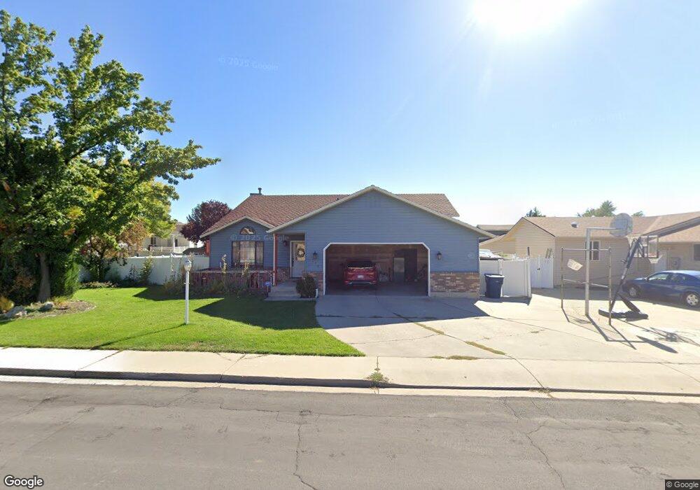
279 W 700 S Orem, UT 84058
Orem South NeighborhoodEstimated Value: $473,000 - $541,000
3
Beds
2
Baths
1,440
Sq Ft
$357/Sq Ft
Est. Value
About This Home
This home is located at 279 W 700 S, Orem, UT 84058 and is currently estimated at $513,717, approximately $356 per square foot. 279 W 700 S is a home located in Utah County with nearby schools including Orem Elementary School, Lakeridge Jr High School, and Mountain View High School.
Ownership History
Date
Name
Owned For
Owner Type
Purchase Details
Closed on
Oct 7, 2005
Sold by
Ellis John Mitchell and Ellis Rachelle D
Bought by
Sherwood Catherine
Current Estimated Value
Home Financials for this Owner
Home Financials are based on the most recent Mortgage that was taken out on this home.
Original Mortgage
$74,675
Outstanding Balance
$39,641
Interest Rate
5.63%
Mortgage Type
Fannie Mae Freddie Mac
Estimated Equity
$474,076
Purchase Details
Closed on
Feb 7, 2001
Sold by
Ellis John Mitchell and Ellis Rachelle D
Bought by
Ellis John Mitchell
Home Financials for this Owner
Home Financials are based on the most recent Mortgage that was taken out on this home.
Original Mortgage
$105,000
Interest Rate
7.08%
Create a Home Valuation Report for This Property
The Home Valuation Report is an in-depth analysis detailing your home's value as well as a comparison with similar homes in the area
Home Values in the Area
Average Home Value in this Area
Purchase History
| Date | Buyer | Sale Price | Title Company |
|---|---|---|---|
| Sherwood Catherine | -- | Lone Peak Title | |
| Ellis John Mitchell | -- | Wasatch Land & Title |
Source: Public Records
Mortgage History
| Date | Status | Borrower | Loan Amount |
|---|---|---|---|
| Open | Sherwood Catherine | $74,675 | |
| Previous Owner | Ellis John Mitchell | $105,000 |
Source: Public Records
Tax History
| Year | Tax Paid | Tax Assessment Tax Assessment Total Assessment is a certain percentage of the fair market value that is determined by local assessors to be the total taxable value of land and additions on the property. | Land | Improvement |
|---|---|---|---|---|
| 2025 | $2,091 | $266,530 | -- | -- |
| 2024 | $2,091 | $255,695 | $0 | $0 |
| 2023 | $1,958 | $257,345 | $0 | $0 |
| 2022 | $2,112 | $268,950 | $0 | $0 |
| 2021 | $1,967 | $379,400 | $168,400 | $211,000 |
| 2020 | $1,802 | $341,600 | $134,700 | $206,900 |
| 2019 | $1,588 | $313,000 | $124,400 | $188,600 |
| 2018 | $1,475 | $277,800 | $107,100 | $170,700 |
| 2017 | $1,299 | $131,010 | $0 | $0 |
| 2016 | $1,371 | $127,545 | $0 | $0 |
| 2015 | $1,316 | $115,775 | $0 | $0 |
| 2014 | $1,271 | $111,265 | $0 | $0 |
Source: Public Records
Map
Nearby Homes
- 288 W 730 S Unit 1426
- 282 W 730 S Unit 1427
- 294 W 730 S Unit 1425
- 278 W 730 S Unit 1428
- 276 W 730 S Unit 1429
- 274 W 730 S Unit 1430
- 707 S 300 W
- 710 S 250 W
- 721 S 300 W
- 266 W 730 S Unit 1431
- 718 S 250 W
- 280 W 700 S
- 287 W 730 S Unit 1421
- 289 W 730 S Unit 1420
- 291 W 730 S Unit 1419
- 281 W 730 S Unit 1422
- 293 W 730 S Unit 1418
- 277 W 730 S Unit 1423
- 297 W 730 S Unit 1417
- 684 S 250 W
Your Personal Tour Guide
Ask me questions while you tour the home.