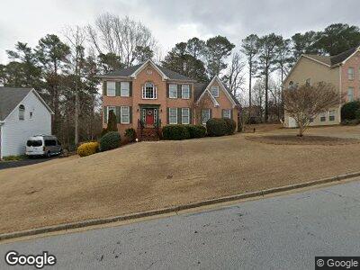
2790 Adams Pointe Dr Unit 1 Snellville, GA 30078
Estimated Value: $446,062 - $510,000
5
Beds
3
Baths
2,546
Sq Ft
$187/Sq Ft
Est. Value
About This Home
This home is located at 2790 Adams Pointe Dr Unit 1, Snellville, GA 30078 and is currently estimated at $476,016, approximately $186 per square foot. 2790 Adams Pointe Dr Unit 1 is a home located in Gwinnett County with nearby schools including Brookwood Elementary School, Alton C. Crews Middle School, and Brookwood High School.
Ownership History
Date
Name
Owned For
Owner Type
Purchase Details
Closed on
Jul 14, 2003
Sold by
Pilgrim Sandra K and Pilgrim Anthony F
Bought by
Prescott Phillip A and Prescott Nancy
Current Estimated Value
Purchase Details
Closed on
Aug 28, 1997
Sold by
Drobny Homes Inc
Bought by
Pilgrim Anthony F and Pilgrim Sandra K
Home Financials for this Owner
Home Financials are based on the most recent Mortgage that was taken out on this home.
Original Mortgage
$164,600
Interest Rate
7.56%
Mortgage Type
New Conventional
Create a Home Valuation Report for This Property
The Home Valuation Report is an in-depth analysis detailing your home's value as well as a comparison with similar homes in the area
Home Values in the Area
Average Home Value in this Area
Purchase History
| Date | Buyer | Sale Price | Title Company |
|---|---|---|---|
| Prescott Phillip A | $230,000 | -- | |
| Pilgrim Anthony F | $182,900 | -- |
Source: Public Records
Mortgage History
| Date | Status | Borrower | Loan Amount |
|---|---|---|---|
| Previous Owner | Pilgrim Anthony F | $164,600 |
Source: Public Records
Tax History Compared to Growth
Tax History
| Year | Tax Paid | Tax Assessment Tax Assessment Total Assessment is a certain percentage of the fair market value that is determined by local assessors to be the total taxable value of land and additions on the property. | Land | Improvement |
|---|---|---|---|---|
| 2023 | $1,293 | $179,080 | $32,400 | $146,680 |
| 2022 | $0 | $159,240 | $30,000 | $129,240 |
| 2021 | $1,391 | $116,000 | $21,200 | $94,800 |
| 2020 | $1,389 | $116,000 | $21,200 | $94,800 |
| 2019 | $1,280 | $100,760 | $18,400 | $82,360 |
| 2018 | $1,262 | $100,760 | $18,400 | $82,360 |
| 2016 | $1,298 | $85,840 | $19,200 | $66,640 |
| 2015 | $1,323 | $85,840 | $19,200 | $66,640 |
| 2014 | -- | $85,840 | $19,200 | $66,640 |
Source: Public Records
Map
Nearby Homes
- 2802 Oak Meadow Ln
- 1900 Mornington Ln
- 1972 Tanglewood Dr
- 1898 Mornington Ln
- 1809 Mornington Ln
- 1916 Oakwood Grove Dr Unit 1
- 1972 Ashwood Grove Dr Unit 2
- 2141 Slick Stone Dr
- 2101 Slick Stone Dr
- 2042 Clay Rd
- 3030 Westpoint Cir
- 2181 Poplar Grove Ct Unit 4
- 1847 Oak Rd
- 2888 Mountain View Rd
- 1838 Cates Ct
- 3080 Westpoint Cir
- 1653 Stonegate Way Unit 2
- 2790 Adams Pointe Dr Unit 1
- 2800 Adams Pointe Dr Unit 1
- 2780 Adams Pointe Dr
- 2810 Adams Pointe Dr
- 2770 Adams Pointe Dr Unit 2
- 1946 Tanglewood Dr Unit 15
- 1946 Tanglewood Dr
- 2795 Adams Pointe Dr
- 2805 Adams Pointe Dr Unit 1
- 2765 Adams Pointe Dr Unit 2
- 0 Adams Pointe Dr Unit 7161511
- 0 Adams Pointe Dr Unit 7106458
- 0 Adams Pointe Dr Unit 7093745
- 0 Adams Pointe Dr Unit 7050591
- 0 Adams Pointe Dr Unit 7039536
- 0 Adams Pointe Dr Unit 8555865
- 0 Adams Pointe Dr Unit 8154904
- 0 Adams Pointe Dr Unit 8860060
- 0 Adams Pointe Dr Unit 8617421
- 0 Adams Pointe Dr Unit 3182357