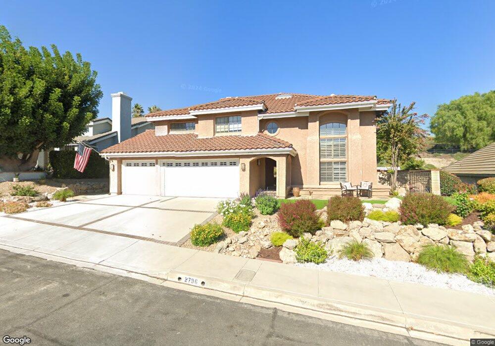
2796 Jason Ct Thousand Oaks, CA 91362
Estimated Value: $1,443,896 - $1,605,000
4
Beds
3
Baths
2,669
Sq Ft
$561/Sq Ft
Est. Value
About This Home
This home is located at 2796 Jason Ct, Thousand Oaks, CA 91362 and is currently estimated at $1,497,474, approximately $561 per square foot. 2796 Jason Ct is a home located in Ventura County with nearby schools including Lang Ranch, Los Cerritos Middle School, and Westlake High School.
Ownership History
Date
Name
Owned For
Owner Type
Purchase Details
Closed on
Sep 25, 2017
Sold by
Becker Thomas F and Becker Karen E
Bought by
Becker Thomas F and Becker Karen E
Current Estimated Value
Home Financials for this Owner
Home Financials are based on the most recent Mortgage that was taken out on this home.
Original Mortgage
$334,000
Interest Rate
3.78%
Mortgage Type
VA
Purchase Details
Closed on
Dec 19, 2007
Sold by
Becker Thomas F and Becker Karen E
Bought by
Becker Thomas F and Becker Karen E
Create a Home Valuation Report for This Property
The Home Valuation Report is an in-depth analysis detailing your home's value as well as a comparison with similar homes in the area
Home Values in the Area
Average Home Value in this Area
Purchase History
| Date | Buyer | Sale Price | Title Company |
|---|---|---|---|
| Becker Thomas F | -- | Timios Title | |
| Becker Thomas F | -- | None Available |
Source: Public Records
Mortgage History
| Date | Status | Borrower | Loan Amount |
|---|---|---|---|
| Closed | Becker Thomas F | $334,000 |
Source: Public Records
Tax History Compared to Growth
Tax History
| Year | Tax Paid | Tax Assessment Tax Assessment Total Assessment is a certain percentage of the fair market value that is determined by local assessors to be the total taxable value of land and additions on the property. | Land | Improvement |
|---|---|---|---|---|
| 2025 | $6,745 | $570,472 | $160,553 | $409,919 |
| 2024 | $6,745 | $559,287 | $157,405 | $401,882 |
| 2023 | $6,542 | $548,321 | $154,319 | $394,002 |
| 2022 | $6,411 | $537,570 | $151,293 | $386,277 |
| 2021 | $6,280 | $527,030 | $148,327 | $378,703 |
| 2020 | $5,839 | $521,628 | $146,807 | $374,821 |
| 2019 | $5,683 | $511,401 | $143,929 | $367,472 |
| 2018 | $5,563 | $501,374 | $141,107 | $360,267 |
| 2017 | $5,450 | $491,544 | $138,341 | $353,203 |
| 2016 | $5,393 | $481,907 | $135,629 | $346,278 |
| 2015 | $5,295 | $474,671 | $133,593 | $341,078 |
| 2014 | $5,215 | $465,375 | $130,977 | $334,398 |
Source: Public Records
Map
Nearby Homes
- 2001 Brookfield Dr
- 2535 Rikkard Dr
- 2311 Gillingham Cir
- 3128 Casino Dr
- 2848 Bayham Cir
- 2347 Laurelwood Dr
- 1825 Sweet Briar Place
- 2252 Northpark St
- 3182 Toulouse Cir
- 3180 Versaille Ct
- 2847 Cedar Wood Place
- 3240 Casino Dr
- 1764 Shady Brook Dr
- 1669 Woodside Dr
- 3100 Woodgreen Ct
- 2321 Sunny Point St
- 2225 Calle Riscoso
- 3249 Springbrook St
- 1972 Olivewood Ct
- 2427 Springbrook St