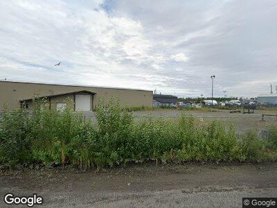
2799 Rampart Dr Anchorage, AK 99501
Mountain View NeighborhoodEstimated Value: $4,644,219
--
Bed
--
Bath
14,100
Sq Ft
$329/Sq Ft
Est. Value
About This Home
This home is located at 2799 Rampart Dr, Anchorage, AK 99501 and is currently estimated at $4,644,219, approximately $329 per square foot. 2799 Rampart Dr is a home located in Anchorage Municipality with nearby schools including William Tyson Elementary School, Clark Middle School, and Bettye Davis East Anchorage High School.
Ownership History
Date
Name
Owned For
Owner Type
Purchase Details
Closed on
Aug 16, 2011
Sold by
Alaska Demolition Llc
Bought by
Green Properties Llc
Current Estimated Value
Home Financials for this Owner
Home Financials are based on the most recent Mortgage that was taken out on this home.
Original Mortgage
$2,137,500
Interest Rate
4.53%
Mortgage Type
Construction
Create a Home Valuation Report for This Property
The Home Valuation Report is an in-depth analysis detailing your home's value as well as a comparison with similar homes in the area
Home Values in the Area
Average Home Value in this Area
Purchase History
| Date | Buyer | Sale Price | Title Company |
|---|---|---|---|
| Green Properties Llc | -- | Auta |
Source: Public Records
Mortgage History
| Date | Status | Borrower | Loan Amount |
|---|---|---|---|
| Open | Green Properties Llc | $2,137,500 | |
| Closed | Green Properties Llc | $2,137,500 |
Source: Public Records
Tax History Compared to Growth
Tax History
| Year | Tax Paid | Tax Assessment Tax Assessment Total Assessment is a certain percentage of the fair market value that is determined by local assessors to be the total taxable value of land and additions on the property. | Land | Improvement |
|---|---|---|---|---|
| 2024 | $32,426 | $2,008,400 | $816,000 | $1,192,400 |
| 2023 | $34,819 | $1,931,900 | $784,400 | $1,147,500 |
| 2022 | $31,678 | $1,881,100 | $784,800 | $1,096,300 |
| 2021 | $34,170 | $1,896,200 | $769,600 | $1,126,600 |
| 2020 | $32,348 | $1,902,800 | $754,300 | $1,148,500 |
| 2019 | $31,158 | $1,904,500 | $739,200 | $1,165,300 |
| 2018 | $30,780 | $1,876,800 | $739,200 | $1,137,600 |
| 2017 | $29,355 | $1,874,500 | $739,200 | $1,135,300 |
| 2016 | $27,500 | $1,869,900 | $739,200 | $1,130,700 |
| 2015 | $27,500 | $1,837,400 | $739,200 | $1,098,200 |
| 2014 | $27,500 | $1,820,700 | $739,200 | $1,081,500 |
Source: Public Records
Map
Nearby Homes
- 3111 Commercial Dr
- 4401 E 4th Ave
- 123 Meyer St
- 550 Bragaw St
- 417 Mumford St
- 314 Flower St
- 501 Mumford St
- 403 Irwin St
- 4103 E 3rd Ave
- 509 Irwin St
- 4026 E 6th Ave
- NHN Tr A Thurston
- 415 N Bragaw St
- 128 N Klevin St
- 4004 E 8th Ave
- 219 Park St
- 3940 E 9th Ave
- 4011 San Roberto Ave
- 4303 E 3rd Ave
- 1430 Columbine St
- 2799 Rampart Dr
- 2815 Rampart Dr
- 2798 Rampart Dr
- 2845/2849 Porcupine Dr
- 2817 Rampart Dr
- 2745 Rampart Dr
- 2804 Rampart Dr
- 2945 Mountain View Dr
- 2945 Mt View Dr
- 429 Industrial Way
- 365 Industrial Way
- 383 Industrial Way Unit 200
- 383 Industrial Way
- 3001 Mountain View Dr
- 3045 Mountain View Dr
- 3045 Mountain View Dr
- 3017 Mountain View Dr
- 2824 Rampart Dr
- 2756 Commercial Dr
- 2845 Porcupine Dr
