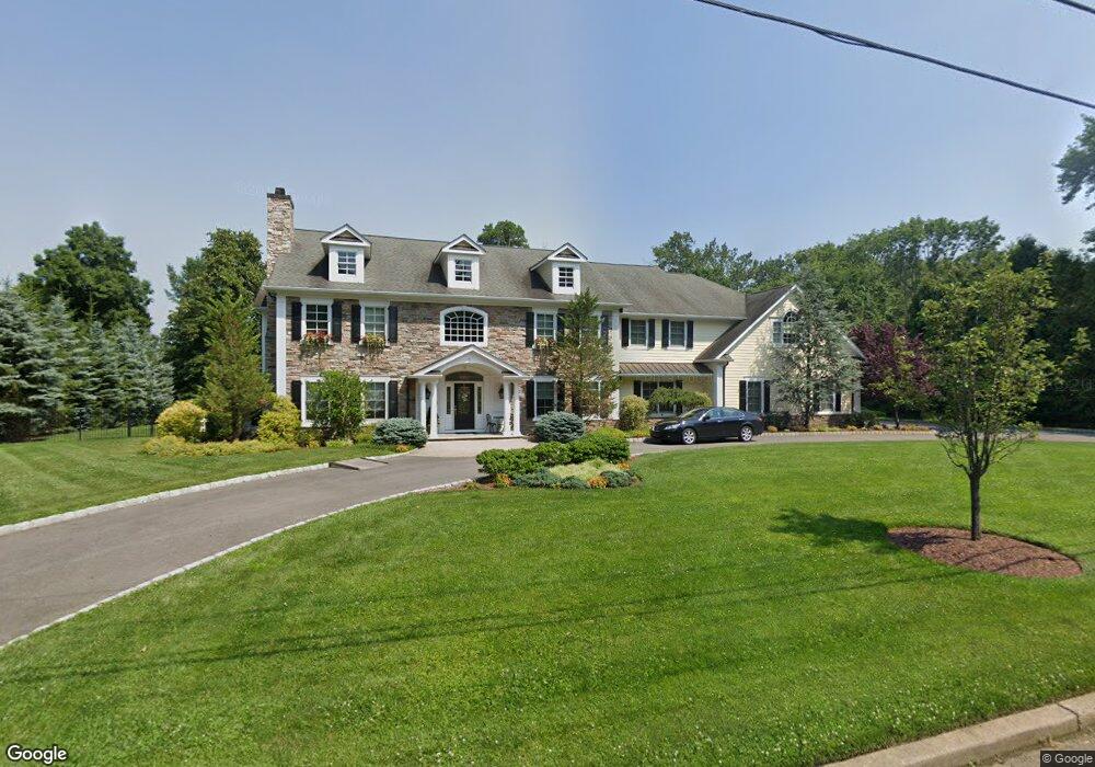
28 Briarcliff Rd Upper Saddle River, NJ 07458
Estimated Value: $2,453,446 - $2,877,000
--
Bed
--
Bath
6,497
Sq Ft
$412/Sq Ft
Est. Value
About This Home
This home is located at 28 Briarcliff Rd, Upper Saddle River, NJ 07458 and is currently estimated at $2,676,482, approximately $411 per square foot. 28 Briarcliff Rd is a home located in Bergen County with nearby schools including Robert D. Reynolds Elementary School, Edith A. Bogert Elementary School, and Emil A. Cavallini Middle School.
Ownership History
Date
Name
Owned For
Owner Type
Purchase Details
Closed on
Oct 31, 2006
Sold by
Gmp Builers Llc
Bought by
Pembroke Michael J
Current Estimated Value
Home Financials for this Owner
Home Financials are based on the most recent Mortgage that was taken out on this home.
Original Mortgage
$1,000,000
Outstanding Balance
$600,115
Interest Rate
6.47%
Estimated Equity
$2,076,367
Purchase Details
Closed on
Dec 6, 2004
Sold by
Silverman Morton
Bought by
Gmp Builders Llc
Create a Home Valuation Report for This Property
The Home Valuation Report is an in-depth analysis detailing your home's value as well as a comparison with similar homes in the area
Home Values in the Area
Average Home Value in this Area
Purchase History
| Date | Buyer | Sale Price | Title Company |
|---|---|---|---|
| Pembroke Michael J | $2,280,000 | -- | |
| Gmp Builders Llc | $855,000 | -- |
Source: Public Records
Mortgage History
| Date | Status | Borrower | Loan Amount |
|---|---|---|---|
| Open | Pembroke Michael J | $1,000,000 |
Source: Public Records
Tax History Compared to Growth
Tax History
| Year | Tax Paid | Tax Assessment Tax Assessment Total Assessment is a certain percentage of the fair market value that is determined by local assessors to be the total taxable value of land and additions on the property. | Land | Improvement |
|---|---|---|---|---|
| 2025 | $38,190 | $1,500,000 | $314,400 | $1,185,600 |
| 2024 | $37,200 | $1,500,000 | $314,400 | $1,185,600 |
| 2023 | $37,095 | $1,500,000 | $314,400 | $1,185,600 |
| 2022 | $37,095 | $1,500,000 | $314,400 | $1,185,600 |
| 2021 | $37,020 | $1,500,000 | $314,400 | $1,185,600 |
| 2020 | $36,510 | $1,500,000 | $314,400 | $1,185,600 |
| 2019 | $35,670 | $1,500,000 | $314,400 | $1,185,600 |
| 2018 | $38,579 | $1,634,000 | $314,400 | $1,319,600 |
| 2017 | $38,268 | $1,634,000 | $314,400 | $1,319,600 |
| 2016 | $37,108 | $1,634,000 | $314,400 | $1,319,600 |
| 2015 | $36,569 | $1,634,000 | $314,400 | $1,319,600 |
| 2014 | $35,915 | $1,634,000 | $314,400 | $1,319,600 |
Source: Public Records
Map
Nearby Homes
- 67 Old Chimney Rd
- 5 Glengorra Ct
- 30 Woodmere Rd
- 7 Anona Dr
- 584 W Saddle River Rd
- 15 Roxbury Rd
- 478 W Saddle River Rd
- 36 Hampshire Hill Rd
- 14 Rambling Brook Rd
- 35 Hampshire Hill Rd
- 19 Meadowbrook Rd
- 49 Litchult Ln
- 39 Litchult Ln Unit 39
- 17 Hillside Ave
- 630 Fairfax Dr
- 23 Plymouth Dr
- 659 Richmond Ct
- 121 Surrey Ct
- 59 Old Stone Church Rd
- 15 Sunrise Ln
- 22 Briarcliff Rd
- 7 Pharis Place
- 11 Pharis Place
- 27 Briarcliff Rd
- 23 Briarcliff Rd
- 31 Briarcliff Rd
- 31 Briarcliff Rd
- 20 Briarcliff Rd
- 19 Briarcliff Rd
- 45 Parker Place
- 58 Sparrowbush Rd
- 8 Pharis Place
- 12 Pharis Place
- 14 Briarcliff Rd
- 4 Pharis Place
- 3 Northern Dr
- 15 Briarcliff Rd
- 47 Sparrowbush Rd
- 22 Glen Carl Rd
- 56 Sparrowbush Rd