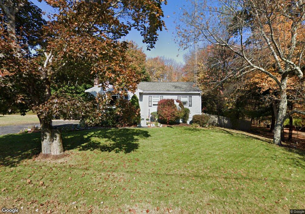
28 Brook St Franklin, MA 02038
Estimated Value: $550,490 - $656,000
3
Beds
1
Bath
1,236
Sq Ft
$484/Sq Ft
Est. Value
About This Home
This home is located at 28 Brook St, Franklin, MA 02038 and is currently estimated at $598,123, approximately $483 per square foot. 28 Brook St is a home located in Norfolk County with nearby schools including Helen Keller Elementary School, Annie Sullivan Middle School, and Franklin High School.
Ownership History
Date
Name
Owned For
Owner Type
Purchase Details
Closed on
Apr 29, 1992
Sold by
Vendeteti-Mcdonald N
Bought by
Timons William J and Timons Karen A
Current Estimated Value
Home Financials for this Owner
Home Financials are based on the most recent Mortgage that was taken out on this home.
Original Mortgage
$125,850
Interest Rate
8.96%
Mortgage Type
Purchase Money Mortgage
Create a Home Valuation Report for This Property
The Home Valuation Report is an in-depth analysis detailing your home's value as well as a comparison with similar homes in the area
Purchase History
We collect this data history from publicly available records. To have your information removed, we recommend requesting removal directly through your county’s website.
| Date | Buyer | Sale Price | Title Company |
|---|---|---|---|
| Timons William J | $132,500 | -- |
Source: Public Records
Mortgage History
We collect this data history from publicly available records. To have your information removed, we recommend requesting removal directly through your county’s website.
| Date | Status | Borrower | Loan Amount |
|---|---|---|---|
| Open | Timons William J | $27,000 | |
| Open | Timons William J | $125,000 | |
| Closed | Timons William J | $125,850 |
Source: Public Records
Tax History
| Year | Tax Paid | Tax Assessment Tax Assessment Total Assessment is a certain percentage of the fair market value that is determined by local assessors to be the total taxable value of land and additions on the property. | Land | Improvement |
|---|---|---|---|---|
| 2025 | $5,981 | $514,700 | $244,700 | $270,000 |
| 2024 | $5,752 | $487,900 | $244,700 | $243,200 |
| 2023 | $5,677 | $451,300 | $255,300 | $196,000 |
| 2022 | $5,390 | $383,600 | $211,000 | $172,600 |
| 2021 | $5,066 | $345,800 | $206,900 | $138,900 |
| 2020 | $5,142 | $354,400 | $222,400 | $132,000 |
| 2019 | $4,883 | $333,100 | $201,100 | $132,000 |
| 2018 | $4,820 | $329,000 | $210,800 | $118,200 |
| 2017 | $4,543 | $311,600 | $193,400 | $118,200 |
| 2016 | $4,494 | $309,900 | $206,200 | $103,700 |
| 2015 | $4,243 | $285,900 | $182,200 | $103,700 |
| 2014 | $3,982 | $275,600 | $171,900 | $103,700 |
Source: Public Records
Map
Nearby Homes
- 10 Homes Ave
- 9 Arrowhead Ln
- 5 Flintlocke Rd
- 77 Oliver Pond Cir Unit 10
- 90 Oliver Pond Cir Unit 43
- 81 Oliver Pond Cir Unit 8
- 89 Oliver Pond Cir Unit 4
- 41 Kimberlee Ave
- 24 Matthew Dr
- 6 Edmunds Way
- 17 Longhill Rd
- 6 Lena Cir
- 47 Kingsbury Rd
- 14 Lexington St
- 56 Leland Rd
- 300 Chestnut St
- 10 Cooper Dr
- 3 Jrs Ln
- 7 Longobardi Dr
- 7 Maple Brook Ln
Your Personal Tour Guide
Ask me questions while you tour the home.