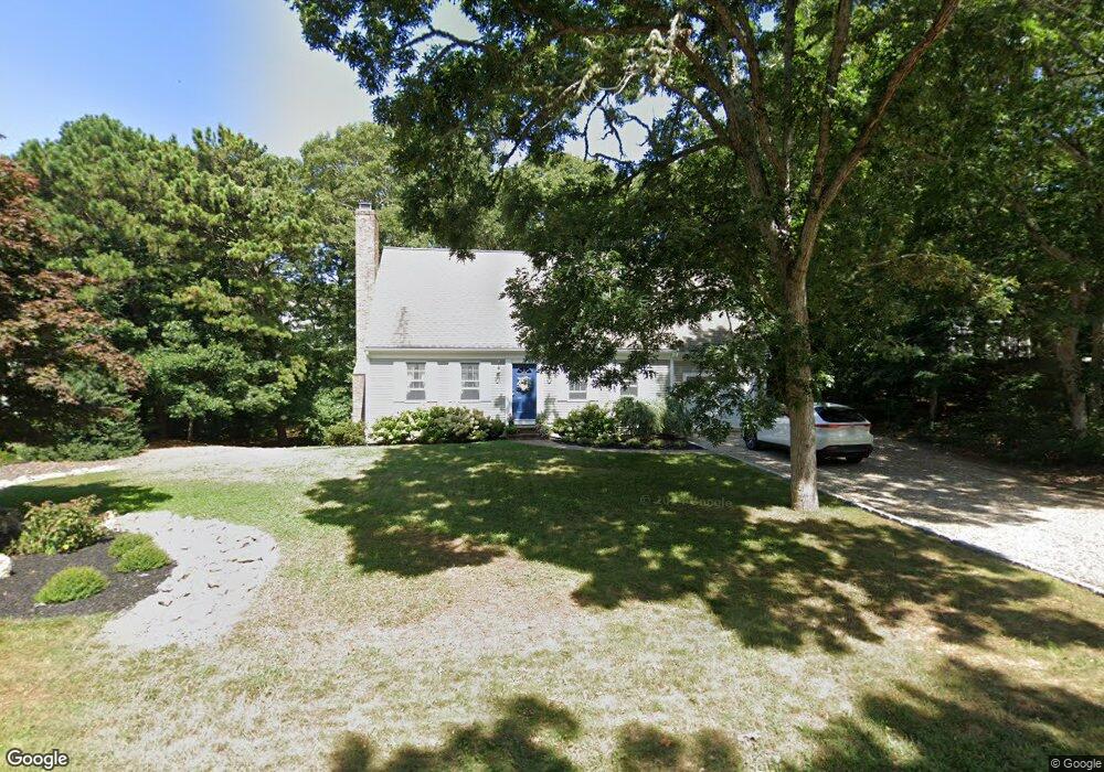
28 Cedar Ln Brewster, MA 02631
Estimated Value: $825,702 - $989,000
3
Beds
2
Baths
1,778
Sq Ft
$508/Sq Ft
Est. Value
About This Home
This home is located at 28 Cedar Ln, Brewster, MA 02631 and is currently estimated at $902,426, approximately $507 per square foot. 28 Cedar Ln is a home located in Barnstable County with nearby schools including Stony Brook Elementary School, Eddy Elementary School, and Nauset Regional Middle School.
Ownership History
Date
Name
Owned For
Owner Type
Purchase Details
Closed on
Apr 4, 2024
Sold by
Austin Lawrence R and Austin Marjorie
Bought by
Lawrence R Austin Ret and Austin
Current Estimated Value
Purchase Details
Closed on
Jul 24, 1996
Sold by
Patriot Builders Inc
Bought by
Austin Lawrence R and Austin Marjorie
Purchase Details
Closed on
Dec 18, 1995
Sold by
Gorman Ralph W
Bought by
Patriot Bldrs Inc
Create a Home Valuation Report for This Property
The Home Valuation Report is an in-depth analysis detailing your home's value as well as a comparison with similar homes in the area
Home Values in the Area
Average Home Value in this Area
Purchase History
| Date | Buyer | Sale Price | Title Company |
|---|---|---|---|
| Lawrence R Austin Ret | -- | None Available | |
| Lawrence R Austin Ret | -- | None Available | |
| Austin Lawrence R | $174,900 | -- | |
| Austin Lawrence R | $174,900 | -- | |
| Patriot Bldrs Inc | $31,000 | -- | |
| Patriot Bldrs Inc | $31,000 | -- |
Source: Public Records
Mortgage History
| Date | Status | Borrower | Loan Amount |
|---|---|---|---|
| Previous Owner | Patriot Bldrs Inc | $146,500 | |
| Previous Owner | Patriot Bldrs Inc | $83,000 |
Source: Public Records
Tax History
| Year | Tax Paid | Tax Assessment Tax Assessment Total Assessment is a certain percentage of the fair market value that is determined by local assessors to be the total taxable value of land and additions on the property. | Land | Improvement |
|---|---|---|---|---|
| 2025 | $5,410 | $786,400 | $233,900 | $552,500 |
| 2024 | $5,098 | $748,600 | $220,700 | $527,900 |
| 2023 | $4,677 | $669,100 | $197,000 | $472,100 |
| 2022 | $4,482 | $571,000 | $171,600 | $399,400 |
| 2021 | $4,270 | $497,700 | $149,200 | $348,500 |
| 2020 | $4,104 | $476,100 | $149,200 | $326,900 |
| 2019 | $2,412 | $458,700 | $143,500 | $315,200 |
| 2018 | $3,719 | $450,300 | $143,500 | $306,800 |
| 2017 | $3,617 | $431,100 | $143,500 | $287,600 |
| 2016 | $3,484 | $413,300 | $140,700 | $272,600 |
| 2015 | $3,338 | $404,100 | $137,900 | $266,200 |
Source: Public Records
Map
Nearby Homes
- 62 Maple Ln
- 5 Maple Ln
- 67 Bakers Pond Rd
- 42 Partridge Cir
- 17 Skymeadow Dr
- 31 Chase Ln
- 0 Partridge
- 261 Linnell Landing Rd Unit 2
- 190 Rt 6a Unit 9B
- 18 West Rd Unit 307
- 398 Lund Farm Way
- 12 Phoebes Close
- 410 Blueberry Pond Dr
- 0 Commons Way Unit 22504099
- 4 Nickerson Rd
- 16 Commons Way
- 332 S Orleans Rd
- 17 Kings Way
- 101 Fletcher Ln Unit L
- 100 Fletcher Ln Unit C
Your Personal Tour Guide
Ask me questions while you tour the home.