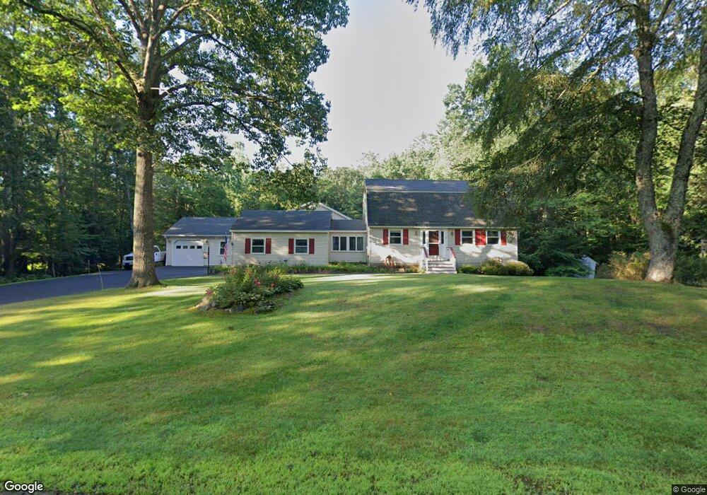
28 Davidson Ave Merrimack, NH 03054
Estimated Value: $603,000 - $689,000
4
Beds
4
Baths
3,160
Sq Ft
$203/Sq Ft
Est. Value
About This Home
This home is located at 28 Davidson Ave, Merrimack, NH 03054 and is currently estimated at $642,205, approximately $203 per square foot. 28 Davidson Ave is a home located in Hillsborough County with nearby schools including Thorntons Ferry School, Merrimack Middle School, and James Mastricola Upper Elementary School.
Ownership History
Date
Name
Owned For
Owner Type
Purchase Details
Closed on
Jun 16, 2022
Sold by
5 Burtons Ret
Bought by
Briggs Connor L and Briggs Kelly C
Current Estimated Value
Home Financials for this Owner
Home Financials are based on the most recent Mortgage that was taken out on this home.
Original Mortgage
$335,200
Outstanding Balance
$312,568
Interest Rate
3.25%
Mortgage Type
Purchase Money Mortgage
Estimated Equity
$329,637
Purchase Details
Closed on
Sep 29, 2017
Sold by
Burton Paul G and Burton Diane J
Bought by
5 Burtons Ret
Purchase Details
Closed on
May 9, 1985
Bought by
Burton Paul G and Burton Diane J
Create a Home Valuation Report for This Property
The Home Valuation Report is an in-depth analysis detailing your home's value as well as a comparison with similar homes in the area
Home Values in the Area
Average Home Value in this Area
Purchase History
| Date | Buyer | Sale Price | Title Company |
|---|---|---|---|
| Briggs Connor L | $419,000 | None Available | |
| 5 Burtons Ret | -- | -- | |
| Burton Paul G | -- | -- |
Source: Public Records
Mortgage History
| Date | Status | Borrower | Loan Amount |
|---|---|---|---|
| Open | Briggs Connor L | $335,200 | |
| Previous Owner | Burton Paul G | $180,000 |
Source: Public Records
Tax History Compared to Growth
Tax History
| Year | Tax Paid | Tax Assessment Tax Assessment Total Assessment is a certain percentage of the fair market value that is determined by local assessors to be the total taxable value of land and additions on the property. | Land | Improvement |
|---|---|---|---|---|
| 2024 | $9,815 | $474,400 | $221,200 | $253,200 |
| 2023 | $9,972 | $512,700 | $221,200 | $291,500 |
| 2022 | $8,911 | $512,700 | $221,200 | $291,500 |
| 2021 | $8,364 | $487,100 | $221,200 | $265,900 |
| 2020 | $6,936 | $288,300 | $155,200 | $133,100 |
| 2019 | $6,957 | $288,300 | $155,200 | $133,100 |
| 2018 | $6,821 | $288,200 | $155,200 | $133,000 |
| 2017 | $6,735 | $288,200 | $155,200 | $133,000 |
| 2016 | $6,568 | $288,200 | $155,200 | $133,000 |
| 2015 | $6,694 | $270,800 | $144,200 | $126,600 |
| 2014 | $6,524 | $270,800 | $144,200 | $126,600 |
| 2013 | $6,475 | $270,800 | $144,200 | $126,600 |
Source: Public Records
Map
Nearby Homes
- 4 Pollard Rd
- 15 Nathan Hale Ln
- 5 Springfield Cir
- 40 Captain Bannon Cir
- 3 Fields Farm Rd
- 40 Turkey Hill Rd
- 9 Ellie Dr
- 1 County Rd
- 105 Seaverns Bridge Rd
- 11 Foxglove Ln
- 10 1/2 Seaverns Bridge Rd
- 6 Whitetail Ridge
- 5 Jade Rd
- 7 Beacon Dr
- 12 Candy Ln
- 39 Marty Dr
- 12 Charles Rd
- 42 Cota Rd
- 30 Beebe Ln
- 3 Victoria Ridge
- 30 Davidson Ave
- 26 Davidson Ave
- 29 Davidson Ave
- 27 Davidson Ave
- 31 Davidson Ave
- 32 Davidson Ave
- 24 Davidson Ave
- 25 Davidson Ave
- 33 Davidson Ave
- 22 Davidson Ave
- 34 Davidson Ave
- 23 Davidson Ave
- 35 Davidson Ave
- 12 Peidmont Ave
- 10 Peidmont Ave
- 21 Davidson Ave
- 8 Peidmont Ave
- 16 Davidson Ave
- 19 Davidson Ave
- 169 Amherst Rd