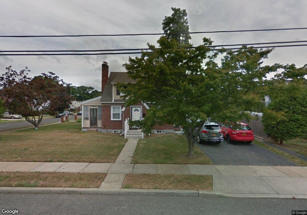
28 Davis St Freeport, NY 11520
Estimated Value: $562,000 - $648,207
3
Beds
2
Baths
1,318
Sq Ft
$459/Sq Ft
Est. Value
About This Home
This home is located at 28 Davis St, Freeport, NY 11520 and is currently estimated at $605,104, approximately $459 per square foot. 28 Davis St is a home located in Nassau County with nearby schools including Roosevelt Middle School, Roosevelt High School, and Roosevelt Children's Academy.
Ownership History
Date
Name
Owned For
Owner Type
Purchase Details
Closed on
May 21, 2015
Sold by
Mim Properties Inc
Bought by
Auguste Marie F
Current Estimated Value
Purchase Details
Closed on
Nov 5, 2013
Sold by
White Karolye
Bought by
Mim Properties Inc
Purchase Details
Closed on
Dec 18, 2012
Sold by
Hernandez Ismaela M
Bought by
White Karolye
Purchase Details
Closed on
May 22, 2009
Sold by
Solid Homes Group Inc
Bought by
M I M Properties Inc
Purchase Details
Closed on
Nov 16, 2006
Sold by
K Vogt Corp
Bought by
Solid Homes Group Inc
Purchase Details
Closed on
Aug 10, 2006
Sold by
Little Pamela
Bought by
K Vogt Corp
Purchase Details
Closed on
Aug 12, 1996
Sold by
Foster Ellsworth Est
Bought by
J R 345 Corp
Home Financials for this Owner
Home Financials are based on the most recent Mortgage that was taken out on this home.
Original Mortgage
$215,000
Interest Rate
8.4%
Create a Home Valuation Report for This Property
The Home Valuation Report is an in-depth analysis detailing your home's value as well as a comparison with similar homes in the area
Home Values in the Area
Average Home Value in this Area
Purchase History
| Date | Buyer | Sale Price | Title Company |
|---|---|---|---|
| Auguste Marie F | $287,000 | Stewart Title | |
| Mim Properties Inc | -- | None Available | |
| White Karolye | -- | -- | |
| M I M Properties Inc | -- | None Available | |
| Solid Homes Group Inc | $268,500 | -- | |
| K Vogt Corp | $225,000 | -- | |
| J R 345 Corp | $315,000 | -- |
Source: Public Records
Mortgage History
| Date | Status | Borrower | Loan Amount |
|---|---|---|---|
| Previous Owner | J R 345 Corp | $215,000 |
Source: Public Records
Tax History
| Year | Tax Paid | Tax Assessment Tax Assessment Total Assessment is a certain percentage of the fair market value that is determined by local assessors to be the total taxable value of land and additions on the property. | Land | Improvement |
|---|---|---|---|---|
| 2025 | $5,744 | $380 | $122 | $258 |
| 2024 | $662 | $380 | $122 | $258 |
Source: Public Records
Map
Nearby Homes
- 12 King St
- 63 Prince Ave
- 20 Sterling Place
- 32 Dawes Ave
- 41 W Fulton Ave
- 171 Ellison Ave
- 365 Wallace St
- 72 Woodside Ave
- 110 Woodside Ave
- 119 E Fulton Ave
- 200 Evans Ave
- 16 Scherer Place
- 315 Maryland Ave
- 188 Woodside Ave
- 156 Brookside Ave
- 400 N Columbus Ave
- 139 New York Ave
- 35 W Seaman Ave
- 31 Cedar St
- 63 E Seaman Ave
Your Personal Tour Guide
Ask me questions while you tour the home.