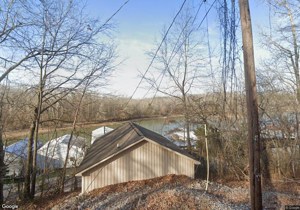
28 Frontal Cir Sugar Tree, TN 38380
Estimated Value: $98,703 - $132,000
Studio
--
Bath
--
Sq Ft
2,309
Sq Ft Lot
About This Home
This home is located at 28 Frontal Cir, Sugar Tree, TN 38380 and is currently estimated at $122,176. 28 Frontal Cir is a home located in Decatur County with nearby schools including Parsons Elementary School, Decaturville Elementary School, and Decatur County Middle School.
Ownership History
Date
Name
Owned For
Owner Type
Purchase Details
Closed on
Sep 22, 2022
Sold by
Barry Burgess John
Bought by
Gary Lynn Davis Jr And Amanda Blair Davis Rev
Current Estimated Value
Purchase Details
Closed on
Aug 20, 2011
Sold by
Stewart L Frank
Bought by
Burgess John Barry
Purchase Details
Closed on
Oct 15, 2004
Sold by
Weir Eddie
Bought by
Frank Stewart L
Purchase Details
Closed on
Apr 11, 1986
Bought by
Weir Eddie
Purchase Details
Closed on
Mar 21, 1974
Purchase Details
Closed on
Jan 2, 1900
Create a Home Valuation Report for This Property
The Home Valuation Report is an in-depth analysis detailing your home's value as well as a comparison with similar homes in the area
Purchase History
| Date | Buyer | Sale Price | Title Company |
|---|---|---|---|
| Gary Lynn Davis Jr And Amanda Blair Davis Rev | $95,000 | -- | |
| Burgess John Barry | $125,000 | -- | |
| Frank Stewart L | $80,000 | -- | |
| Weir Eddie | -- | -- | |
| -- | -- | -- | |
| -- | -- | -- |
Source: Public Records
Tax History
| Year | Tax Paid | Tax Assessment Tax Assessment Total Assessment is a certain percentage of the fair market value that is determined by local assessors to be the total taxable value of land and additions on the property. | Land | Improvement |
|---|---|---|---|---|
| 2025 | $152 | $9,250 | $8,750 | $500 |
| 2024 | $269 | $10,425 | $10,000 | $425 |
| 2023 | $269 | $10,425 | $10,000 | $425 |
| 2022 | $269 | $10,425 | $10,000 | $425 |
| 2021 | $269 | $10,425 | $10,000 | $425 |
| 2020 | $269 | $10,425 | $10,000 | $425 |
| 2019 | $233 | $10,350 | $10,000 | $350 |
| 2018 | $206 | $10,350 | $10,000 | $350 |
| 2017 | $320 | $16,075 | $10,000 | $6,075 |
| 2016 | $320 | $16,075 | $10,000 | $6,075 |
| 2015 | $320 | $16,075 | $10,000 | $6,075 |
| 2014 | $320 | $16,077 | $0 | $0 |
Source: Public Records
Map
Nearby Homes
- 95 Pats Dr
- 229 Bill Perry Dr
- LOT H5 Bill Perry Dr
- 0 Bill Perry Dr
- 347 Lakeshore Dr
- 590 Oak Park Dr
- 155 Lakeshore Dr
- 0 Cedar Ln
- 246 Brown Bluff Ln
- 0 Brown Bluff Ln
- 000 Brodies Landing
- 240 Birdsong Ln
- 1124 Lick Creek Boat Dock Loop
- 2642 Brodies Landing Rd
- 3175 Bunches Chapel Rd
- 0 River Breeze Dr Unit RTC2821791
- 0 River Breeze Dr Unit 2501777
- 0 River Breeze Dr Unit 10194884
- 00 Brodies Landing Rd
- 178 Cottage Cir
- 26 Frontal Cir
- 24 Frontal Cir
- 32 Frontal Cir
- 22 Frontal Cir
- 36 Frontal Cir
- 20 Frontal Cir
- 34 Frontal Cir
- 38 Frontal Cir
- 18 Frontal Cir
- 40 Frontal Cir
- 42 Frontal Cir
- 12 Frontal Cir
- 44 Frontal Cir
- 10 Floating Dock Dr
- 135 Richie Ln
- 16 Frontal Cir
- 8 Floating Dock Dr
- 14 Frontal Cir
- 6 Floating Dock Dr
- 6 Floating Dock Ln
Your Personal Tour Guide
Ask me questions while you tour the home.