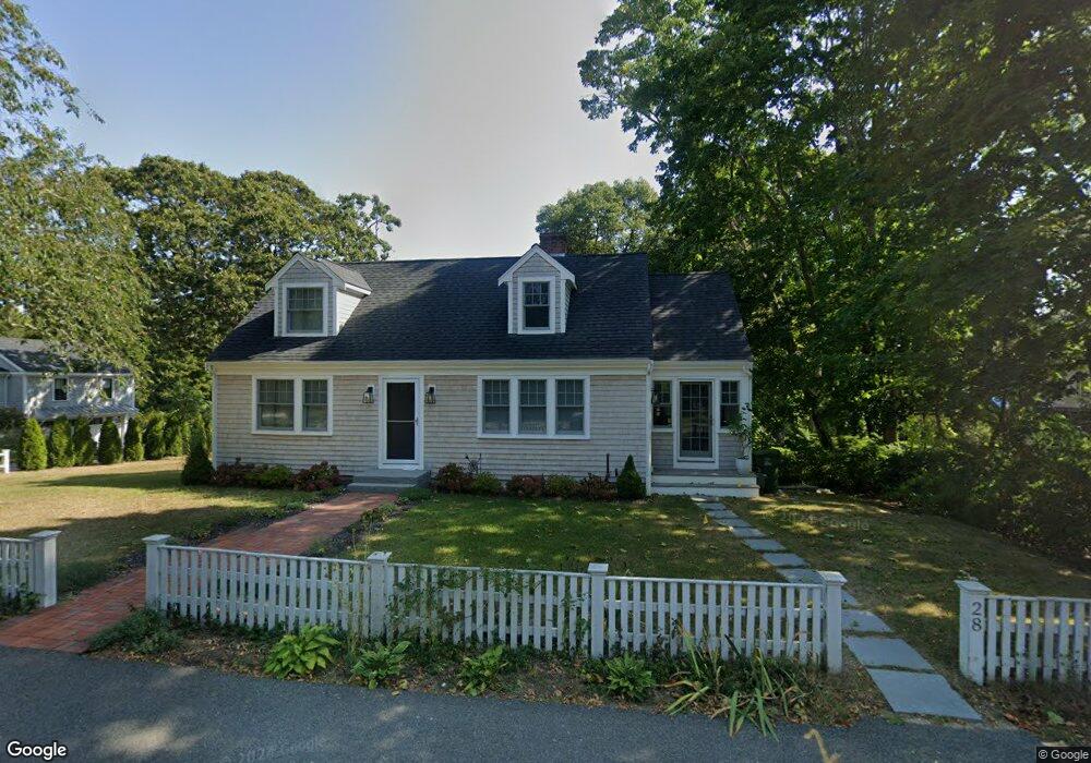
28 High St Cotuit, MA 02635
Cotuit NeighborhoodEstimated Value: $746,000 - $902,000
About This Home
This home is located at 28 High St, Cotuit, MA 02635 and is currently estimated at $822,232, approximately $585 per square foot. 28 High St is a home located in Barnstable County with nearby schools including Barnstable United Elementary School, West Villages Elementary School, and Barnstable Intermediate School.
Ownership History
We collect this data history from publicly available records. To have your information removed, we recommend requesting removal directly through your county’s website.
Purchase Details
Purchase Details
Purchase Details
Purchase Details
Home Values in the Area
Average Home Value in this Area
Purchase History
We collect this data history from publicly available records. To have your information removed, we recommend requesting removal directly through your county’s website.
| Date | Buyer | Sale Price | Title Company |
|---|---|---|---|
| -- | None Available | ||
| -- | -- | ||
| $160,000 | -- | ||
| $120,000 | -- |
Mortgage History
We collect this data history from publicly available records. To have your information removed, we recommend requesting removal directly through your county’s website.
| Date | Status | Borrower | Loan Amount |
|---|---|---|---|
| Open | $200,000 | ||
| Previous Owner | $100,000 |
Tax History
We collect this data history from publicly available records. To have your information removed, we recommend requesting removal directly through your county’s website.
| Year | Tax Paid | Tax Assessment Tax Assessment Total Assessment is a certain percentage of the fair market value that is determined by local assessors to be the total taxable value of land and additions on the property. | Land | Improvement |
|---|---|---|---|---|
| 2025 | $5,419 | $649,000 | $345,700 | $303,300 |
| 2024 | $4,962 | $629,700 | $345,700 | $284,000 |
| 2023 | $4,832 | $577,300 | $321,500 | $255,800 |
| 2022 | $4,525 | $437,600 | $222,200 | $215,400 |
| 2021 | $4,750 | $430,200 | $243,400 | $186,800 |
| 2020 | $17,321 | $413,800 | $243,400 | $170,400 |
| 2019 | $4,849 | $408,200 | $254,000 | $154,200 |
| 2018 | $15,682 | $389,500 | $256,200 | $133,300 |
| 2017 | $13,906 | $383,500 | $256,200 | $127,300 |
| 2016 | $4,444 | $386,100 | $258,800 | $127,300 |
| 2015 | $4,569 | $396,600 | $253,700 | $142,900 |
Map
- 33 Oyster Place Rd
- 134 School St
- 994 Main St
- 1089 Main St
- 120 Ocean View Ave
- 552 Main St
- 239 Oxford Dr
- 399 Santuit Rd
- 359 Santuit Rd
- 359 Santuit Rd
- 6 Cedar St
- 6 Cedar St
- 11 Riverview Ave Unit A
- 11 Riverview Ave Unit 11A
- 105 Bay Rd
- 1331 Main St
- 107 Abbey Gate Rd
- 236 Pine Ridge Rd
- 7 Oxford Dr
- 10 Abbey Gate Rd
- 40 School St
- 0 Cedarwood Rd Unit 71941348
- 0 Cedarwood Rd Unit 72015706
- 0 Cedarwood Rd Unit 20612195
- 0 Cedarwood Rd Unit 20507940
- 0 Cedarwood Rd Unit 2039628
- 0 Cedarwood Rd Unit 21505027
- 0 Cedarwood Rd Unit 22101527
- 18 High St
- 7 High St
- 33 School St
- 20 School St
- 72 School St
- 865 Main St
- 23 High St
- 889 Main St
- 12 School St
- 66 School St
- 61 School St
- 33 High St
Ask me questions while you tour the home.