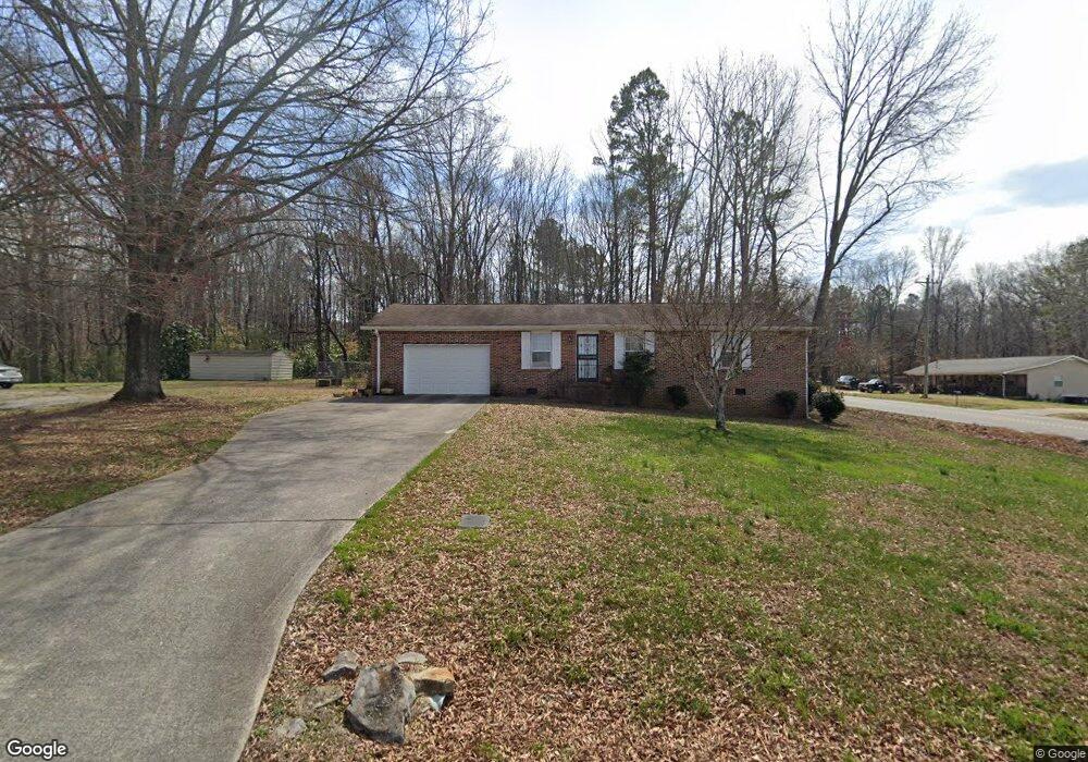
28 Meadow Brook Dr Rock Spring, GA 30739
Rock Spring NeighborhoodEstimated Value: $222,000 - $294,000
--
Bed
2
Baths
1,256
Sq Ft
$202/Sq Ft
Est. Value
About This Home
This home is located at 28 Meadow Brook Dr, Rock Spring, GA 30739 and is currently estimated at $254,308, approximately $202 per square foot. 28 Meadow Brook Dr is a home located in Walker County with nearby schools including Rock Spring Elementary School, Lafayette High School, and Alice M Daley Adventist School.
Ownership History
Date
Name
Owned For
Owner Type
Purchase Details
Closed on
Apr 29, 2004
Sold by
Buckman Albert H and Buckman Inez D
Bought by
Shadrick Ronald L and Shadrick Patsy G
Current Estimated Value
Purchase Details
Closed on
Oct 7, 1998
Sold by
Fleet Mortgage Corp
Bought by
Buckman Albert H and Buckman Inez D
Purchase Details
Closed on
May 5, 1998
Sold by
Cooper Eula Mae
Bought by
Secretary Of Housing & Urban
Purchase Details
Closed on
Oct 22, 1996
Sold by
Pack Brenda A
Bought by
Eubanks James M A and Eubanks K
Purchase Details
Closed on
Oct 22, 1993
Sold by
Mitchell Michael D and Mitchell Darlene
Bought by
Pack Brenda A
Purchase Details
Closed on
Mar 14, 1979
Bought by
Mitchell Michael D and Mitchell Darlene
Create a Home Valuation Report for This Property
The Home Valuation Report is an in-depth analysis detailing your home's value as well as a comparison with similar homes in the area
Home Values in the Area
Average Home Value in this Area
Purchase History
| Date | Buyer | Sale Price | Title Company |
|---|---|---|---|
| Shadrick Ronald L | $82,500 | -- | |
| Buckman Albert H | $71,500 | -- | |
| Secretary Of Housing & Urban | $80,800 | -- | |
| Fleet Mortgage Corp | $80,800 | -- | |
| Eubanks James M A | $76,000 | -- | |
| Cooper Eula Mae | -- | -- | |
| Pack Brenda A | $60,000 | -- | |
| Mitchell Michael D | -- | -- |
Source: Public Records
Tax History Compared to Growth
Tax History
| Year | Tax Paid | Tax Assessment Tax Assessment Total Assessment is a certain percentage of the fair market value that is determined by local assessors to be the total taxable value of land and additions on the property. | Land | Improvement |
|---|---|---|---|---|
| 2024 | $384 | $73,856 | $3,408 | $70,448 |
| 2023 | $329 | $70,215 | $3,408 | $66,807 |
| 2022 | $142 | $60,950 | $3,408 | $57,542 |
| 2021 | $126 | $42,894 | $3,408 | $39,486 |
| 2020 | $126 | $35,056 | $3,408 | $31,648 |
| 2019 | $125 | $35,056 | $3,408 | $31,648 |
| 2018 | $928 | $35,056 | $3,408 | $31,648 |
| 2017 | $248 | $35,056 | $3,408 | $31,648 |
| 2016 | $130 | $34,624 | $2,976 | $31,648 |
| 2015 | $961 | $33,922 | $3,560 | $30,362 |
| 2014 | $870 | $33,922 | $3,560 | $30,362 |
| 2013 | -- | $33,922 | $3,560 | $30,362 |
Source: Public Records
Map
Nearby Homes
- 5602 Georgia 95
- 00 Georgia 95
- 1003 Highway N Old 27
- 1370 Old Highway 27
- 10180 Us Highway 27
- 701 Bicentennial Trail
- 1902 Long Hollow Rd
- 15 Willow Cir
- 23 Willow Cir
- 16 Willow Cir
- 11 Willow Cir
- The Pearson Plan at Laurel Ridge
- The Benson II Plan at Laurel Ridge
- The Langford Plan at Laurel Ridge
- The Lawson Plan at Laurel Ridge
- The Piedmont Plan at Laurel Ridge
- The Coleman Plan at Laurel Ridge
- The McGinnis Plan at Laurel Ridge
- 28 Meadowbrook Dr
- 64 Meadowbrook Dr
- 64 Meadow Brook Dr
- 582 Georgia 95
- 582 Highway 95
- 594 Highway 95
- 51 Meadow Brook Dr
- 102 Meadow Brook Dr
- 77 Meadow Brook Dr
- 542 Highway 95
- 662 Highway 95
- 512 Highway 95
- 148 Meadow Brook Dr
- 137 Meadow Brook Dr
- 7403 N Highway 27
- 684 Highway 95
- 661 Highway 95
- 661 Highway 95
- 163 Meadow Brook Dr
- 0 Meadowbrook Dr