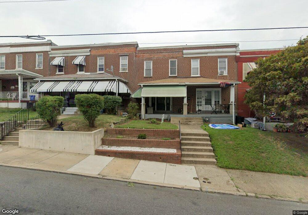
28 N State Rd Upper Darby, PA 19082
Estimated Value: $161,000 - $197,000
3
Beds
1
Bath
1,128
Sq Ft
$158/Sq Ft
Est. Value
About This Home
This home is located at 28 N State Rd, Upper Darby, PA 19082 and is currently estimated at $177,674, approximately $157 per square foot. 28 N State Rd is a home located in Delaware County with nearby schools including Drexel Hill Middle School, Upper Darby High School, and West Philadelphia Achievement Charter Elementary School.
Ownership History
Date
Name
Owned For
Owner Type
Purchase Details
Closed on
Jul 16, 2015
Sold by
Mcgee Darren and Rogan James
Bought by
Rogan James Thomas
Current Estimated Value
Purchase Details
Closed on
Feb 20, 2008
Sold by
Gentile Michael
Bought by
Mcgee Darren and Rogan James
Purchase Details
Closed on
Jul 7, 2003
Sold by
Mitchell Dennis
Bought by
Gentile Michael
Home Financials for this Owner
Home Financials are based on the most recent Mortgage that was taken out on this home.
Original Mortgage
$38,400
Interest Rate
5.45%
Mortgage Type
Purchase Money Mortgage
Purchase Details
Closed on
Dec 30, 1994
Sold by
Goslee John S
Bought by
Mitchell Dennis
Home Financials for this Owner
Home Financials are based on the most recent Mortgage that was taken out on this home.
Original Mortgage
$37,230
Interest Rate
8.75%
Mortgage Type
FHA
Create a Home Valuation Report for This Property
The Home Valuation Report is an in-depth analysis detailing your home's value as well as a comparison with similar homes in the area
Home Values in the Area
Average Home Value in this Area
Purchase History
| Date | Buyer | Sale Price | Title Company |
|---|---|---|---|
| Rogan James Thomas | -- | None Available | |
| Mcgee Darren | $40,000 | None Available | |
| Gentile Michael | $48,000 | Fidelity National Title Insu | |
| Mitchell Dennis | $37,000 | Commonwealth Land Title Ins |
Source: Public Records
Mortgage History
| Date | Status | Borrower | Loan Amount |
|---|---|---|---|
| Previous Owner | Gentile Michael | $38,400 | |
| Previous Owner | Mitchell Dennis | $37,230 |
Source: Public Records
Tax History Compared to Growth
Tax History
| Year | Tax Paid | Tax Assessment Tax Assessment Total Assessment is a certain percentage of the fair market value that is determined by local assessors to be the total taxable value of land and additions on the property. | Land | Improvement |
|---|---|---|---|---|
| 2025 | $3,214 | $76,000 | $19,350 | $56,650 |
| 2024 | $3,214 | $76,000 | $19,350 | $56,650 |
| 2023 | $3,184 | $76,000 | $19,350 | $56,650 |
| 2022 | $3,098 | $76,000 | $19,350 | $56,650 |
| 2021 | $4,178 | $76,000 | $19,350 | $56,650 |
| 2020 | $2,432 | $37,600 | $12,100 | $25,500 |
| 2019 | $2,390 | $37,600 | $12,100 | $25,500 |
| 2018 | $2,362 | $37,600 | $0 | $0 |
| 2017 | $2,301 | $37,600 | $0 | $0 |
| 2016 | $206 | $37,600 | $0 | $0 |
| 2015 | $211 | $37,600 | $0 | $0 |
| 2014 | $211 | $37,600 | $0 | $0 |
Source: Public Records
Map
Nearby Homes
- 7502 Parkview Rd
- 24 Sunshine Rd
- 9 Berbro Ave
- 46 S State Rd
- 7409 Miller Ave
- 25 N Pennock Ave
- 18 Elm Ave
- 105 N Fairview Ave
- 207 Berbro Ave
- 107 S Keystone Ave
- 29 College Ave
- 26 New St
- 7920 W Chester Pike
- 171 N Carol Blvd
- 7226 Penarth Ave
- 512 Fairfield Ave
- 41 N Keystone Ave
- 8125 W Chester Pike Unit A4
- 77 N Keystone Ave
- 1314 Farrington Rd