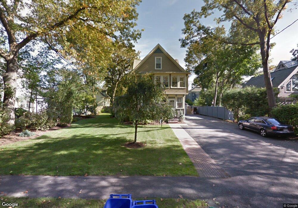
28 Oakland Ave Unit 30 Auburndale, MA 02466
Auburndale NeighborhoodEstimated Value: $1,105,000 - $1,464,965
6
Beds
3
Baths
2,598
Sq Ft
$498/Sq Ft
Est. Value
About This Home
This home is located at 28 Oakland Ave Unit 30, Auburndale, MA 02466 and is currently estimated at $1,293,991, approximately $498 per square foot. 28 Oakland Ave Unit 30 is a home located in Middlesex County with nearby schools including Williams Elementary School, Charles E Brown Middle School, and Newton South High School.
Ownership History
Date
Name
Owned For
Owner Type
Purchase Details
Closed on
Dec 15, 2021
Sold by
Tedesco Kenneth V
Bought by
Kenneth V Tedesco Ret
Current Estimated Value
Purchase Details
Closed on
Mar 31, 1999
Sold by
Est Farrell Margaret and Farrell Douglas A
Bought by
Tedesco Kenneth
Home Financials for this Owner
Home Financials are based on the most recent Mortgage that was taken out on this home.
Original Mortgage
$230,000
Interest Rate
6.78%
Mortgage Type
Purchase Money Mortgage
Create a Home Valuation Report for This Property
The Home Valuation Report is an in-depth analysis detailing your home's value as well as a comparison with similar homes in the area
Home Values in the Area
Average Home Value in this Area
Purchase History
| Date | Buyer | Sale Price | Title Company |
|---|---|---|---|
| Kenneth V Tedesco Ret | -- | None Available | |
| Tedesco Kenneth | $256,000 | -- |
Source: Public Records
Mortgage History
| Date | Status | Borrower | Loan Amount |
|---|---|---|---|
| Previous Owner | Tedesco Kenneth | $60,000 | |
| Previous Owner | Tedesco Kenneth | $275,000 | |
| Previous Owner | Tedesco Kenneth | $262,000 | |
| Previous Owner | Tedesco Kenneth | $230,000 |
Source: Public Records
Tax History Compared to Growth
Tax History
| Year | Tax Paid | Tax Assessment Tax Assessment Total Assessment is a certain percentage of the fair market value that is determined by local assessors to be the total taxable value of land and additions on the property. | Land | Improvement |
|---|---|---|---|---|
| 2025 | $11,132 | $1,135,900 | $728,200 | $407,700 |
| 2024 | $10,763 | $1,102,800 | $707,000 | $395,800 |
| 2023 | $10,309 | $1,012,700 | $576,800 | $435,900 |
| 2022 | $9,865 | $937,700 | $534,100 | $403,600 |
| 2021 | $9,257 | $860,300 | $490,000 | $370,300 |
| 2020 | $8,982 | $860,300 | $490,000 | $370,300 |
| 2019 | $8,402 | $804,000 | $457,900 | $346,100 |
| 2018 | $8,428 | $778,900 | $433,500 | $345,400 |
| 2017 | $7,946 | $714,600 | $397,700 | $316,900 |
| 2016 | $7,461 | $655,600 | $364,900 | $290,700 |
| 2015 | $7,113 | $612,700 | $341,000 | $271,700 |
Source: Public Records
Map
Nearby Homes
- 27 Oakwood Rd
- 2202 Commonwealth Ave Unit 2
- 2202 Commonwealth Ave Unit 1
- 17 Lasell St
- 283 Melrose St
- 17 Deforest Rd
- 103 Loring Rd
- 224 Auburn St Unit 224
- 224 Auburn St Unit A
- 226 Auburn St Unit 226
- 41 Orchard Ave
- 217 Summer St
- 283 Woodland Rd
- 707 South St
- 62-64 Rowe St Unit B
- 49 Staniford St
- 1754 Washington St
- 13 Weir St
- 2084 Washington St
- 45 Moulton St
- 28 Oakland Ave Unit 28
- 28 Oakland Ave Unit 1
- 36 Oakland Ave
- 20 Oakland Ave
- 55 Evergreen Ave Unit 57
- 55 Evergreen Ave Unit 1
- 55-57 Erergreen Ave Unit 1
- 55-57 Evergreen Ave Unit 1
- 55-57 Evergreen Ave
- 55 Erergreen Ave Unit 1
- 51 Evergreen Ave
- 61 Evergreen Ave
- 61 Evergreen Ave Unit 1
- 40 Oakland Ave Unit 42
- 63 Evergreen Ave Unit 2
- 49 Evergreen Ave
- 14 Oakland Ave
- 67 Evergreen Ave Unit 69
- 69 Evergreen Ave
- 67 Evergreen Ave Unit 2