
Seller's Agent in 2025
Peter McPheeters
OceanView Properties
(207) 468-1704
38 in this area
73 Total Sales
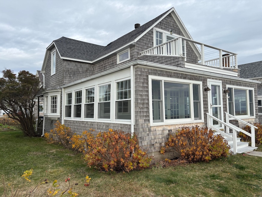


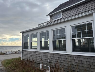

Classic Ocean Avenue cottage in Biddeford Pool. Stunning views and antique charm!
| Date | Type | Sale Price | Title Company |
|---|---|---|---|
| Interfamily Deed Transfer | -- | -- | |
| Interfamily Deed Transfer | -- | -- | |
| Interfamily Deed Transfer | -- | -- |
| Date | Status | Loan Amount | Loan Type |
|---|---|---|---|
| Previous Owner | $280,000 | New Conventional |
| Date | Event | Price | List to Sale | Price per Sq Ft |
|---|---|---|---|---|
| 11/17/2025 11/17/25 | Sold | $2,125,000 | -1.2% | $1,872 / Sq Ft |
| 11/17/2025 11/17/25 | For Sale | $2,150,000 | -- | $1,894 / Sq Ft |
| 10/12/2025 10/12/25 | Pending | -- | -- | -- |
| Year | Tax Paid | Tax Assessment Tax Assessment Total Assessment is a certain percentage of the fair market value that is determined by local assessors to be the total taxable value of land and additions on the property. | Land | Improvement |
|---|---|---|---|---|
| 2024 | $19,480 | $1,369,900 | $1,210,000 | $159,900 |
| 2023 | $17,936 | $1,367,100 | $1,207,200 | $159,900 |
| 2022 | $16,630 | $1,013,400 | $870,400 | $143,000 |
| 2021 | $15,605 | $856,000 | $733,000 | $123,000 |
| 2020 | $16,878 | $841,800 | $727,100 | $114,700 |
| 2019 | $16,819 | $841,800 | $727,100 | $114,700 |
| 2018 | $16,583 | $841,800 | $727,100 | $114,700 |
| 2017 | $16,728 | $833,500 | $727,100 | $106,400 |
| 2016 | $16,553 | $833,500 | $727,100 | $106,400 |
| 2015 | $16,228 | $833,500 | $727,100 | $106,400 |
| 2014 | $15,828 | $833,500 | $727,100 | $106,400 |
| 2013 | -- | $1,049,300 | $934,900 | $114,400 |
Seller's Agent in 2025
Peter McPheeters
OceanView Properties
(207) 468-1704
38 in this area
73 Total Sales
Source: Maine Listings
MLS Number: 1643731
APN: BIDD-000070-000000-000011
Disclaimer: Certain information contained herein is derived from information provided by parties other than Homes.com. All information provided is deemed reliable, but is not guaranteed to be accurate and should be independently verified.
![]() Listing data is derived in whole or in part from Maine Real Estate Information System, Inc. (d/b/a Maine Listings) and is for consumers' personal, noncommercial use only. Dimensions are approximate and not guaranteed. All data should be independently verified.
Listing data is derived in whole or in part from Maine Real Estate Information System, Inc. (d/b/a Maine Listings) and is for consumers' personal, noncommercial use only. Dimensions are approximate and not guaranteed. All data should be independently verified.
© 2025 Maine Real Estate Information System, Inc. All Rights Reserved. Equal Housing Opportunity.
Homes.com, LLC, 17600 Laguna Canyon Rd Irvine, CA 92618 (888)-952-6393
![]()