Estimated Value: $920,000 - $996,000
4
Beds
3
Baths
1,980
Sq Ft
$483/Sq Ft
Est. Value
About This Home
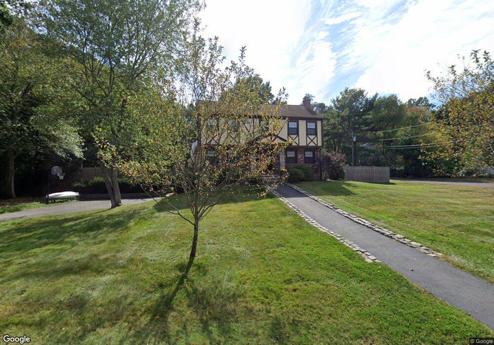
This home is located at 28 Paul Revere Rd, Acton, MA 01720 and is currently estimated at $955,859, approximately $482 per square foot. 28 Paul Revere Rd is a home located in Middlesex County with nearby schools including Acton-Boxborough Regional High School.
Ownership History
Date
Name
Owned For
Owner Type
Purchase Details
Closed on
Oct 18, 2012
Sold by
Goodwin Kenneth B and Goodwin Paula J
Bought by
Goodwin Ft and Goodwin Kenneth B
Current Estimated Value
Purchase Details
Closed on
Jan 2, 1986
Bought by
Goodwin Kenneth B
Create a Home Valuation Report for This Property
The Home Valuation Report is an in-depth analysis detailing your home's value as well as a comparison with similar homes in the area
Home Values in the Area
Average Home Value in this Area
Purchase History
| Date | Buyer | Sale Price | Title Company |
|---|---|---|---|
| Goodwin Ft | -- | -- | |
| Goodwin Kenneth B | $206,000 | -- |
Source: Public Records
Mortgage History
| Date | Status | Borrower | Loan Amount |
|---|---|---|---|
| Open | 2012 Goodwin Ft | $150,000 | |
| Previous Owner | Goodwin Kenneth B | $100,000 | |
| Previous Owner | Goodwin Kenneth B | $100,000 | |
| Previous Owner | Goodwin Kenneth B | $50,000 | |
| Previous Owner | Goodwin Kenneth B | $44,600 | |
| Previous Owner | Goodwin Kenneth B | $123,000 | |
| Previous Owner | Goodwin Kenneth B | $134,500 |
Source: Public Records
Tax History Compared to Growth
Tax History
| Year | Tax Paid | Tax Assessment Tax Assessment Total Assessment is a certain percentage of the fair market value that is determined by local assessors to be the total taxable value of land and additions on the property. | Land | Improvement |
|---|---|---|---|---|
| 2025 | $14,641 | $853,700 | $340,800 | $512,900 |
| 2024 | $13,701 | $821,900 | $340,800 | $481,100 |
| 2023 | $13,460 | $766,500 | $309,700 | $456,800 |
| 2022 | $12,775 | $656,800 | $269,400 | $387,400 |
| 2021 | $12,482 | $617,000 | $249,400 | $367,600 |
| 2020 | $11,775 | $612,000 | $249,400 | $362,600 |
| 2019 | $11,219 | $579,200 | $249,400 | $329,800 |
| 2018 | $10,285 | $530,700 | $249,400 | $281,300 |
| 2017 | $10,033 | $526,400 | $249,400 | $277,000 |
| 2016 | $9,871 | $513,300 | $249,400 | $263,900 |
| 2015 | $9,877 | $518,500 | $249,400 | $269,100 |
| 2014 | $9,601 | $493,600 | $249,400 | $244,200 |
Source: Public Records
Map
Nearby Homes
- 6 Black Horse Dr
- 1 Black Horse Dr
- 3 Squirrel Hill Rd
- 98 Summer Rd
- 11 Grist Mill Rd
- 8 Macleod Ln
- 342 Arlington St
- 92 Willow St Unit 3
- 5 Autumn Ln
- 90 Willow St Unit 1
- 54 Macintosh Ln
- 68 Macintosh Ln
- 134 Russet Ln
- 130 Russet Ln
- 62 Trefry Ln
- 4 Half Moon Hill
- 56 Windsor Ave
- 351 Burroughs Rd
- 542 Massachusetts Ave
- 4,7,8 Crestwood Ln
- 27 Paul Revere Rd
- 26 Paul Revere Rd
- 4 Patrick Henry Cir
- 4 Patrick Henry Cir Unit 1
- 30 Paul Revere Rd
- 25 Paul Revere Rd
- 3 Patrick Henry Cir
- 29 Paul Revere Rd
- 23 Paul Revere Rd
- 6 Patrick Henry Cir
- 24 Paul Revere Rd
- 5 Paul Revere Rd
- 5 Patrick Henry Cir
- 32 Paul Revere Rd
- 7 Paul Revere Rd
- 14 Ethan Allen Dr
- 3 Paul Revere Rd
- 18 Ethan Allen Dr
- 21 Paul Revere Rd
- 9 Paul Revere Rd