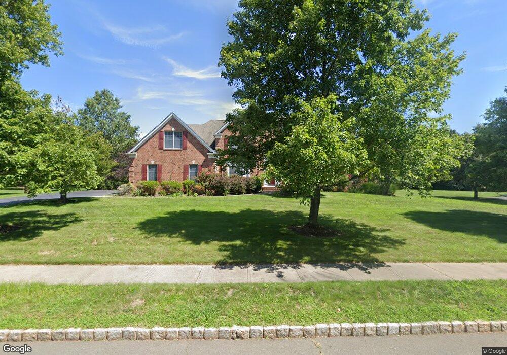
28 Pear Tree Dr Skillman, NJ 08558
Estimated Value: $1,578,504 - $1,727,000
4
Beds
4
Baths
4,656
Sq Ft
$353/Sq Ft
Est. Value
About This Home
This home is located at 28 Pear Tree Dr, Skillman, NJ 08558 and is currently estimated at $1,645,626, approximately $353 per square foot. 28 Pear Tree Dr is a home located in Somerset County with nearby schools including Orchard Hill Elementary School, Village Elementary School, and Montgomery Lower Mid School.
Ownership History
Date
Name
Owned For
Owner Type
Purchase Details
Closed on
May 26, 2011
Sold by
Cartus Corporation
Bought by
Nadkarni Sadhana and Nadkarni Uday
Current Estimated Value
Purchase Details
Closed on
May 23, 2011
Sold by
Maurer Brian R and Maurer Penny M
Bought by
Cartus Corporation
Purchase Details
Closed on
Dec 20, 2002
Sold by
Rr Land Deve
Bought by
Maurer Brian and Maurer Penny
Home Financials for this Owner
Home Financials are based on the most recent Mortgage that was taken out on this home.
Original Mortgage
$530,000
Interest Rate
6.19%
Purchase Details
Closed on
Jan 25, 1999
Sold by
Thompson Realty
Bought by
Lanwin Devt Corp
Create a Home Valuation Report for This Property
The Home Valuation Report is an in-depth analysis detailing your home's value as well as a comparison with similar homes in the area
Home Values in the Area
Average Home Value in this Area
Purchase History
| Date | Buyer | Sale Price | Title Company |
|---|---|---|---|
| Nadkarni Sadhana | $950,000 | First American Title Ins Co | |
| Cartus Corporation | $950,000 | First American Title Ins Co | |
| Maurer Brian | $769,000 | -- | |
| Lanwin Devt Corp | $400,000 | -- |
Source: Public Records
Mortgage History
| Date | Status | Borrower | Loan Amount |
|---|---|---|---|
| Previous Owner | Maurer Brian | $530,000 |
Source: Public Records
Tax History Compared to Growth
Tax History
| Year | Tax Paid | Tax Assessment Tax Assessment Total Assessment is a certain percentage of the fair market value that is determined by local assessors to be the total taxable value of land and additions on the property. | Land | Improvement |
|---|---|---|---|---|
| 2025 | $25,988 | $758,100 | $250,000 | $508,100 |
| 2024 | $25,988 | $758,100 | $250,000 | $508,100 |
| 2023 | $25,950 | $758,100 | $250,000 | $508,100 |
| 2022 | $24,434 | $758,100 | $250,000 | $508,100 |
| 2021 | $24,221 | $758,100 | $250,000 | $508,100 |
| 2020 | $24,017 | $758,100 | $250,000 | $508,100 |
| 2019 | $23,850 | $758,100 | $250,000 | $508,100 |
| 2018 | $23,289 | $758,100 | $250,000 | $508,100 |
| 2017 | $22,933 | $758,100 | $250,000 | $508,100 |
| 2016 | $22,531 | $758,100 | $250,000 | $508,100 |
| 2015 | $22,030 | $758,100 | $250,000 | $508,100 |
| 2014 | $21,765 | $758,100 | $250,000 | $508,100 |
Source: Public Records
Map
Nearby Homes
- 122 Bedens Brook Rd
- 35 Brookside Dr
- 111 E Prospect St
- 3 Congressional Ct
- 17 Elm St
- 45 Camp Meeting Ave
- 87 Columbia Ave
- 82 Aunt Molly Rd
- 48 Fairview Rd
- 8 Princeton Ave
- 24 Seminary Ave
- 455 Spring Hill Rd
- 14 Blackwell Ave
- 0 Mountain View Rd
- 12 Ironwood Rd
- 325 Mountain View Rd
- 6 Otter Creek Rd
- 5 Otter Creek Rd
- 00 Route 518
- 145 Hopewell - Wertsville Rd
- 22 Pear Tree Dr
- 34 Pear Tree Dr
- 18 Moores Grove Ct
- 8 Moores Grove Ct
- 12 Pear Tree Dr
- 24 Moores Grove Ct
- 60 Route 518
- 48 Georgetown Franklin T
- 32 Spring Hill Rd
- 3 Moores Grove Ct
- 000 Spring Hill Rd
- 30 Moores Grove Ct
- 0 Spring Hill Rd Unit 5778575
- 0 Spring Hill Rd Unit 6105812
- 11 Moores Grove Ct
- 17 Moores Grove Ct
- 7 Moores Grove Ct
- 25 Moores Grove Ct
- 42 Spring Hill Rd
- 36 Moores Grove Ct
