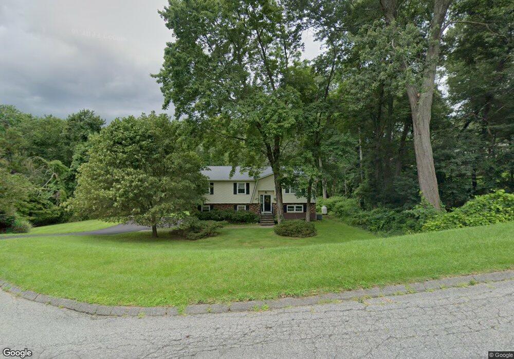
28 Randi Rd Danbury, CT 06811
Estimated Value: $538,000 - $582,000
3
Beds
3
Baths
1,338
Sq Ft
$416/Sq Ft
Est. Value
About This Home
This home is located at 28 Randi Rd, Danbury, CT 06811 and is currently estimated at $556,567, approximately $415 per square foot. 28 Randi Rd is a home located in Fairfield County with nearby schools including Pembroke Elementary School, Broadview Middle School, and Danbury High School.
Ownership History
Date
Name
Owned For
Owner Type
Purchase Details
Closed on
Dec 2, 2022
Sold by
Flynn David
Bought by
Flynn Patricia G
Current Estimated Value
Purchase Details
Closed on
Jul 12, 2001
Sold by
Matteus Bartlett and Matteus Kathy
Bought by
Flynn David and Flynn Patricia
Home Financials for this Owner
Home Financials are based on the most recent Mortgage that was taken out on this home.
Original Mortgage
$150,000
Interest Rate
7.2%
Purchase Details
Closed on
Aug 2, 1996
Sold by
Tynan Arthur and Tynan Mary A
Bought by
Matteus Bartlett and Matteus Kathy
Home Financials for this Owner
Home Financials are based on the most recent Mortgage that was taken out on this home.
Original Mortgage
$170,100
Interest Rate
8.27%
Mortgage Type
Unknown
Purchase Details
Closed on
Jul 31, 1992
Sold by
Kristoph William and Kristoph Marita
Bought by
Kanzaki Arthur and Tynan Mary
Create a Home Valuation Report for This Property
The Home Valuation Report is an in-depth analysis detailing your home's value as well as a comparison with similar homes in the area
Home Values in the Area
Average Home Value in this Area
Purchase History
| Date | Buyer | Sale Price | Title Company |
|---|---|---|---|
| Flynn Patricia G | -- | None Available | |
| Flynn David | $259,000 | -- | |
| Matteus Bartlett | $189,000 | -- | |
| Kanzaki Arthur | $191,500 | -- |
Source: Public Records
Mortgage History
| Date | Status | Borrower | Loan Amount |
|---|---|---|---|
| Previous Owner | Kanzaki Arthur | $160,000 | |
| Previous Owner | Kanzaki Arthur | $160,000 | |
| Previous Owner | Kanzaki Arthur | $150,000 | |
| Previous Owner | Kanzaki Arthur | $170,100 |
Source: Public Records
Tax History Compared to Growth
Tax History
| Year | Tax Paid | Tax Assessment Tax Assessment Total Assessment is a certain percentage of the fair market value that is determined by local assessors to be the total taxable value of land and additions on the property. | Land | Improvement |
|---|---|---|---|---|
| 2025 | $7,440 | $297,710 | $94,640 | $203,070 |
| 2024 | $7,276 | $297,710 | $94,640 | $203,070 |
| 2023 | $6,946 | $297,710 | $94,640 | $203,070 |
| 2022 | $6,366 | $225,600 | $91,500 | $134,100 |
| 2021 | $6,227 | $225,600 | $91,500 | $134,100 |
| 2020 | $6,227 | $225,600 | $91,500 | $134,100 |
| 2019 | $6,227 | $225,600 | $91,500 | $134,100 |
| 2018 | $10,335 | $225,600 | $91,500 | $134,100 |
| 2017 | $10,138 | $211,800 | $87,200 | $124,600 |
| 2016 | $6,074 | $211,800 | $87,200 | $124,600 |
| 2015 | $5,985 | $211,800 | $87,200 | $124,600 |
| 2014 | $5,846 | $211,800 | $87,200 | $124,600 |
Source: Public Records
Map
Nearby Homes
- 35 Mendes Rd
- 37 Eastview Dr
- 136 Pembroke Rd Unit 101
- 136 Pembroke Rd Unit 4-34
- 136 Pembroke Rd Unit 7-57
- 136 Pembroke Rd Unit 9-78
- 1 Marker Rd
- 8 Snug Harbor Dr
- 3 Moody Ln
- 70 Possum Dr
- 256B Great Plain Rd
- 262 Great Plain Rd
- 1 Sylvan Rd
- 6 Vista St
- 255 Great Plain Rd
- 47 Blackberry Rd
- 8 Great Meadow Rd
- 32 Dana Rd
- 59 Barnum Rd
- 3 Great Meadow Rd
- 8 Durham Rd
- 17 Buckskin Heights Dr
- 15 Buckskin Heights Dr
- 9 Randi Rd
- 6 Durham Rd
- 10 Randi Rd
- 13 Buckskin Heights Dr
- 8 Randi Rd
- 11 Randi Rd
- 11 Buckskin Heights Dr
- 4 Durham Rd
- 20 Buckskin Heights Dr
- 18 Buckskin Heights Dr
- 14 Buckskin Heights Dr
- 5 Durham Rd
- 16 Buckskin Heights Dr
- 3 Durham Rd
- 14 Buckskin Heights Dr
- 9 Buckskin Heights Dr
- 12 Buckskin Heights Dr