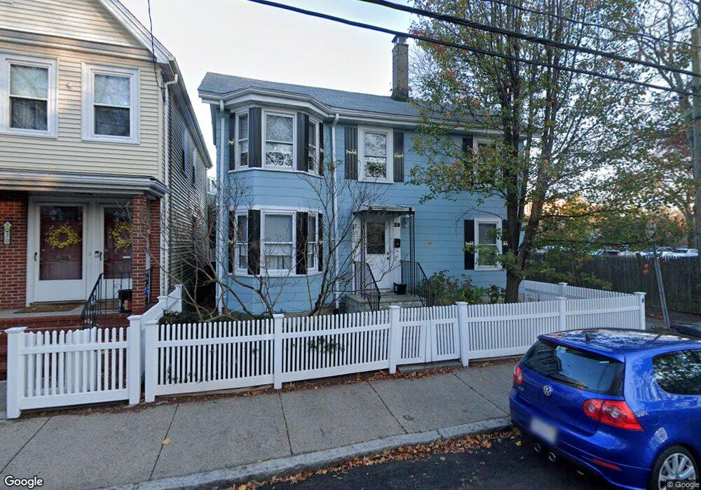
28 Roberts Rd Cambridge, MA 02138
Mid-Cambridge NeighborhoodEstimated Value: $1,474,318 - $1,941,000
3
Beds
2
Baths
1,484
Sq Ft
$1,116/Sq Ft
Est. Value
About This Home
This home is located at 28 Roberts Rd, Cambridge, MA 02138 and is currently estimated at $1,656,580, approximately $1,116 per square foot. 28 Roberts Rd is a home located in Middlesex County with nearby schools including Saint Theresa School and St. Paul's Choir School.
Ownership History
Date
Name
Owned For
Owner Type
Purchase Details
Closed on
Jun 6, 1990
Sold by
Silva Gloria
Bought by
Demetri Pauline P
Current Estimated Value
Home Financials for this Owner
Home Financials are based on the most recent Mortgage that was taken out on this home.
Original Mortgage
$143,500
Interest Rate
10.39%
Mortgage Type
Purchase Money Mortgage
Create a Home Valuation Report for This Property
The Home Valuation Report is an in-depth analysis detailing your home's value as well as a comparison with similar homes in the area
Home Values in the Area
Average Home Value in this Area
Purchase History
We collect this data history from publicly available records. To have your information removed, we recommend requesting removal directly through your county’s website.
| Date | Buyer | Sale Price | Title Company |
|---|---|---|---|
| Demetri Pauline P | $160,000 | -- |
Source: Public Records
Mortgage History
We collect this data history from publicly available records. To have your information removed, we recommend requesting removal directly through your county’s website.
| Date | Status | Borrower | Loan Amount |
|---|---|---|---|
| Closed | Demetri Pauline P | $140,400 | |
| Closed | Demetri Pauline P | $143,500 |
Source: Public Records
Tax History
| Year | Tax Paid | Tax Assessment Tax Assessment Total Assessment is a certain percentage of the fair market value that is determined by local assessors to be the total taxable value of land and additions on the property. | Land | Improvement |
|---|---|---|---|---|
| 2025 | $7,753 | $1,220,900 | $868,300 | $352,600 |
| 2024 | $7,567 | $1,278,200 | $940,700 | $337,500 |
| 2023 | $7,327 | $1,250,300 | $958,500 | $291,800 |
| 2022 | $7,250 | $1,224,600 | $966,300 | $258,300 |
| 2021 | $6,674 | $1,140,800 | $900,700 | $240,100 |
| 2020 | $6,384 | $1,110,300 | $882,800 | $227,500 |
| 2019 | $5,822 | $980,100 | $775,400 | $204,700 |
| 2018 | $5,596 | $889,700 | $700,900 | $188,800 |
| 2017 | $5,618 | $865,600 | $686,000 | $179,600 |
| 2016 | $5,228 | $747,900 | $575,600 | $172,300 |
| 2015 | $5,099 | $652,000 | $498,100 | $153,900 |
| 2014 | $4,850 | $578,800 | $429,500 | $149,300 |
Source: Public Records
Map
Nearby Homes
- 104 Trowbridge St Unit 4
- 29 Line St
- 1643 Cambridge St Unit 42
- 106 Ellery St
- 9 Farrar St Unit 9
- 1531 Cambridge St
- 42 Calvin St
- 7 Durham St Unit 1
- 88 Highland Ave
- 29 Hanson St Unit 2
- 29 Hanson St Unit 1
- 17 Buckingham St Unit 3
- 33 Beacon St
- 59 Ellery St Unit R
- 16 Ellery Square
- 6 Goodman Rd
- 393 Broadway Unit 10
- 3 Crawford St Unit 3
- 17 Hammond St Unit 2
- 345 Harvard St Unit 1D
- 30 Roberts Rd
- 3 Baldwin Street Ct
- 32 Roberts Rd Unit 32A
- 5 Baldwin Ct Unit 1
- 5 Baldwin Ct Unit A
- 5 Lamont Ave
- 5 Lamont Ave Unit 1
- 7 Lamont Ave
- 7 Lamont Ave Unit 2
- 34 Roberts Rd
- 7 Baldwin Street Ct
- 29 Roberts Rd
- 27 Roberts Rd
- 29 Roberts Rd Unit 2
- 29 Roberts Rd Unit 29
- 29 Roberts Rd Unit 29,29
- 25 Roberts Rd
- 40-40 1/2 Roberts Rd
- 36 Roberts Rd
- 36 Roberts Rd Unit 2
Your Personal Tour Guide
Ask me questions while you tour the home.