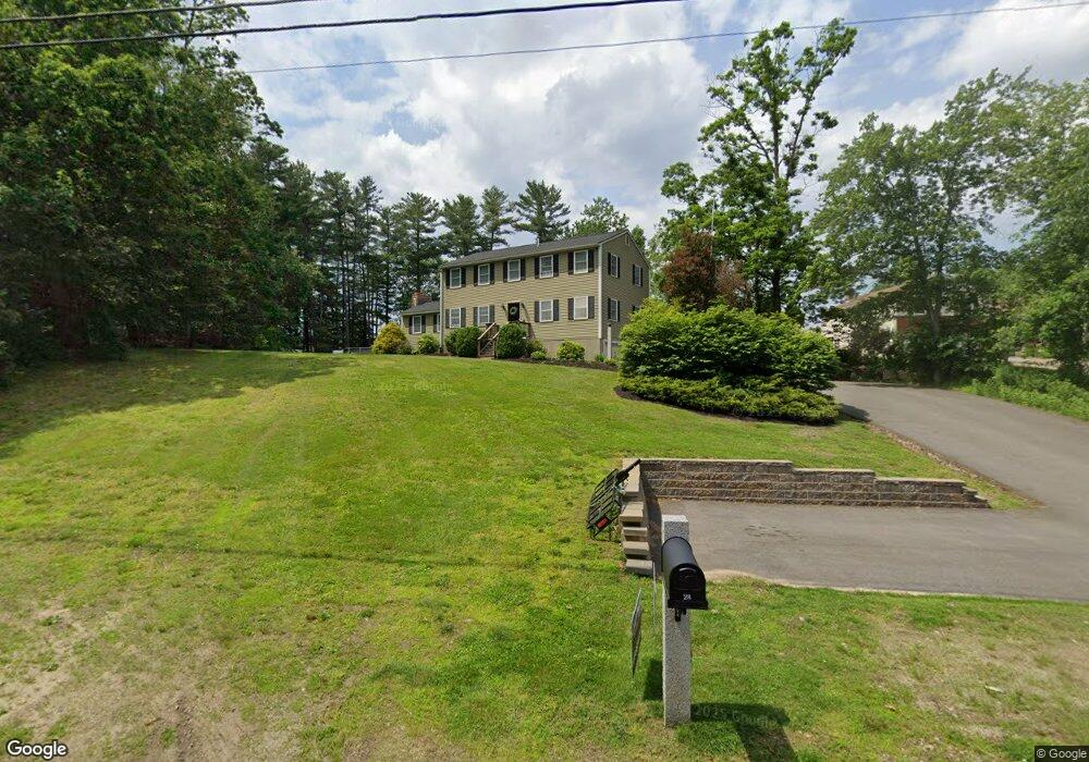
28 Ross Dr Londonderry, NH 03053
Estimated Value: $630,392 - $743,000
4
Beds
3
Baths
2,402
Sq Ft
$276/Sq Ft
Est. Value
About This Home
This home is located at 28 Ross Dr, Londonderry, NH 03053 and is currently estimated at $663,348, approximately $276 per square foot. 28 Ross Dr is a home located in Rockingham County with nearby schools including South Londonderry Elementary School, Londonderry Middle School, and Londonderry Senior High School.
Ownership History
Date
Name
Owned For
Owner Type
Purchase Details
Closed on
Sep 1, 2010
Sold by
Fnma
Bought by
Odonnell Darren and Odonnell Eileen
Current Estimated Value
Home Financials for this Owner
Home Financials are based on the most recent Mortgage that was taken out on this home.
Original Mortgage
$192,000
Interest Rate
4.55%
Purchase Details
Closed on
Apr 5, 2010
Sold by
Mccarthy James and Fnma
Bought by
Fnma
Purchase Details
Closed on
Jan 17, 2003
Sold by
Burton David K and Burton Mary Ann
Bought by
Mccarthy James R and Mccarthy Lynne M
Purchase Details
Closed on
Jul 1, 1998
Sold by
Sullivan John J and Sullivan Marguerite M
Bought by
Burton David K and Burton Mary Ann
Home Financials for this Owner
Home Financials are based on the most recent Mortgage that was taken out on this home.
Original Mortgage
$114,000
Interest Rate
7.04%
Create a Home Valuation Report for This Property
The Home Valuation Report is an in-depth analysis detailing your home's value as well as a comparison with similar homes in the area
Home Values in the Area
Average Home Value in this Area
Purchase History
| Date | Buyer | Sale Price | Title Company |
|---|---|---|---|
| Odonnell Darren | $80,000 | -- | |
| Fnma | $234,500 | -- | |
| Mccarthy James R | $250,000 | -- | |
| Burton David K | $126,900 | -- |
Source: Public Records
Mortgage History
| Date | Status | Borrower | Loan Amount |
|---|---|---|---|
| Open | Burton David K | $215,000 | |
| Closed | Burton David K | $192,000 | |
| Previous Owner | Burton David K | $114,000 |
Source: Public Records
Tax History Compared to Growth
Tax History
| Year | Tax Paid | Tax Assessment Tax Assessment Total Assessment is a certain percentage of the fair market value that is determined by local assessors to be the total taxable value of land and additions on the property. | Land | Improvement |
|---|---|---|---|---|
| 2024 | $8,278 | $512,900 | $199,900 | $313,000 |
| 2023 | $7,966 | $509,000 | $199,900 | $309,100 |
| 2022 | $7,401 | $400,500 | $149,800 | $250,700 |
| 2021 | $7,361 | $400,500 | $149,800 | $250,700 |
| 2020 | $7,284 | $362,200 | $121,100 | $241,100 |
| 2019 | $7,023 | $362,200 | $121,100 | $241,100 |
| 2018 | $6,669 | $305,900 | $100,200 | $205,700 |
| 2017 | $6,610 | $305,900 | $100,200 | $205,700 |
| 2016 | $6,577 | $305,900 | $100,200 | $205,700 |
| 2015 | $6,430 | $305,900 | $100,200 | $205,700 |
| 2014 | $6,451 | $305,900 | $100,200 | $205,700 |
| 2011 | -- | $311,800 | $100,200 | $211,600 |
Source: Public Records
Map
Nearby Homes
- 57D Constitution Dr
- 124 Capitol Hill Dr
- 14 Reed St
- 5 Elise Ave Unit Lot 94
- 23a Reed St
- 3 Elise Ave Unit 95
- 14 Elise Ave Unit 7
- 12 Elise Ave Unit 6
- 8 Elise Ave Unit Lot 4
- 9 Elise Ave Unit Lot 92
- 6 Elise Ave Unit 3
- 6 Elise Ave Unit Lot 3
- 7 Elise Ave Unit Lot 93
- 10 Elise Ave Unit 5
- 10 Elise Ave Unit Lot 5
- 36 Elise Ave Unit Lot 18
- 1 Elise Ave Unit Lot 96
- 14 Mohawk Dr
- 10 Twin Brook Dr
- 7 Gardner Cir
- 30 Ross Dr
- 26 Ross Dr
- 49 Morrison Dr Unit 30
- 51 Morrison Dr Unit 26
- 47 Morrison Dr Unit 28
- 47 Morrison Dr Unit 47
- 53 Morrison Dr Unit 25
- 27 Ross Dr
- 45 Morrison Dr Unit 29
- 55 Morrison Dr Unit 55
- 55 Morrison Dr
- 55 Morrison Dr Unit 24
- 32 Ross Dr
- 18 Morrison Dr
- 57 Morrison Dr Unit 23
- 57 Morrison Dr
- 29 Ross Dr
- 6 Davenport Dr
- 6 Davenport Dr Unit 105
- 20 Morrison Dr