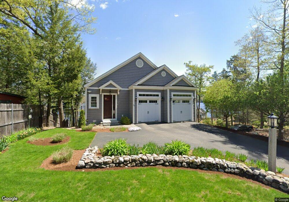
28 Route 11d Alton Bay, NH 03810
Estimated Value: $2,759,863 - $3,372,000
2
Beds
4
Baths
3,182
Sq Ft
$926/Sq Ft
Est. Value
About This Home
This home is located at 28 Route 11d, Alton Bay, NH 03810 and is currently estimated at $2,945,466, approximately $925 per square foot. 28 Route 11d is a home located in Belknap County with nearby schools including Alton Central School (Elem) and Prospect Mountain High School.
Ownership History
Date
Name
Owned For
Owner Type
Purchase Details
Closed on
Sep 15, 2025
Sold by
Kifer Ft and Kifer
Bought by
King Stephen and King Sally
Current Estimated Value
Purchase Details
Closed on
Apr 25, 2005
Sold by
Longmuir Francee H
Bought by
Fugal Jan P
Home Financials for this Owner
Home Financials are based on the most recent Mortgage that was taken out on this home.
Original Mortgage
$250,001
Interest Rate
5.87%
Mortgage Type
Purchase Money Mortgage
Create a Home Valuation Report for This Property
The Home Valuation Report is an in-depth analysis detailing your home's value as well as a comparison with similar homes in the area
Home Values in the Area
Average Home Value in this Area
Purchase History
| Date | Buyer | Sale Price | Title Company |
|---|---|---|---|
| King Stephen | $2,814,600 | -- | |
| King Stephen | $2,814,600 | -- | |
| Fugal Jan P | $695,000 | -- |
Source: Public Records
Mortgage History
| Date | Status | Borrower | Loan Amount |
|---|---|---|---|
| Previous Owner | Fugal Jan P | $241,000 | |
| Previous Owner | Fugal Jan P | $250,001 |
Source: Public Records
Tax History Compared to Growth
Tax History
| Year | Tax Paid | Tax Assessment Tax Assessment Total Assessment is a certain percentage of the fair market value that is determined by local assessors to be the total taxable value of land and additions on the property. | Land | Improvement |
|---|---|---|---|---|
| 2024 | $13,795 | $1,062,800 | $573,600 | $489,200 |
| 2022 | $12,084 | $1,062,800 | $573,600 | $489,200 |
| 2021 | $12,078 | $1,061,300 | $573,600 | $487,700 |
| 2020 | $12,028 | $862,200 | $422,200 | $440,000 |
| 2019 | $10,786 | $862,200 | $422,200 | $440,000 |
| 2018 | $11,572 | $862,200 | $422,200 | $440,000 |
| 2017 | $11,088 | $862,200 | $422,200 | $440,000 |
| 2016 | $11,422 | $807,200 | $405,800 | $401,400 |
| 2015 | $10,788 | $756,000 | $354,600 | $401,400 |
| 2014 | $10,225 | $738,300 | $366,500 | $371,800 |
| 2013 | $5,703 | $424,300 | $362,400 | $61,900 |
Source: Public Records
Map
Nearby Homes
- 74 Jesus Valley Rd
- 204 Route 11-D
- Lots 134-135 Wendy Dr
- Lot 5-2-1 Jesus Valley Rd
- 581 E Side Dr
- 25 Georges Rd
- 241 Mount Major Hwy
- 11/13/A High Point Dr
- Lot 13 Jaytee Dr
- 00 Old Wolfeboro Rd Unit 40
- 141 Lakewood Dr
- 115 Mount Major Hwy
- 654 Alton Mountain Rd
- 650 Alton Mountain Rd
- 606 Alton Mountain Rd
- 642 Alton Mountain Rd
- 510 Old Wolfeboro Rd
- Lot #64 Alton Shores Rd
- 23 Riverlake St
- 30 Bly Ave
- 30 Route 11d
- 27 Route 11d
- 34 Route 11d
- 20 Route 11d
- 34 New Hampshire 11d
- 34 Route 11d
- 27 New Hampshire 11d
- 33 Route 11d
- 24 Route 11d
- 18 Route 11d
- 18 New Hampshire 11d
- 28 New Hampshire 11d
- 3 Loon Cove Rd
- 5 Loon Cove Rd
- 51 New Hampshire 11d
- 52 Route 11d
- 7 Loon Cove Rd
- 13 Nelsons Pine Point
- 13 Loon Cove Rd
- 6 Loveren Ln