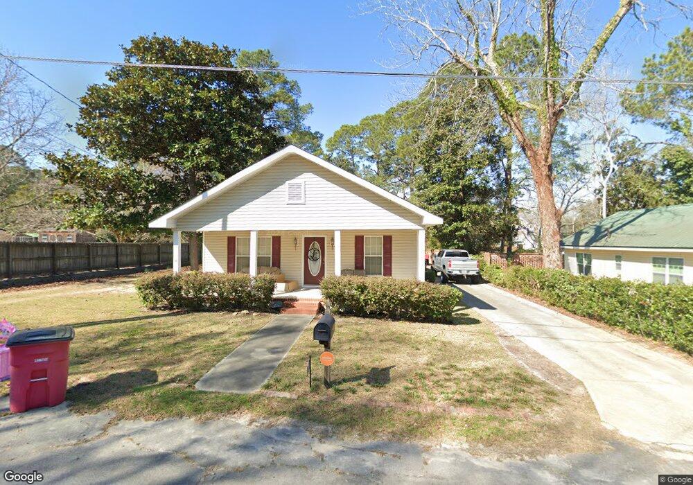
28 S Sixth Ave Mc Rae, GA 31055
Estimated Value: $104,677 - $153,000
3
Beds
1
Bath
1,512
Sq Ft
$82/Sq Ft
Est. Value
About This Home
This home is located at 28 S Sixth Ave, Mc Rae, GA 31055 and is currently estimated at $123,919, approximately $81 per square foot. 28 S Sixth Ave is a home located in Telfair County with nearby schools including Telfair County Elementary School, Telfair County Middle School, and Telfair County High School.
Ownership History
Date
Name
Owned For
Owner Type
Purchase Details
Closed on
Mar 14, 2007
Sold by
Cravey Richard E
Bought by
Larkey Danny and Larkey Marisa
Current Estimated Value
Home Financials for this Owner
Home Financials are based on the most recent Mortgage that was taken out on this home.
Original Mortgage
$86,700
Outstanding Balance
$52,507
Interest Rate
6.27%
Mortgage Type
New Conventional
Estimated Equity
$71,412
Purchase Details
Closed on
Sep 26, 2002
Sold by
Williams James and Williams N
Bought by
Cravey Richard E
Purchase Details
Closed on
May 14, 1992
Sold by
Georgia Federal Bank
Bought by
Williams James and Williams N
Purchase Details
Closed on
Mar 20, 1992
Bought by
Georgia Federal Bank
Create a Home Valuation Report for This Property
The Home Valuation Report is an in-depth analysis detailing your home's value as well as a comparison with similar homes in the area
Home Values in the Area
Average Home Value in this Area
Purchase History
| Date | Buyer | Sale Price | Title Company |
|---|---|---|---|
| Larkey Danny | $85,000 | -- | |
| Cravey Richard E | $10,000 | -- | |
| Williams James | -- | -- | |
| Georgia Federal Bank | -- | -- |
Source: Public Records
Mortgage History
| Date | Status | Borrower | Loan Amount |
|---|---|---|---|
| Open | Larkey Danny | $86,700 |
Source: Public Records
Tax History Compared to Growth
Tax History
| Year | Tax Paid | Tax Assessment Tax Assessment Total Assessment is a certain percentage of the fair market value that is determined by local assessors to be the total taxable value of land and additions on the property. | Land | Improvement |
|---|---|---|---|---|
| 2024 | $1,718 | $44,032 | $1,102 | $42,930 |
| 2023 | $1,644 | $42,102 | $1,102 | $41,000 |
| 2022 | $1,194 | $42,102 | $1,102 | $41,000 |
| 2021 | $857 | $29,412 | $1,102 | $28,310 |
| 2020 | $804 | $27,271 | $1,102 | $26,169 |
| 2019 | $808 | $27,271 | $1,102 | $26,169 |
| 2018 | $1,190 | $27,609 | $1,102 | $26,507 |
| 2017 | $826 | $27,938 | $1,102 | $26,836 |
| 2016 | $826 | $27,938 | $1,102 | $26,836 |
| 2015 | -- | $27,938 | $1,102 | $26,836 |
| 2014 | -- | $28,546 | $1,010 | $27,536 |
| 2013 | -- | $28,913 | $1,377 | $27,536 |
Source: Public Records
Map
Nearby Homes
- 0 Ll350 & 398 7th District Unit 30490
- 210 W Graham St
- 15 Ben Ave
- 78 S Second Ave
- 47 S First Ave
- 125 Fifth Ave
- 427 3rd Ave
- 17 2nd St
- Lot 126 Pansy Ln
- 141 S First Ave
- 27 E Bruce St
- 0 Center Ave
- 76 E Grant St
- 36 Strozier St
- 0 Bonaire St Unit 10647239
- 0 Jackson Ave Unit 10548102
- 160 E Willow Creek Ln
- 22 Spring Ave
- 0 U S 23
- 00 U S 341
- 69 College St
- 61 College St
- 31 S Sixth Ave
- 124 Huckabee St
- 57 College St
- 120 W College St
- 130 Huckabee St
- 116 Huckabee St
- 0 W College St Unit 7146827
- 0 W College St Unit 8485865
- 0 W College St Unit 7307562
- 0 W College St Unit 7017476
- 34 Seventh Ave
- 53 College St
- 75 W College St
- 40 Seventh Ave
- 114 Huckabee St
- 0 Huckabee St Unit 7433324
- 0 Huckabee St Unit 8190012
- 0 Huckabee St Unit 8473869